Field trip to the South Wales Coalfield, Sunday June 9th 2019

Field trip to the South Wales Coalfield, Sunday June 9th 2019

Members enjoyed a trip round the Pontneddfechan area led by Dr Gareth George. Gareth also led a field trip on the Mumbles Coast for the Severnside group of the OUGS on the Saturday, so all our members attending went to both meetings, and we were joined by some Severnside members for our Sunday field trip. The weather was rainy in the morning, but it brightened up later on.

We visited four separate sites during the day: Penwyllt Quarries, the River Tawe at Ynyswen, Henrhyd Falls and Craig y Dinas.

The Penwyllt quarry area includes limestone quarries, quartz-arenite quarries and a large area of old industrial sites including brick-making and an old rail track-bed.

The limestone quarry has thick basal beds which represent the top of the Oxwich Head limestone with thinner overlying beds which are the bottom of the Oystermouth series.

chris-pic1
Limestone quarry with the Oxwich/Oystermouth junction

In some areas there is a paleosol between the Oxwich & Oystermouth; but it was inaccessible in this particular quarry.

Left on the quarry floor were some blocks with a good demonstration of hummocks and swales: a particular sedimentary feature which usually indicates formation during stormy weather.

chris-pic2
The curved upper surface of the block is the hummock

chris-pic5
hummocky pattern of the laminae on the side of the block

We then went to a quarry in the Twrch sandstone where there is an excellent example of an old channel formation: a localised lens-shaped sandstone structure within regular beds.

chris-pic6
old river channel in the Twrch sandstone

We then went to the River Tawe at Ynyswen where the river forms a deeply incised meander with multiple sandstone beds exposed in the vertical valley side. Within this exposure is a distinctive bed called the Twelve-foot sandstone. The river is actually running over the top of the Twrch sandstone which we had previously seen in the quarry at Penwyllt.

chris-pic8
the twelve-foot sandstone high in the vertical valley side

chris-pic7
the top surface of the Twrch sandstone forming the river bed

The next stop was Henrhyd Falls – the highest waterfall in South Wales, with a drop >90ft. The water falls over a resistant sandstone layer known as Farewell Rock. The name came from the 19th century coal miners who recognised that if they dug down to this particular rock layer, they could say farewell to any chance of finding coal beneath it!

chris-pic3
Henrhyd Falls, where brave souls can walk behind the falls!

The final stop was at Craig y Dinas. From there, it was a short walk along the Sychryd valley to see Bwa Maen – a spectacular folded block of limestone within a fault zone. Bwa Maen is “bow of rock” in English. The South Wales coalfield has several extensive fault systems. The old miners did not know about faults; they just knew that there were lines where you could not follow the coal seams any more, and they called these “disturbances”. The Vale of Neath Disturbance is one such major fault system, with the main splay of the fault (the Dinas Fault) going along the Sychryd Valley.

chris-pic4
Bwa Maen

chris-pic9
the apex of the fold


Summer Weekend 3rd – 6th May 2019
North Pembrokeshire - leader Sid Howells

Summer Weekend 3rd – 6th May 2019 North Pembrokeshire - leader Sid Howells

Club members had a very enjoyable weekend with a combination of excellent weather, interesting geology and a knowledgeable guide, Sid Howells who is a geological and environmental education specialist. We started on the Friday evening with a summary of the geology and distribution of fact sheets from Sid.

Saturday

On Saturday morning, we caught the coast path bus which took us to Clegyr Boia (SM 744252), a high point which gave us 360° visibility so we could see the features of the landscape and where we would be walking. We had a striking view over St David’s Cathedral which had been constructed within a glacial melt-water channel.

chrisp1-1
Photo 1: St. David's Cathedral

Melt-water channels are a particular feature of North Pembrokeshire geology with another one extending from Abereiddi to Porthgain which we saw on Sunday and Monday.
We then walked to the coast at Maen Bachau (SM 722241) and continued round the coast till we reached St Non’s Bay (SM 753242) at the end of the day. This gave us panoramic views of the bays, inlets and islands. We could not, however, get down to sea level except in a few areas – for the best views of Pembrokeshire geology, Sid informed us that we needed to paddle in by kayak!

The first thing we did at Maen Bachau was to look at the variety of pebbles on the beach. Most of the geological layers represented in Pembrokeshire were present there, as well as some from further afield. Photo 2 shows a pebble composed of the basal Cambrian Conglomerate, which outcrops at St Non’s Bay and elsewhere. (Sorry there is no scale – this pebble is about 8 inches across).

chrisp2-1
Photo 2: pebble of basal Cambrian Conglomerate

Here are the Pre-Cambrian rhyolitic tuffs from as close as we could get.

chrisp3-1
Photo 3: Pre-cambrian rhyolitic tuffs

Between Porthlysgi Bay and Porth Clais was an amazing sequence of rocks: Ordovician microdiorite sills intruded into Cambrian sedimentary rocks, before the whole assemblage had been rotated through 90°, so the beds and sills were all vertical. (photos 4&5)

chrisp6-1
Photo 4: Ordovician microdiorite sills

chrisp7-1
Photo 5: Enlarged photo of above

The two thin sills at the left hand margin of the first picture are shown at higher power in the second picture, with evident columnar jointing caused by rapid cooling of the liquid sill material. (Photo 5)
The wide sill extended beyond the next headland to the West where it was seen as a combined sea stack/arch due to its resistance to erosion by the sea.

chrisp5-2
Photo 6: Sea stack/arch

Here is a higher power view of the Cambrian sandstones into which the sills are intruded.

chris4
Photo 7: Cambrian Sandstones

Sunday

We went to Porthgain (SM 814328) in the morning and Garn Fawr (SM 897388) and the adjacent coast in the afternoon. This part of North Pembrokeshire is characterised by the presence of a large eroded syncline with a gabbro sill in the two arms of the sill, as shown on the geological map.

Porthgain (photo 8) was a thriving quarry and port before the arrival of the railways. Plenty of the industrial history is still visible. It is situated at one end of a glacial melt-water channel which extends to Abereiddi, where we went on Monday.

chrisp19-1
photo 8: Porthgain

The main exports were slates and building stone. Both the old slate quarry and the old building stone quarry are visible from the coastal path.

chrisp8-1
Photo 9: Slate quarry

chrisp9-1
Photo 10: Stone quarry

The building stone quarry exploited material from the gabbro sill. The sill extends out to the West as a headland (photo 11), resistant to erosion by the sea. (The photo also shows Strumble Head in the distance beyond the gabbro headland, which was our destination after lunch.)

chrisp10-1
Photo 11: Gabbro sill forming headland

Garn Fawr shows well-formed columnar jointing at the top. The dip of the columns provided a handy resting place for club members after climbing to the summit! (photo 12)

chrisp11-1
Photo 12: Garn Fawr

On the left of the photo, in the distance is Pen Brush headland, which was our last stop. This is composed of pillow lavas: a formation >1,000m in thickness. The next photo (photo 13) is taken with a zoom lens from the coast path South of Porth Maenmelyn and shows well-formed pillow lavas at the inaccessible tip of the headland.

chrisp12-1
Photo 13: Pen Brush headland

Photo 14 is a close view of three adjacent pillows with a hammer for scale. You can see the dark infill material between the pillows, the chill margin around the outside of a pillow and the pattern of spherical weathering.

chrisp13-1
Photo 14: Pillow Lava

Monday

We went to Abereiddi (SM 797312) and then walked North along the coastal path. There is an old, abandoned slate quarry which is now flooded by the sea and mainly used by coasteering enthusiasts the Blue Lagoon. (photo 15)

chrisp14-1
Photo 15: Abandoned slate quarry

Continuing North along the coast path, we came to Traeth Llyfn (SM 802319 for the steps down). Photo 16 shows the bay with evident East-West trending beds.

chrisp17-1
Photo 16: Traeth Llyfn Bay

At the Northern end of the bay is a promontory composed of particularly resistant material which continues westward as two small islands. Photo 17 shows a higher power view of the promontory. The rounded top of an intrusion is visible with a radial pattern of cooling joints.

chrisp15-2
Photo 17: Enlarged photo of bay

Looking at the Ordnance Survey map and the geological map, it is clear that the coast is made up of multiple bays with intervening headlands. There is a clear East-West trend of the headlands which is mirrored in the geological map. The headlands are all resistant material while the bays are composed of softer, more easily eroded material.

The last photo is the mainly vertical shales of Traeth Llyfn bay on the right with a fault towards the left hand edge trending diagonally downwards. Light brown quaternary infill material is evident above the fault line. (photo 17)

chrisp18-1
Photo 18: Vertical shales of Traeth Llyfn Bay

group-photo1-strumble-head-1


Summer Weekend Anglesey ( Yns Môn) July 6-9th 2018 Leader Dr Charlie Bendall.

Summer Weekend Anglesey ( Yns Môn) July 6-9th 2018 Leader Dr Charlie Bendall.

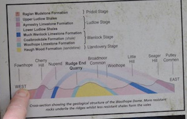
Anglesey ( a UNESCO geo-park) holds a great variety of rocks which range in age from Precambrian to deposits from the last Ice-Age and are known for their complexity. This complexity has been fascinating geologists since the early C19 and has become a classic area for study for geologists and students of geology from around the world. The rocks were mapped for the first time by Edward Greenly who published his classic work, “ The Geology of Anglesey” in 1919 and the one inch map in 1920.

Our base was to be a B&B in Aberffraw which was situated next to Tywyn Aberffraw dunes which were full of botanical interest. An added bonus to the weekend.

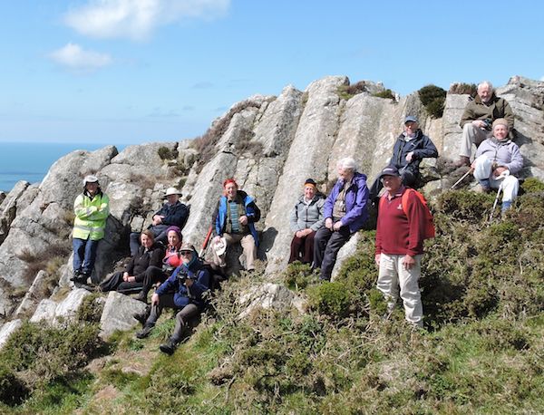
At the introductory talk on the Friday evening Charlie explained that his aim was to look at the rocks from the Precambrian to the Carboniferous so that we could gain an insight into the complexity of the geology. This would entail us criss-crossing the island in order to follow the rock sequence.

Saturday 7th July - Lligwy Bay. (SH 496 871) and Parys Mountain (SH 437905)

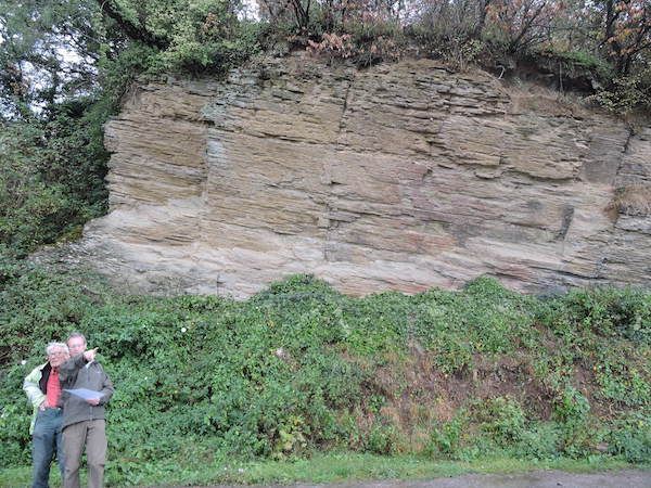
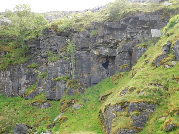
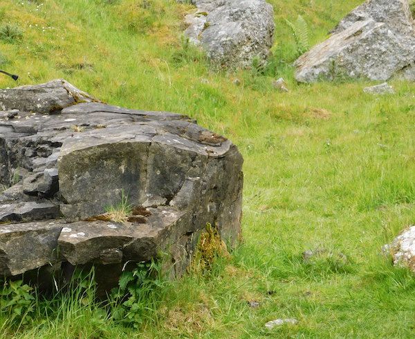
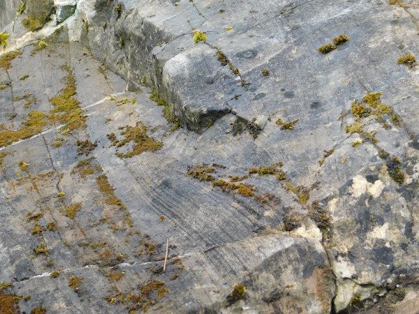
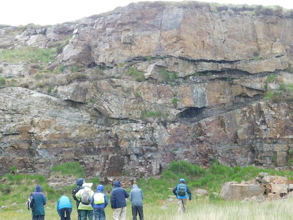
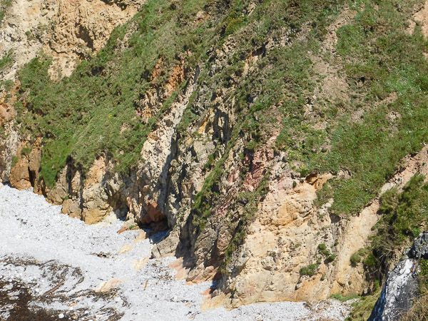
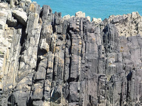
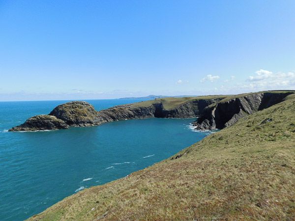
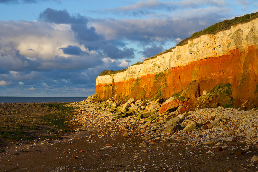
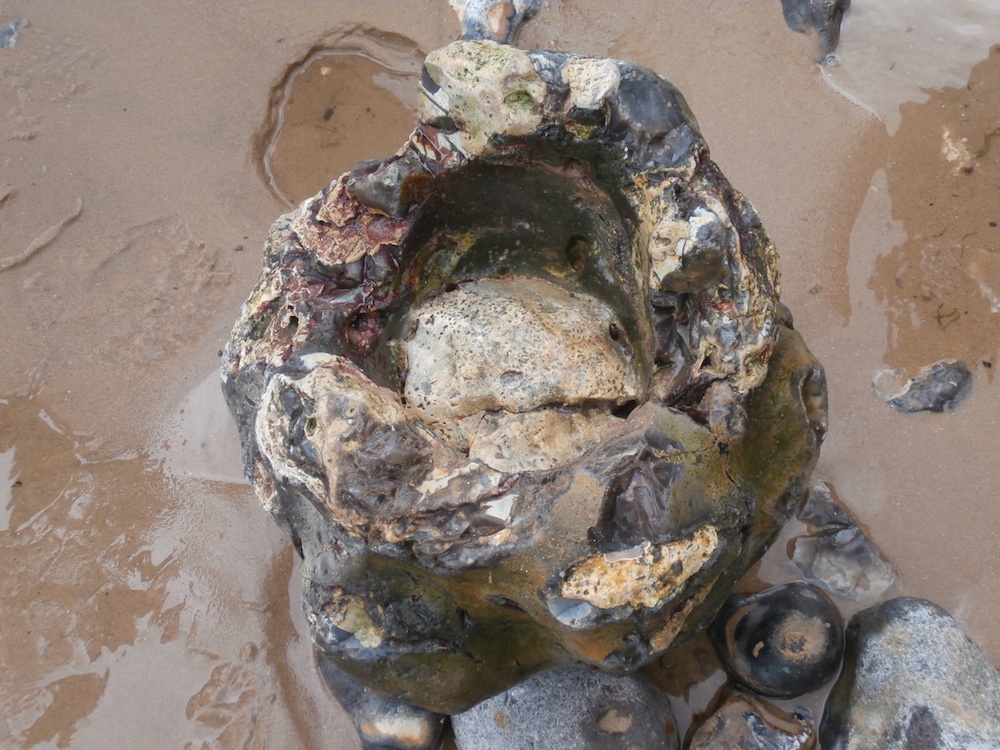
The visit to Lligwy Bay was in two parts of very different geology. In the morning we investigated the southern shore. The rocks exposed here are of Carboniferous Limestone and extend all the way to Red Wharf Bay. The limestone lies unconformably on Devonian sandstone. Charlie explained that the limestone is cyclothemic. In other words the lithological features are repeated. The cyclothems represent transgressive-regressive sequences as sea level rose and fell. As the sea level fell the surfaces became exposed and eroded forming palaeokarstic surfaces. A large block on the beach showed a good example of a palaeokarstic surface. The limestone was found to be highly fossiliferous and had also undergone dolomitisation.

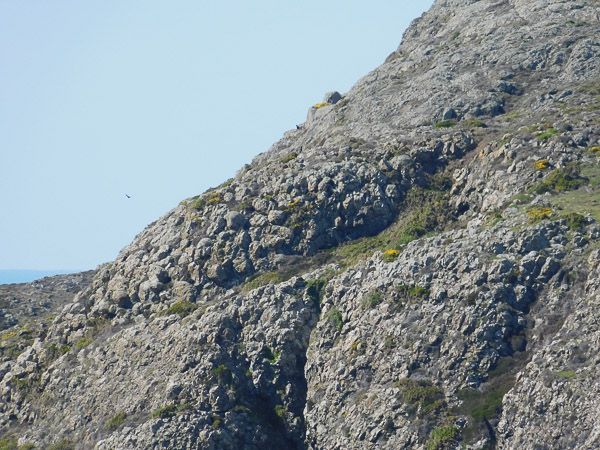
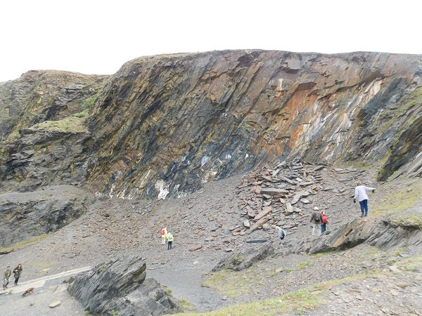
Working out the rock sequenceLligwy-bay
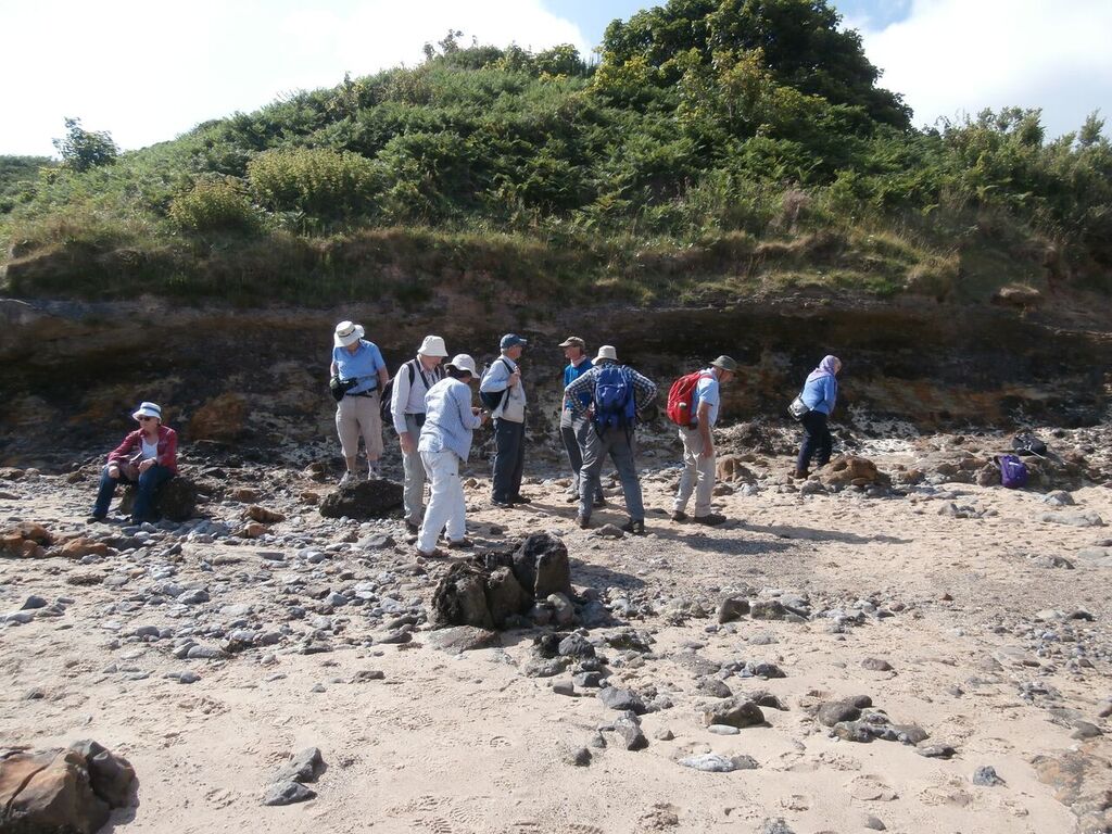
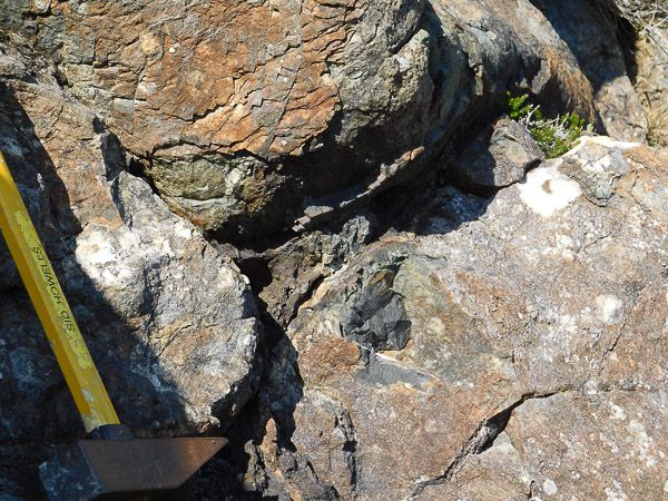
A layer of conglomerate within the sequence was explained as being fluvatile in nature and was laid down when the limestone was exposed as land. The conglomerate was a mix of limestone, quartzite and sandstone pebbles.

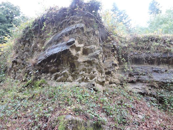
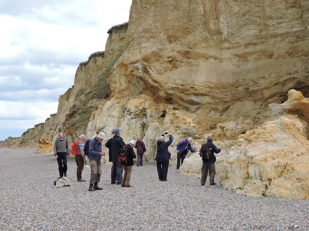
We then crossed to the north side of the bay. Here the geology was was very different the rocks being interbedded red sandstones, siltstones and mudstones of Devonian age. These rocks are folded and cleaved and Treagus et.al. (2011) have interpreted them to be the result of two S-verging anticline–syncline pairs, one with a strongly overturned middle limb their associated minor folds and an axial-planar cleavage. They also consider the deformation to be related to the Acadian orogeny.

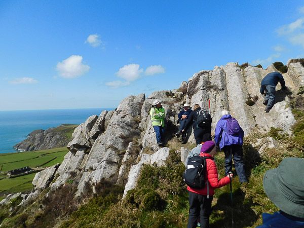
Attempting to identify way-upidentifying-way-up

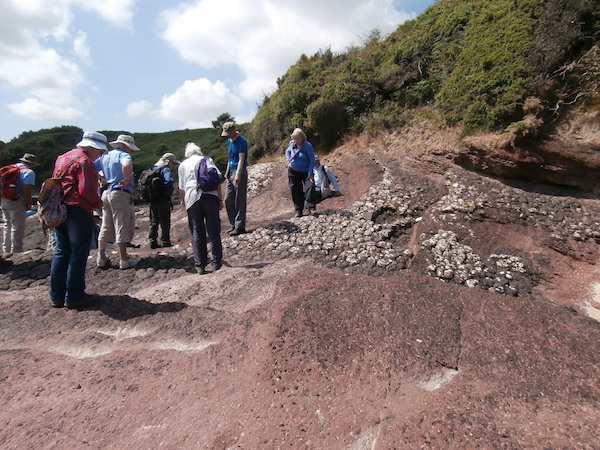
Our task was to see if we could determine if the rocks were the correct way up or overturned and to find the relationship between them. This led to a discussion of how to determine way-up, in particular the use of bedding - cleavage relationships. We found that the first part of the exposure was the correct way up but as we traversed the outcrop it became apparent that the next section was inverted followed by right way up demonstrating just how folded these rocks are.

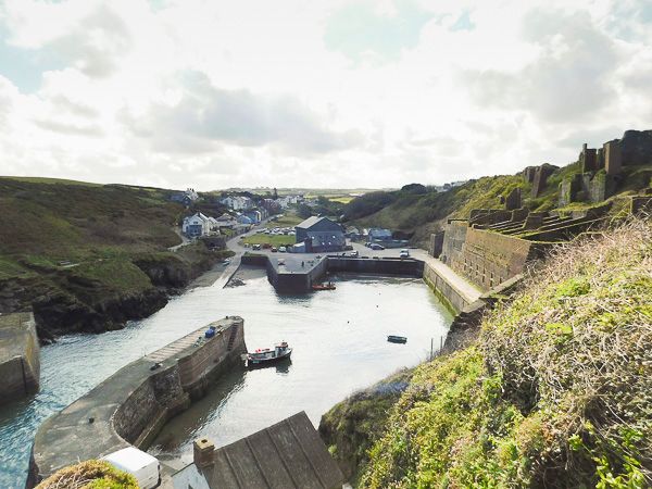
After a hot morning’s work we drove to Amlwch for a well deserved lunch. Whilst there we took the opportunity to visit the Geo Môn museum at the harbour after a superb lunch at the Sail Loft cafe.

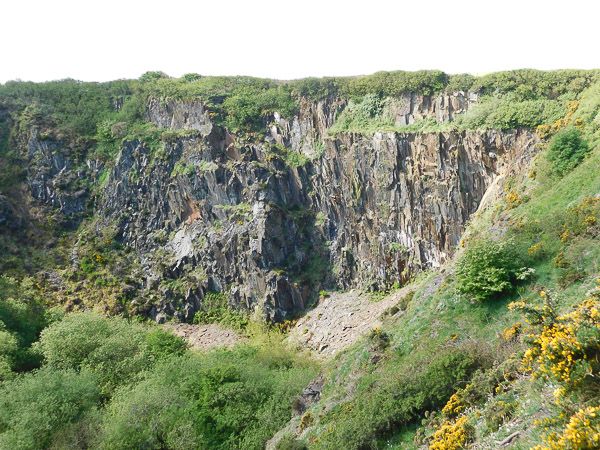
In the afternoon we drove to Parys Mountain once the largest copper mine in Europe. By now the temperature was reaching 30C.
Mining at Parys mountain dates back to the Bronze age and the Romans also mined here, although the main period of mining occurred between 1768 and 1883. The mine closed in 1904. Large-scale industrial production only developed after the discovery of a particularly rich lode in 1768.This was developed by Thomas Williams, the country’s first ‘Copper King’ and by the 1780s the Parys Mountain Copper Mines, were the largest in Europe. The copper ores were shipped from the port of nearby Amlwch to Swansea, at that time the global centre of copper smelting, and found fame when they were used to sheath the hulls of Nelson’s naval ships. More recently the Anglesey Mining Company was formed in 1984 since when they have continued to look into the profitability of any future mining.

View of the Great Opencastparys-mountain2

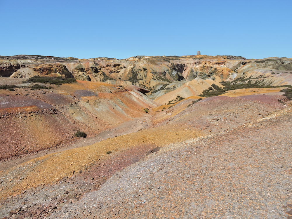
The mineralisation is a Volcanogenic Massive Sulphide deposit (VMS), which typically occur as lenses of polymetallic massive sulphides that form at or near the sea floor in submarine volcanic environments.They form from metal-enriched fluids associated with seafloor hydrothermal convection. VMS deposits are major sources of Zn, Cu, Pb, Ag and Au, and significant sources for Co, Sn, Se, Mn, Cd, In, Bi, Te, Ga and Ge. Some also contain significant amounts of As, Sb and Hg. At Parys mountain the volcanic event occurred in the late Ordovician, producing ores of pyrite, chalcopyrite, sphalerite and galena. Also present are arsenic, antimony, bismuth, silver and gold.

The rocks are underlain by the Mona Complex and the succeeding lower parts of the Ordovician; the latter being shales and mudstones (Parys Shales). The mudstones and shales that host the volcanic rock and ash are thought to be upper Ordovician in age, and succeeded by Silurian mudstones. Deformation of the rocks occurred during the Caledonian Orogeny such that the rocks were folded into a synclinal structure and faulted. During deformation some of the ore metals were remobilised to form sulphide-quartz-chlorite veins and silica-rich fluids permeated the rocks leading to a cherty appearance.

Standing at the view point looking down the Great Opencast it looked like a moonscape and has been used as a film location on numerous occasions. The colours that can be seen are due to the oxides of iron caused by the weathering of pyrite. We visited one of the settling ponds to do some simple chemistry: pH was found to be 2.3. Tony had brought along sodium hydroxide and barium chloride solutions. Adding barium chloride to a sample of the pond water caused the precipitation of barium sulphate subsequent addition of sodium hydroxide caused the precipitation of iron.

The fact that this pond was highly polluted and had a pH of 2.3 it was extraordinary to see an Emperor dragonfly and several Azure damselflies flying around and over the pond. I assume they had not emerged from here but had flown over from a perfectly habitable pond a couple of hundred metres away.

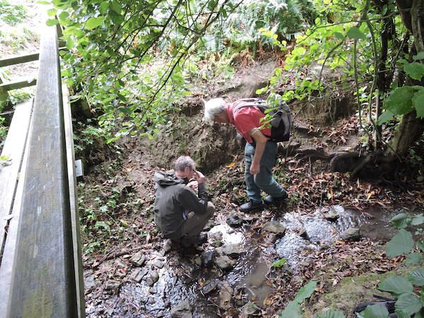
The mine drains into the Afon Goch Amlwch and eventually discharges into the Irish sea at Porth Offeiriad and according to Morgan et.al. (2017) it is one of the most polluting discharges in the UK. Annually it discharges 10 tons of copper and 24 tons of zinc into the Irish sea. They suggested one means of removal of the iron by the use of Sono-electrochemistry ( electrolysis with assisted power ultrasound). Other ideas for preventing mine waste discharge into water bodies ( for all mines) include the use of biochar, algae which take up the minerals and then can be harvested and, similarly, with metallophyte plants.

Mine drainagemine-drainage

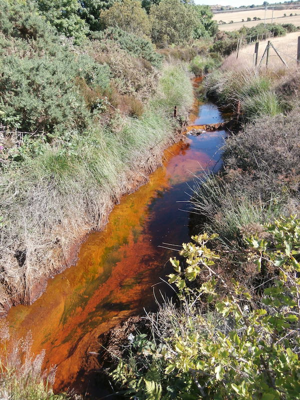
The final stop was the site of C20th recovery of copper. Here the acidic copper-rich mine drainage was fed into a system of brick lined ponds into which scrap iron had been added. This caused the reduction of the dissolved copper to elemental copper which could then be scraped off the iron. This is known as the “cementation process”. Finally we observed the drainage from the lower adit into the Afon Goch causing highly polluted water to flow through Amlwch towards the Irish sea.

After a long and hot day we headed back to cool off and find some sustenance.

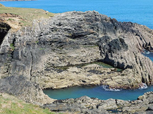
Sunday 8th July Cemaes bay ( SH 210 818), Trwyn, y Parc, Rhoscolyn (SH 288 757)

At the start of what was going to be another very hot day we all headed for Cemaes Bay.

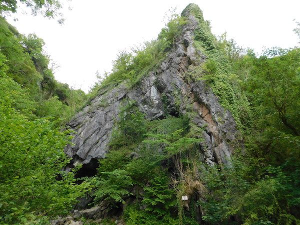
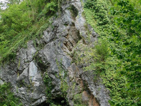
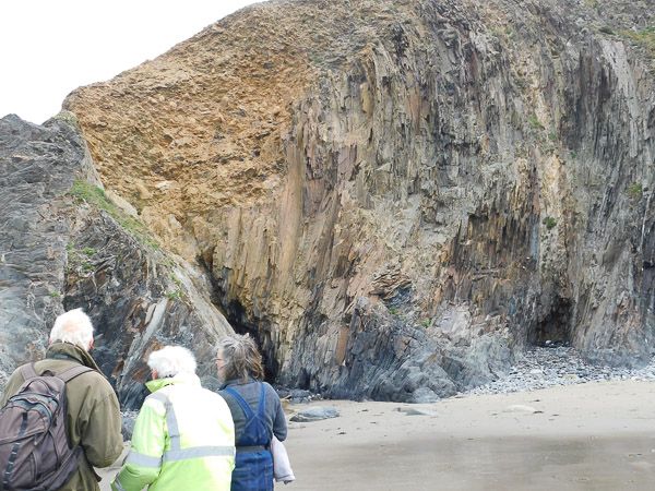
We were here to explore the world-famous Gwna Mélange ( Gwna Group, Monian Complex) which forms a highly chaotic unit and from which Greenly (1919) first introduced the term “Mélange”.

Gwna Mélange Cemaes BayGwna-melange-copy

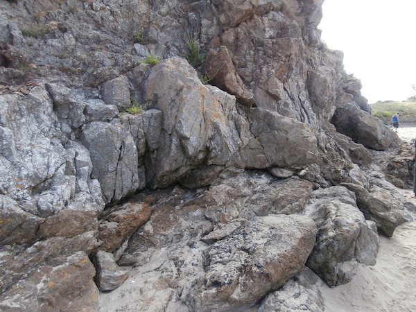
The age of deposition and tectono-sedimentary setting of the Mélange has caused a lot of debate. Greenly originally suggested this was a tectonic breccia but Shackleton and others suggested that it is an olistostrome or slide breccia formed as components slid and slumped from a shelf into deeper marine setting. The latest thinking is that the Mona Complex and thus the Mélange, was formed by the fore-arc accretion of tectonic units above a subduction zone, of West Pacific type, and is therefore characterised by Ocean Plate Stratigraphy.( Maruyama et.al. 2010)

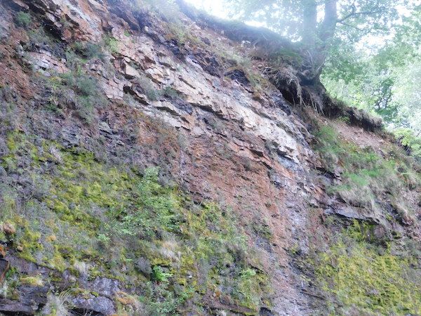
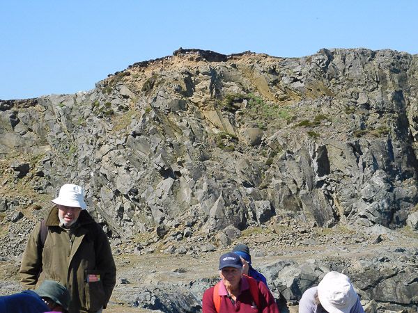
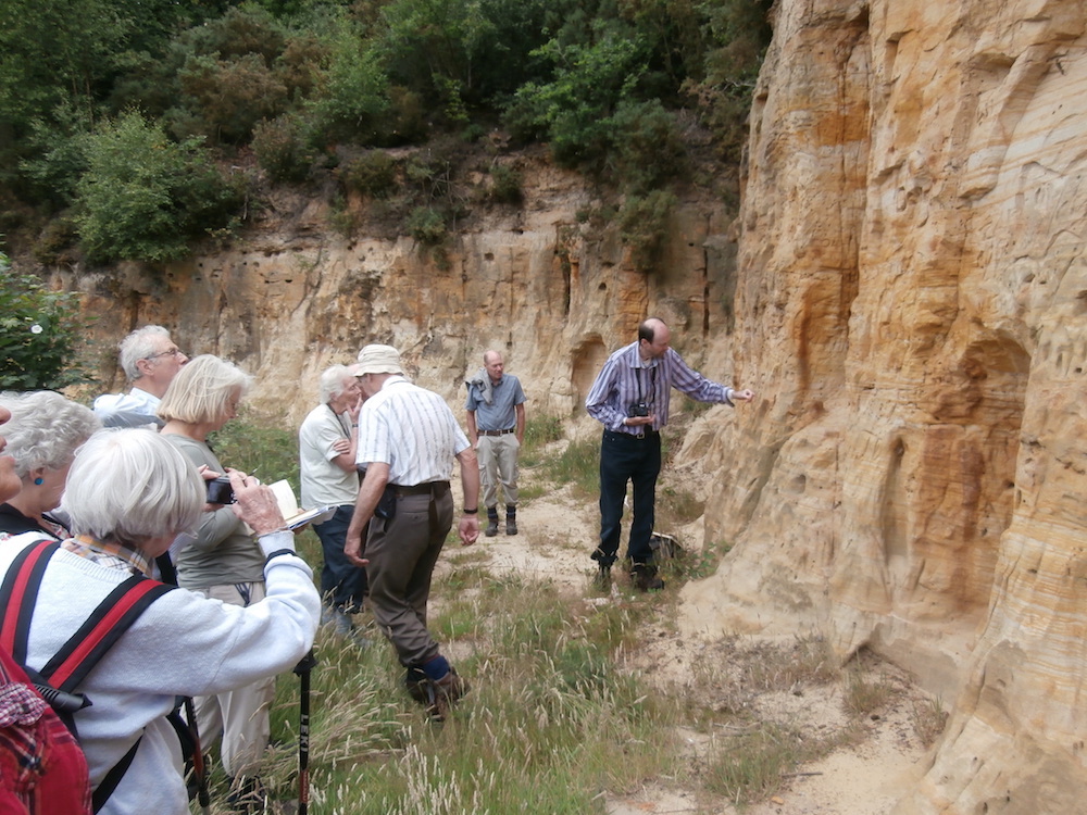
We then took a short walk to the limestone quarry at Trwyn y Parc. Historically the limestone was quarried for agricultural lime but is now disused. Charlie explained that the quarry is formed from a megaclast of limestone of the Gwna Group Mélange. These clasts range in size from tens to hundreds of metres across but it is in this region next to Cemaes Bay, that the largest clasts occur. The clast has a thickness of about 250m and is a fine-grained calcite limestone. A fault runs along the southern edge of the quarry. We spent some time looking for the stromatolite horizons known to be present. Also present were a number of pipes or pot holes which are the product of karstic weathering by ground water solution in the early Cenozoic. There was a vertical section through one of the pipes in the cliff face. The left margin had detached blocks of limestone and the interior was infilled with a fine breccia.

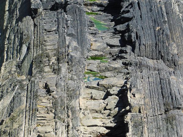
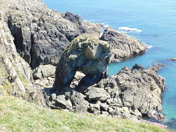
From here we drove to South stack for lunch and with the intention of looking at the folding in the South stack formation but the shear number of people present made this impossible. So we had lunch and drove to Rhoscollyn where we parked near the church at SH 288 757 and walked to cliffs below the coastguard lookout. These highly deformed rocks of the Rhoscolyn Formation were turbiditic silts and muds with occasional sands which had been extensively folded and faulted and metamorphosed to the chlorite or biotite grade. They were cut by occasional quartz veins.

Generations of students had cut their teeth on these as the folding is complex, comprising more than one episode, thus producing a crenulated cleavage. The overall structure, the Rhoscolyn Anticline, is on a kilometre scale running northeast to southwest, plunging to the northeast. Dating had been difficult because of the lack of fossils. For this reason early geologists had regarded them as Precambrian; but more recent evidence indicates early Cambrian.

Rhoscolyn FormationRhoscolyn2

Walking toward the coastguard lookout, we came to a clear change of slope and the overlying Holyhead Quartzite was exposed in a number of glacially smoothed bedding planes where the dip was easily seen and the overall anticlinal structure became apparent. Good sections were exposed in faulted inlets where the complex folding was well displayed.
We returned down the main track to the church and parked cars.

Monday 9th July Newborough Warren (NH392634)

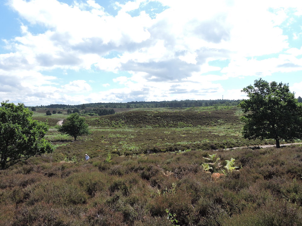
Monday morning was spent at Newborough Warren on the south-west coast, where the famous Gwna pillow lavas outcrop through a huge expanse of sandy beach.These are unusually well formed pillows of basalt, relatively non-vesicular and in a wide range of sizes, greenish with secondary chlorite. The rock is spilitic, the molten basalt having been altered by sea water during its emergence from the sea floor and subsequently by circulation of sea water through the hot pillows. These pillows must have been transported by ocean closure from some far distant mid-ocean ridge. Close to the pillow lavas are outcrops of bedded tuffs and volcaniclastic rocks with occasional jasper, suggesting a mix of igneous processes.

Pillow Lava Newborough Warren pillow-lava-newborough-1

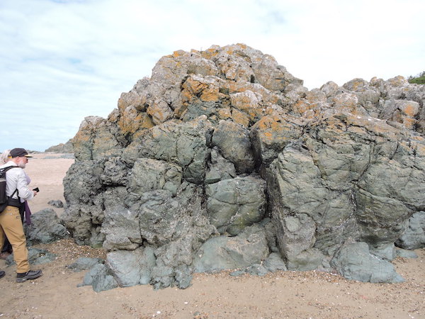
Most of us had an opportunity of looking at the exposure at the foot of the Marquis of Anglesey’s column just off the A5, on the way home. This classic location exposes a late Precambrian blue glaucophane schist. These are produced by (comparatively) low temperature and high pressures, and are therefore evidence of subduction. (Cool rock is carried deep down, so achieving the high pressure before the rock heats up.) Many boulders and other exposures were visible and were indeed blue, exhibited schistosity and tight folding.

Unfortunately there seemed to be repairs going on, so we could not look at the views from the top of the column. However the visit marked a significant postscript to a rewarding and enjoyable visit to the island in glorious weather.


Summer weekend North Norfolk 2017

Summer weekend North Norfolk 2017

This year the club decided to take a look at the Quaternary geology of north Norfolk, which would be a complete change from our local geology. The leader was Tim Holt-Wilson who is well known for his work on the geodiversity of Norfolk. His knowledge and previous work in the area led to a highly interesting and informative weekend.

The solid geology of Norfolk is mainly covered by Quaternary deposits, although in some areas the underlying rock does appear at the surface as at Hunstanton where the cliffs are composed of Cretaceous age rocks. The oldest rocks are to be found in the west and these dip gently eastwards towards the north sea basin. The oldest rocks are Lower Cretaceous sandstones and clays, which form an eroded escarpment between Heacham and Castle Rising, and underlie much sandy heathland locally. Rock types vary from sands and impermeable clays to tough, iron-cemented sandstones. Overlying these rocks are rocks of the Upper Cretaceous chalk which contain numerous flint nodules.

As you move eastwards the chalk becomes overlain by Pliocene-Pleistocene marine sands and gravels, these being the Norwich Crag and the Wroxham Crag Formations resting unconformably on the chalk. Other “pre-glacial” deposits are the freshwater and estuarine deposits known as the Cromer Forest Bed.
The overlying superficial deposits are very complex and it is these that we had really come to see. Ice-sheets and seas transgressed and regressed many times over this landscape which left a complex sequence of marine and terrestrial sediments. Between about 2.6 million and 900,000 years ago, Southern England was joined to France, at the Straits of Dover, which now links the North Sea to the English Channel. Numerous small-scale oscillations from warmer to cooler episodes occurred resulting in frequent but relatively small falls and rises in sea level, which would have affected the Norfolk coastline.

Around 900,000 years ago, a marked climatic shift occurred, resulting in a climate dominated by extremes both globally and locally. During this time over 20 major climatic shifts from ‘warm stages’ (or interglacials) to ‘cold stages’, (or glacials), have been recognised globally, with each lasting several tens of thousands of years. During the maximum extent of glaciation, ice covered the whole of the British Isles north of Bristol and London. The thickness of ice over Norfolk is estimated to have been between 2 and 3km. At least three major glaciations have been recognised: the earliest of these is called the Happisburgh Glaciation and started around 640,000 years ago. The second, and largest glaciation is the Anglian Glaciation and occurred around 450,000 years ago. The third glaciation, which didn’t extend as far into Norfolk, is known as the Devensian glaciation which was at its coldest around 25,000 years ago. Each of the glaciations dramatically modified the geography of Norfolk and deposited vast quantities of sediment.

Sandringham warren
Sandringham-warren

The first location on the Saturday morning was Sandringham Warren and Dersingham bog (TF 6694 2839) where Tim showed us landscape features related to Lower Cretaceous geology. It is here that sands of the Leziate Beds ( Sandringham Sands Formation, Upper Jurassic to Lower Cretaceous) are capped by harder, iron-rich layers of basal Dersingham Beds (Dersingham Formation). Leziate Beds consist of loose, quartz rich sands and iron-cemented sandstones and were laid down under marine conditions.The Dersingham Beds the basal of which are iron-cemented sandstones, overlain by sands, silts and clays. The Dersingham Beds produce the plateau feature seen at Sandringham Warren. Tim explained that a series of bluffs separated by dry valleys is thought to represent a line of a former cliff and the dry valleys a product of a process known as “spring sapping” where groundwater outflow undermines slopes and therefore cuts back into the slope forming a valley. Dersingham bog which is a SSSI, is developed on layers of poorly draining sandy “head” washed down from the Leziate Beds and is now an acid mire. It has many rare plants like bog ashphodel, round-leaved sundew and cranberry.

Snettisham Common Pitsnettisham-common-pit

We then drove to Snettisham Common Pit (TF 6710 3362) which is a county wildlife site and turned out to be a superb sandstone quarry from which high silica sandstone had been quarried in the 19th century for use as foundry sand. The quarry has vertical exposures up to 5m in height of Leziate Beds topped by strata of the Dersingham Beds. The sands showed good examples of cross-bedding and the walls of the quarry were peppered with the holes from solitary bees. One important feature in the quarry is faulting which may be associated with glacial loading or periglacial cambering.

Lunch at Ringstead Commonlunch-at-Ringstead-Common

A short stop at Heacham chalk pit where the Lower Chalk (Grey Chalk, Upper Cretaceous, Plenus Zone)is exposed. It was here that Mike Hodgson found a very large ammonite, and although worn, was impressive. The next stop was Ringstead Common nature reserve, for a well earned lunch before we looked at the geology. Middle Chalk ( white chalk, Upper Cretaceous, Labiatus Zone) is exposed here. Ringstead is an example of an outwash valley. During the decline and melting of the North Sea ice-sheet valleys in central and western Norfolk were deeply excavated by the action of torrential melt-water streams issuing from the margin of the retreating ice. Ringstead is the result of a former drainage overflow channel that was cut by the melting ice water. Lots of examples of chalk flora were also present.

Cliffs at HunstantonCliffs-at-Hunstaton

We returned to Hunstanton ( our base) and after an ice-cream on the sea front spent the remainder of the day observing the cliffs at Hunstanton (TF 673415). The cliffs extend from Hunstanton to St. Edmunds Point, Old Hunstanton, about 1.5km away, and the whole is a SSSI of Cretaceous deposits. The colour contrast of the rocks is impressive with, at the base, the rusty brown of the Carstone Formation to the red of the Hunstanton Chalk Formation ( Red Chalk) to the white and grey of the Ferriby Chalk Formation. As the cliffs dip to the east, at St.Edmund's Point the Red Chalk is at beach level and the Carstone is no longer visible.

The Carstone is formed of coarse sand particles interspersed with rolled pebbles indicative of deposition in a high energy, shallow sea, near shore environment, with strong currents. The lower Carstone is Aptian in age (112-116ma) whilst the upper Carstone is Middle Albion (105ma). When it is fresh the Carstone is grey-green in colour but darkens to brown with weathering. On the foreshore the Carstone forms a strange pattern of ‘tuffets’, where the sea has preferentially eroded joints in the rock.

Above the Carstone is the Red Chalk (101ma) and it is thought there was a gradual transition from one to the other. The more pebbly Carstone being laid down in a higher energy and shallower environment to the finer Carstone. The Red Chalk being laid down very slowly in deeper water but close enough to land to receive iron-rich clay. When the sea-level rose sufficiently the land was completely flooded and only white chalk was deposited. The Carstone contains fossils including ammonite fragments, bivalves and traces of burrowing organisms, whilst the fossils of the Red Chalk include belemnites, brachiopods, echinoids and corals. The lowermost bed of the White Chalk also contains numerous fossils including, bivalves, brachiopods, belemnites, echinoids. Between the top of the Red Chalk and the base of the Ferriby chalk is the Paradoxica Bed. This was originally named from what was thought to be a sponge but in fact turned out to be sediment-filled, anastomosing Thalassinoides burrow systems.

Paramoudra or Pot Stone Paramoudra-or-Pot-stone
On the Sunday our group went east to spend the day to try and gain a basic understanding of the Quaternary geomorpholgy. Our first stop was west Runton. ( TG 185432) where the Cromer Forest bed is the Type site for the Cromerian Interglacial Period. The area is a SSSI because of it's rich fossil beds and one of the most important Quaternary sites in the UK.It is famous for the elephant or steppe mammoth, Mammuthus trogontherii, which was discovered in 1990 and is one of the oldest and best preserved fossil elephants ever found in the UK.

Commencing on the beach we are standing on a chalk wave-cut platform and there are large flint circles and other flint structures which resemble garden pots. These are the Paramoudra or “Pot stones” which are trace fossils of an unknown creature and referred to as Bathicnus paramoudrea. As we work up the succession the Wroxham Crag lies unconformably on the chalk. This is a shelly deposit and is pre-Pastonian to Cromerian in age. The shells are marine bivalves that are cold water species and herald the onset of the glaciation.
Overlying the Wroxham Crag are the Cromer Forest Beds which according to the BGS Lexicon can be described as follows: “The formation encompasses the fluvial, lacustrine and organic deposits of the postulated "Ancaster River", which is believed to have flowed from the Pennines to the North Sea along a line corresponding approximately to the present north coast of Norfolk. Four members are recognised in north Norfolk coastal sections. The Sheringham Member (lowest member) comprises freshwater organic mud, clay and sand. The Runton Member includes laminated freshwater silty clay. The West Runton Member comprises layers of alluvial clay and organic freshwater mud. The Bacton Member (highest Member) comprises clay and organic mud.”

The Cromer Forest bed has yielded the richest Pleistocene vertebrate fauna in UK and include, fish, amphibians, reptiles, birds and mammals. The upper part of the Cromer Forest Bed the layers become gravelly and marine bivalves are present indicating a return to marine conditions.This, along with cross bedding suggest esturine conditions. Above the Cromer Forest Bed Formation are glacial deposits belonging to the Anglian Stage. They consist of a complex sequence of fluviatile sediments and contorted drift which demonstrate a climate cooling from the interglacial to glacial conditions. They include river sands, gravels, glacial till and outwash sands. There is remarkable folding in the glacial sediments the consequence of glacio-tectonic deformation.

Glacio-tectonised strata at Weybourne Hope
Glacio-tectonised-strata-at-Weybourne-Hope-2

From West Runton we travelled to Weybourne Hope. The overall first impression was of high cliffs of contorted soft sediment very unlike any glacial till in mid-Wales. The lower cliffs are composed of the Weybourne Chalk Member (Norwich Chalk, Upper Cretaceous, Campanian), which are glacio-tectonised where sub-horizontal shear planes have occurred due to glacial ice movement. This is chalk breccia in which fractured flints and fragmented shells occur. Above the chalk is the Wroxham Crag Member (Early Middle Pleistocene) as seen at West Runton but is disturbed and distorted due to the effects of glaciation. Above the Wroxham Crags Formation are Members of the Sheringham Cliffs Formation (Middle Pleistocene), the Runton Till Member a matrix-supported diamicton and the chalky Weybourne Town Member which is a highly consolidated matrix-supported diamicton. Above these there is a sharp erosional boundary and then the Briton's Lane Sand and Gravel Member of the Briton's Lane Formation (Late Pleistocene).

We then visited Blakeney Esker ( TG 031422), apparently the best in England. An esker is a long winding ridge of sand and gravel which has been deposited within a tunnel made by a subglacial stream cut into the base of an ice sheet. They are not normally preserved very well as the loose sand and gravel are washed away by melting ice sheet. The esker is 3.5km long and runs from Blakeney to Wiverton, with a base width of 100m. This is also a wildlife site and the differences in the geology are reflected in the plants at the top and bottom of the esker. Those at the top are acid heath type plants where as those at the base are growing on clay.

Our final stop was to St. Mary's church Brancaster to look at the building stones in it's walls. This is something the club is well used to undertaking. The church building is known for the re-use of Roman stone in the walls. There are the remains of two Norman windows in the south side of the west end of the chancel and these have been blocked in by stone taken from the Roman Fort of Branodunum. It was also used as a facing stone and isolated stones were found dotted around the walls. The stone is a very distinctive quartzite and comes from quarries around Castle Rising.
Building Stones Brancaster Church
brancaster-church-1


2016 Annual Weekend Field Trip – Lake District

2016 Annual Weekend Field Trip – Lake District

Keswick at Night
keswick-at-night-4
The Club’s Annual Summer Weekend, 8-11 July 2016, was spent in the Lake District, based in the delightful lakeside town of Keswick, among the northern lakes, and admirably led by Cumberland Geological Society stalwart, John Rodgers. The Lake District, which is also the Cumbrian Mountains, is some 30 miles square of Ordovician and Lower Silurian rocks surrounded by younger Carboniferous rock. A band of Ordovician Skiddaw Slate lies across the north and a band of Silurian rock across the south of the district. Between them is a band of igneous rock, mostly lavas and ash flows, the Borrowdale Volcanic Group, hosted by Ordovician rock. This formed due to arc volcanism, caused by a subduction front as the Iapetus ocean closed only 40 km to the north, across the Solway Firth. An underlying batholith of granite caused the original uplift of older rock. During the Ice Age this erosion resistant dome was sculpted by glaciers to form the picturesque lakes and lakeland scenery.

On the Friday evening our leader gave an introductory talk on the lakeland geology. A month spent there would not do justice to the district, so our two days had to be very selective. On the Saturday we explored an area north-east of Keswick in the Skiddaw Group, around Mungrisdale and Mosedale Bridge, moving on in the afternoon to the nearby valley between the dramatic Bowscale and Carrock Fells. These localities allowed us to examine structures in the Skiddaw slate, and look at the effect of metamorphism on the slates, particularly rocks spotted with cordierite, and containing acicular andalusite.

Mosedale wall showing hornfels
Mosedale-wall-showing-Hornfels
In the valleys of the Caldew and Grainsgill Beck we could see both granite outcrops and glacial action. The weather was mostly kind but, this was our twelth annual weekend excursion, and we can’t expect perfect weather all the time. It literally blew a gale when we walked up to the Tungsten mine. Saturday evening ended with a discussion back at the B&B;before the group dispersed to various Keswick restaurants.

Group at Friar's Crag Derwent water
dewentwater

Sunday began at Friar’s Crag looking south down Derwent Water and discussing the working of the glacier which formed this, generally flowing north towards us, round the dolerite intrusion on which we stood, continuing north of us to excavate also Bassenthwaite Lake. This area is on the northern part of the Borrowdale Volcanic Group, so again we were able to combine consideration of the local volcanics - this area was a caldera – with an appreciation of the extraordinary erosive power of the glaciers. We drove down the west bank of Derwent Water to see roche moutonneés, lava flows and columnar cooling among many other features.

Walking the Rosthwaite moraines
walking-the-Rosthwaite-moraines

In the afternoon we walked the Rosthwaite moraines just south of Derwent water, in the glacial valley now occupied by the north-flowing river Derwent and its tributaries from Seathwaite and Stonethwaite to the south, endeavouring to understand the glacial movements which left this debris. Another splendid weekend ended on the Monday morning, for most us with a look at Keswick and the Threlkeld Museum just east of the town.