Summer Weekend Anglesey ( Yns Môn) July 6-9th 2018 Leader Dr Charlie Bendall.
Anglesey ( a UNESCO geo-park) holds a great variety of rocks which range in age from Precambrian to deposits from the last Ice-Age and are known for their complexity. This complexity has been fascinating geologists since the early C19 and has become a classic area for study for geologists and students of geology from around the world. The rocks were mapped for the first time by Edward Greenly who published his classic work, “ The Geology of Anglesey” in 1919 and the one inch map in 1920.
Our base was to be a B&B in Aberffraw which was situated next to Tywyn Aberffraw dunes which were full of botanical interest. An added bonus to the weekend.
At the introductory talk on the Friday evening Charlie explained that his aim was to look at the rocks from the Precambrian to the Carboniferous so that we could gain an insight into the complexity of the geology. This would entail us criss-crossing the island in order to follow the rock sequence.
Saturday 7th July - Lligwy Bay. (SH 496 871) and Parys Mountain (SH 437905)
The visit to Lligwy Bay was in two parts of very different geology. In the morning we investigated the southern shore. The rocks exposed here are of Carboniferous Limestone and extend all the way to Red Wharf Bay. The limestone lies unconformably on Devonian sandstone. Charlie explained that the limestone is cyclothemic. In other words the lithological features are repeated. The cyclothems represent transgressive-regressive sequences as sea level rose and fell. As the sea level fell the surfaces became exposed and eroded forming palaeokarstic surfaces. A large block on the beach showed a good example of a palaeokarstic surface. The limestone was found to be highly fossiliferous and had also undergone dolomitisation.
Working out the rock sequence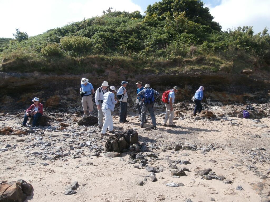
A layer of conglomerate within the sequence was explained as being fluvatile in nature and was laid down when the limestone was exposed as land. The conglomerate was a mix of limestone, quartzite and sandstone pebbles.
We then crossed to the north side of the bay. Here the geology was was very different the rocks being interbedded red sandstones, siltstones and mudstones of Devonian age. These rocks are folded and cleaved and Treagus et.al. (2011) have interpreted them to be the result of two S-verging anticline–syncline pairs, one with a strongly overturned middle limb their associated minor folds and an axial-planar cleavage. They also consider the deformation to be related to the Acadian orogeny.
Attempting to identify way-up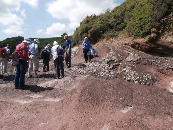
Our task was to see if we could determine if the rocks were the correct way up or overturned and to find the relationship between them. This led to a discussion of how to determine way-up, in particular the use of bedding - cleavage relationships. We found that the first part of the exposure was the correct way up but as we traversed the outcrop it became apparent that the next section was inverted followed by right way up demonstrating just how folded these rocks are.
After a hot morning’s work we drove to Amlwch for a well deserved lunch. Whilst there we took the opportunity to visit the Geo Môn museum at the harbour after a superb lunch at the Sail Loft cafe.
In the afternoon we drove to Parys Mountain once the largest copper mine in Europe. By now the temperature was reaching 30C.
Mining at Parys mountain dates back to the Bronze age and the Romans also mined here, although the main period of mining occurred between 1768 and 1883. The mine closed in 1904. Large-scale industrial production only developed after the discovery of a particularly rich lode in 1768.This was developed by Thomas Williams, the country’s first ‘Copper King’ and by the 1780s the Parys Mountain Copper Mines, were the largest in Europe. The copper ores were shipped from the port of nearby Amlwch to Swansea, at that time the global centre of copper smelting, and found fame when they were used to sheath the hulls of Nelson’s naval ships. More recently the Anglesey Mining Company was formed in 1984 since when they have continued to look into the profitability of any future mining.
View of the Great Opencast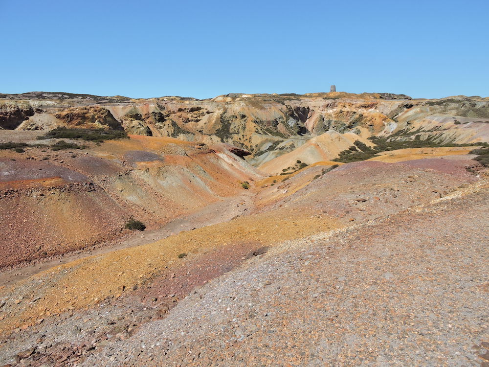
The mineralisation is a Volcanogenic Massive Sulphide deposit (VMS), which typically occur as lenses of polymetallic massive sulphides that form at or near the sea floor in submarine volcanic environments.They form from metal-enriched fluids associated with seafloor hydrothermal convection. VMS deposits are major sources of Zn, Cu, Pb, Ag and Au, and significant sources for Co, Sn, Se, Mn, Cd, In, Bi, Te, Ga and Ge. Some also contain significant amounts of As, Sb and Hg. At Parys mountain the volcanic event occurred in the late Ordovician, producing ores of pyrite, chalcopyrite, sphalerite and galena. Also present are arsenic, antimony, bismuth, silver and gold.
The rocks are underlain by the Mona Complex and the succeeding lower parts of the Ordovician; the latter being shales and mudstones (Parys Shales). The mudstones and shales that host the volcanic rock and ash are thought to be upper Ordovician in age, and succeeded by Silurian mudstones. Deformation of the rocks occurred during the Caledonian Orogeny such that the rocks were folded into a synclinal structure and faulted. During deformation some of the ore metals were remobilised to form sulphide-quartz-chlorite veins and silica-rich fluids permeated the rocks leading to a cherty appearance.
Standing at the view point looking down the Great Opencast it looked like a moonscape and has been used as a film location on numerous occasions. The colours that can be seen are due to the oxides of iron caused by the weathering of pyrite. We visited one of the settling ponds to do some simple chemistry: pH was found to be 2.3. Tony had brought along sodium hydroxide and barium chloride solutions. Adding barium chloride to a sample of the pond water caused the precipitation of barium sulphate subsequent addition of sodium hydroxide caused the precipitation of iron.
The fact that this pond was highly polluted and had a pH of 2.3 it was extraordinary to see an Emperor dragonfly and several Azure damselflies flying around and over the pond. I assume they had not emerged from here but had flown over from a perfectly habitable pond a couple of hundred metres away.
The mine drains into the Afon Goch Amlwch and eventually discharges into the Irish sea at Porth Offeiriad and according to Morgan et.al. (2017) it is one of the most polluting discharges in the UK. Annually it discharges 10 tons of copper and 24 tons of zinc into the Irish sea. They suggested one means of removal of the iron by the use of Sono-electrochemistry ( electrolysis with assisted power ultrasound). Other ideas for preventing mine waste discharge into water bodies ( for all mines) include the use of biochar, algae which take up the minerals and then can be harvested and, similarly, with metallophyte plants.
Mine drainage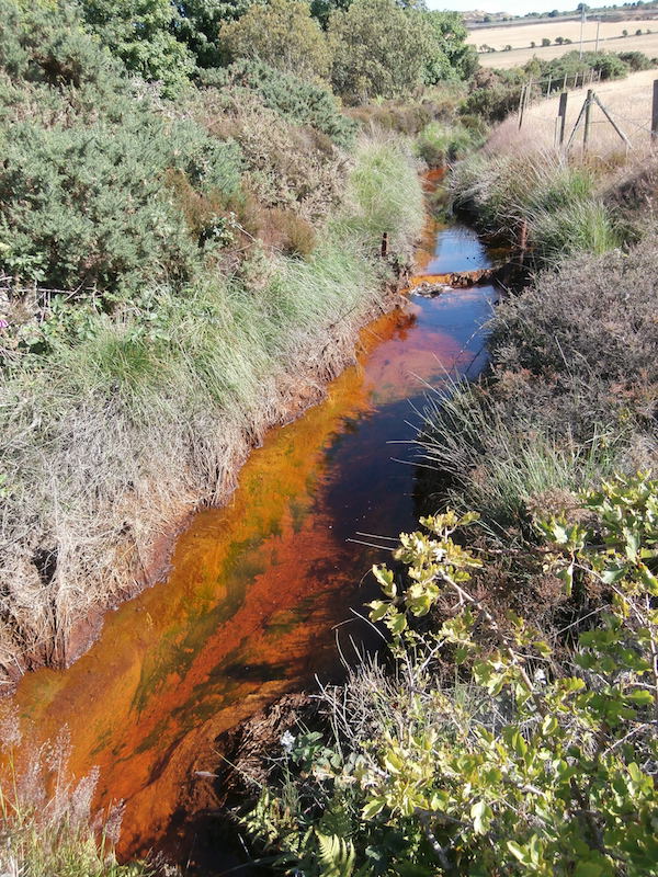
The final stop was the site of C20th recovery of copper. Here the acidic copper-rich mine drainage was fed into a system of brick lined ponds into which scrap iron had been added. This caused the reduction of the dissolved copper to elemental copper which could then be scraped off the iron. This is known as the “cementation process”. Finally we observed the drainage from the lower adit into the Afon Goch causing highly polluted water to flow through Amlwch towards the Irish sea.
After a long and hot day we headed back to cool off and find some sustenance.
Sunday 8th July Cemaes bay ( SH 210 818), Trwyn, y Parc, Rhoscolyn (SH 288 757)
At the start of what was going to be another very hot day we all headed for Cemaes Bay.
We were here to explore the world-famous Gwna Mélange ( Gwna Group, Monian Complex) which forms a highly chaotic unit and from which Greenly (1919) first introduced the term “Mélange”.
Gwna Mélange Cemaes Bay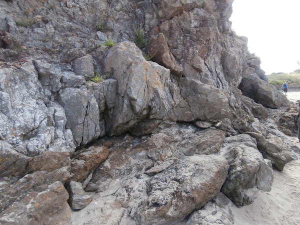
The age of deposition and tectono-sedimentary setting of the Mélange has caused a lot of debate. Greenly originally suggested this was a tectonic breccia but Shackleton and others suggested that it is an olistostrome or slide breccia formed as components slid and slumped from a shelf into deeper marine setting. The latest thinking is that the Mona Complex and thus the Mélange, was formed by the fore-arc accretion of tectonic units above a subduction zone, of West Pacific type, and is therefore characterised by Ocean Plate Stratigraphy.( Maruyama et.al. 2010)
We then took a short walk to the limestone quarry at Trwyn y Parc. Historically the limestone was quarried for agricultural lime but is now disused. Charlie explained that the quarry is formed from a megaclast of limestone of the Gwna Group Mélange. These clasts range in size from tens to hundreds of metres across but it is in this region next to Cemaes Bay, that the largest clasts occur. The clast has a thickness of about 250m and is a fine-grained calcite limestone. A fault runs along the southern edge of the quarry. We spent some time looking for the stromatolite horizons known to be present. Also present were a number of pipes or pot holes which are the product of karstic weathering by ground water solution in the early Cenozoic. There was a vertical section through one of the pipes in the cliff face. The left margin had detached blocks of limestone and the interior was infilled with a fine breccia.
From here we drove to South stack for lunch and with the intention of looking at the folding in the South stack formation but the shear number of people present made this impossible. So we had lunch and drove to Rhoscollyn where we parked near the church at SH 288 757 and walked to cliffs below the coastguard lookout. These highly deformed rocks of the Rhoscolyn Formation were turbiditic silts and muds with occasional sands which had been extensively folded and faulted and metamorphosed to the chlorite or biotite grade. They were cut by occasional quartz veins.
Generations of students had cut their teeth on these as the folding is complex, comprising more than one episode, thus producing a crenulated cleavage. The overall structure, the Rhoscolyn Anticline, is on a kilometre scale running northeast to southwest, plunging to the northeast. Dating had been difficult because of the lack of fossils. For this reason early geologists had regarded them as Precambrian; but more recent evidence indicates early Cambrian.
Rhoscolyn Formation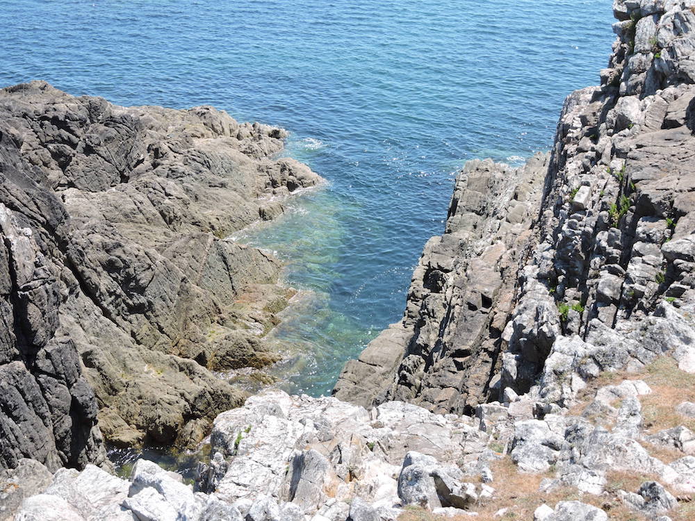
Walking toward the coastguard lookout, we came to a clear change of slope and the overlying Holyhead Quartzite was exposed in a number of glacially smoothed bedding planes where the dip was easily seen and the overall anticlinal structure became apparent. Good sections were exposed in faulted inlets where the complex folding was well displayed.
We returned down the main track to the church and parked cars.
Monday 9th July Newborough Warren (NH392634)
Monday morning was spent at Newborough Warren on the south-west coast, where the famous Gwna pillow lavas outcrop through a huge expanse of sandy beach.These are unusually well formed pillows of basalt, relatively non-vesicular and in a wide range of sizes, greenish with secondary chlorite. The rock is spilitic, the molten basalt having been altered by sea water during its emergence from the sea floor and subsequently by circulation of sea water through the hot pillows. These pillows must have been transported by ocean closure from some far distant mid-ocean ridge. Close to the pillow lavas are outcrops of bedded tuffs and volcaniclastic rocks with occasional jasper, suggesting a mix of igneous processes.
Pillow Lava Newborough Warren 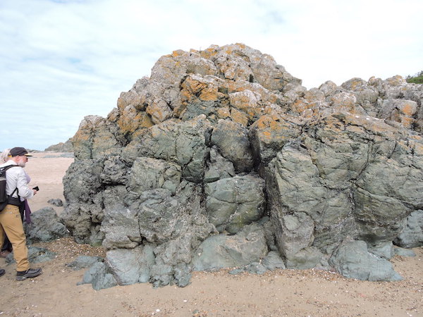
Most of us had an opportunity of looking at the exposure at the foot of the Marquis of Anglesey’s column just off the A5, on the way home. This classic location exposes a late Precambrian blue glaucophane schist. These are produced by (comparatively) low temperature and high pressures, and are therefore evidence of subduction. (Cool rock is carried deep down, so achieving the high pressure before the rock heats up.) Many boulders and other exposures were visible and were indeed blue, exhibited schistosity and tight folding.
Unfortunately there seemed to be repairs going on, so we could not look at the views from the top of the column. However the visit marked a significant postscript to a rewarding and enjoyable visit to the island in glorious weather.