Breccia by Bill Bagley
At the last meeting our chairman Bill Bagley gave a very informative talk on Breccia and its formation.
He commenced by explaining what breccia is and how it differs from conglomerate which could possibly be confused with it.
Breccia may be defined as a rock composed of angular rock fragments set in a matrix of finer grained materials. The name Breccia comes from the Italian breccia for rubble. The angular nature of the fragments implies that the fragments are from a local source and have not travelled very far. Most breccias are sedimentary in origin but may also be formed from the in-situ breakup of local rocks.
Breccia can be confused with conglomerate. Both are composed of shards of rock set in a cement matrix. Breccia however is composed entirely of shattered angular clasts, whereas conglomerate is composed mainly of rounded clasts with occasional angular clasts. The angular clasts are created locally, but rounded clasts are created by transport and friction over a long distance
There are two main classes of breccia as far as their construction is concerned :
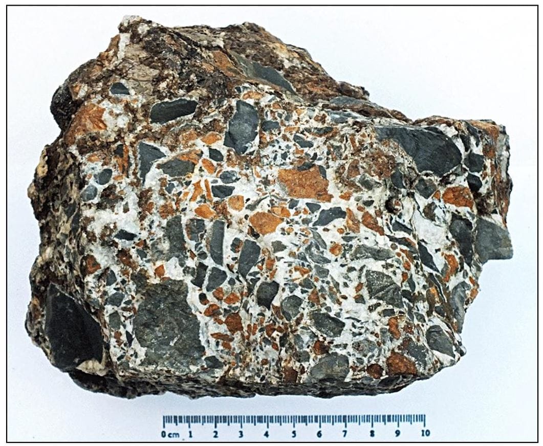
Clast supported — Where the clasts touch each other, and the matrix fills the voids.
Matrix supported — Where the clasts are not in contact and the matrix surrounds each clast.
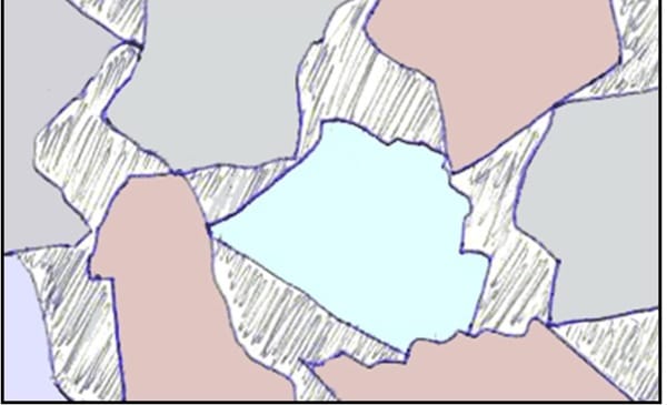
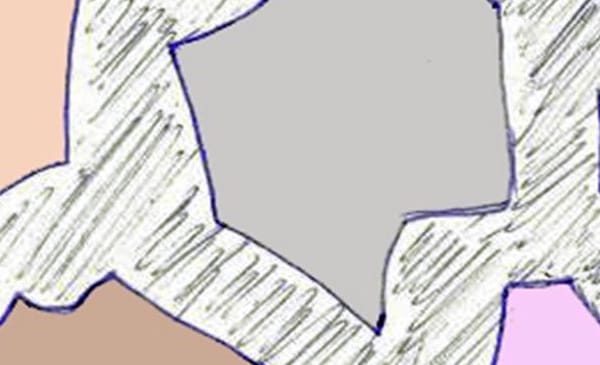
Diagram showing clast and matrix supported breccia by Bill Bagley
The basic types of breccia are sedimentary (including Collapse), igneous, hydrothermal, tectonic, impact. However there are many variations of each type, very often named after the locality where they are found. There are literally dozens of breccias named after their locality, each one having it’s own distinctive appearance
Of all the different basic types of breccia sedimentary is probably the most common. There is so much erosion of surface rocks that this is hardly surprising. All types of rock, including the harder igneous rocks are subject to erosion from wind ice and rain. Just about every exposed hillside has some scree slopes. The steeper the hillside the more scree there is.
Very large accumulations of scree can occur as the result of debris flows. which are produced when a storm washes loose scree into swollen streams and rivers. The scree in the debris flow will be deposited on lower ground where the river widens, especially so in estuaries.
Coastal rocks are especially subject to erosion, mostly by wave and storm action. Most cliffs have freshly formed scree at their bases.
It is the accumulated scree from whichever source which will eventually, after a very long period of time become cemented to form breccia.
In a karst terrain, a collapse breccia may form due to collapse of rock into a sinkhole or in cave development. Another name for collapse breccia is “solution-collapse breccia”, because it is caused by dissolution of underlying soluble bedrock, such as limestone or dolomite. Once the groundwater has dissolved the soluble rock the non- soluble rocks collapse and become crushed.
Igneous breccia can be formed from rocks coming from two different origins, volcanic eruptions, or igneous intrusions, for this reason igneous breccia is commonly referred to as volcanic breccia. The volcanic breccias are the result of violent eruptions causing pyroclastic flows of fractured pieces of rock plucked from the wall of the magma conduit, mixed with a smaller amount of pieces of rock picked up by the lava as it flows down the volcano slopes. The resulting breccia is uniform in rock type
Volcanoes eject molten lava to the surface, whereas igneous intrusions occur when magma cools and solidifies before it reaches the surface. Igneous intrusions are often the result of more than one episode of intrusion into the same fault and when new hot magma intrudes into previously cooled magma, fracturing occurs, especially around the outer edges of the intrusion, and it is this outer fractured rock which later becomes brecciated.
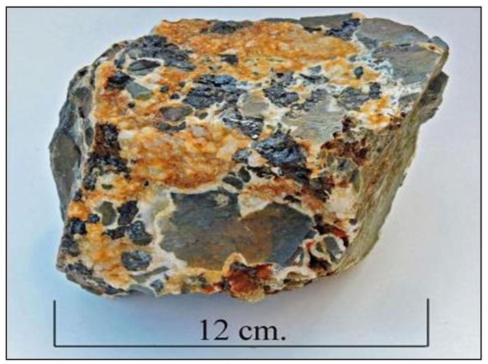
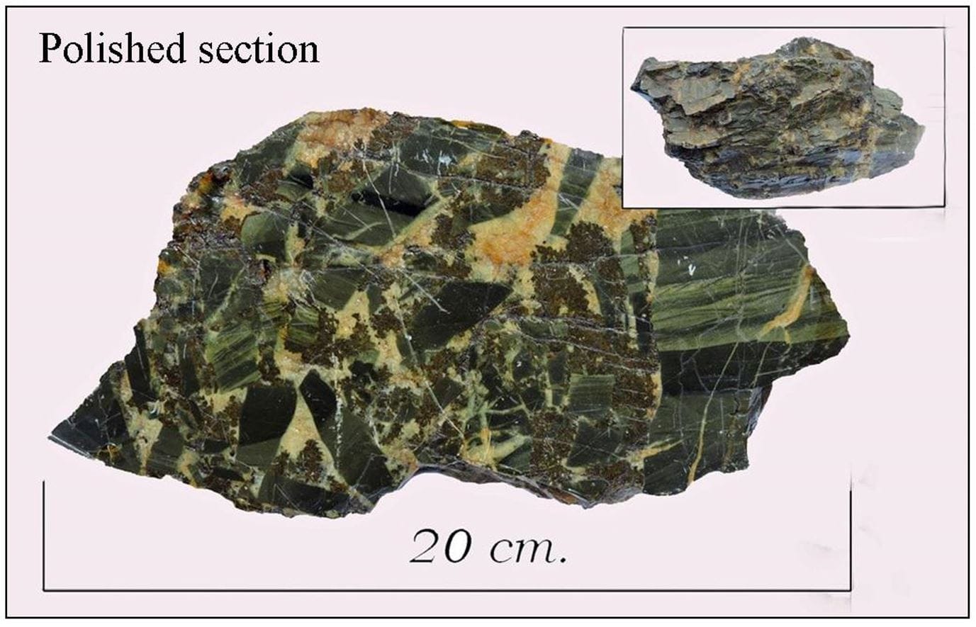
Hydrothermal breccia from Bryn-y-Rafr mine west Wales by Bill Bagley
Hydrothermal breccias occur at relatively shallow depths in the Earth’s crust, at temperatures between 150 oC and 350 oC. Fractures in the rock are home to circulating hot fluids, very often mineralised. As with any hot or boiling fluid, expansion occurs, which causes extreme pressure to be exerted on the walls of the fracture by the fluid. If the extreme pressure exerted by the fluid is suddenly decreased, due to the fluid finding an escape route, the hydrofracturing process is triggered. The instantaneous decrease in pressure causes the fracture walls to shatter and implode rock fragments into the hot circulating fluid. The fluid, now carrying rock fragments will eventually cool and solidify, and a breccia is created.
In ore bodies the circulating fluid is usually rich in silica or calcite, but the fluid also carries other dissolved minerals, such as galena, copper, sphalerite, etc. which upon cooling crystallise, and become incorporated into the breccia
Vein breccia Cwmrheidol mine west Wales by Bill Bagley
Ferroan dolomite in hydrothermal breccia west Wales by Bill Bagley
Tectonic or fault breccia is formed by the action of the opposing walls of a fault grinding against each other. The cement may be the result of mineral matter introduced into ground water.
Impact breccia is not a common type of breccia because it is the product of immense heat and pressure generated by an asteroid strike, which fortunately does not happen very often.
Impact breccia is composed of shattered fragments of rock set in a crystalline matrix of melted rock, the composition of which can vary widely, dependant of the type of rock at the asteroid impact site.
71% of the Earth’s surface is covered by water, so it is inevitable that many asteroid strikes have been in the oceans which makes them much more difficult to observe.
A very interesting talk.
Read past news