Summer Weekend 2024 Field Trip to the Lleyn Peninsula led by Dr. Rob Crossley
The club’s annual weekend away took place at the western end of the Lleyn Peninsula, led by Rob Crossley from Geomôn.
On Friday night, we had a presentation from Rob including information about the effects of the last glaciation and how it would affect what we were going to see. The western Lleyn Peninsula includes a major shear zone and several different unconformities with time gaps ranging from 8Ma to 64Ma.
On Saturday, we explored the shores of Aberdaron Bay.
On Sunday, we explored the shores of Porth Neigwl (Hell’s Mouth), but we had to cut it short due to bad weather.
Returning home on Monday morning, we visited the Llanbedrog volcanics.
24,000 years ago, at the height of the last glaciation, most of the UK was covered by ice. But it was not a single ice sheet. The large Irish Ice Sheet covered Ireland and almost the whole of the Irish Sea, and was continuous with the ice flowing south from more northern parts of the UK. There was also a much smaller, separate, Welsh Ice Sheet covering most of Wales with a small part of the adjacent Irish Sea.
These two ice sheets were adjacent. The boundary between the two ran over the Lleyn peninsula. Aberdaron was under the Irish Ice Sheet. Abersoch was under the Welsh Ice Sheet.
They each carried rocks from the ground that they flowed over, which are now visible as glacial erratics. This is the explanation for the marked difference in the glacial erratics seen at Aberdaron compared to those seen at Abersoch.
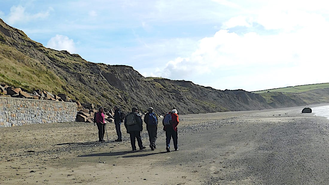
The group heading East along Aberdaron Bay from Aberdaron. The cliffs are formed of glacial boulder clay overlain by fluvio-glacial outwash deposits. The large boulder on the right on the beach is a glacial erratic, left behind as the sea erodes the glacial deposits.
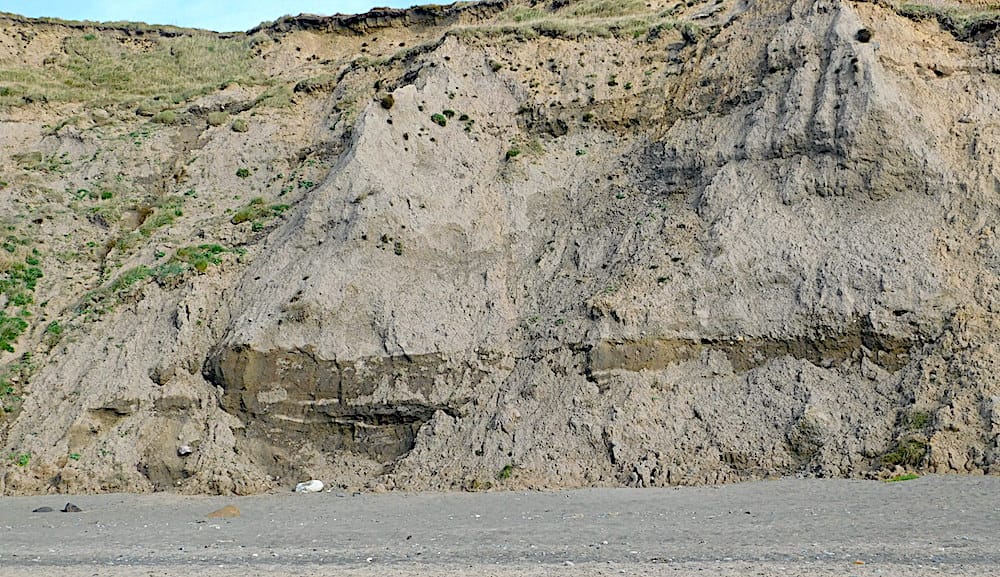
The glacial outwash forming the cliffs is mainly composed of sandy material and clay minerals with some larger rocks. On a dry day, the horizontal bands rich in clay minerals stand out because they retain water.
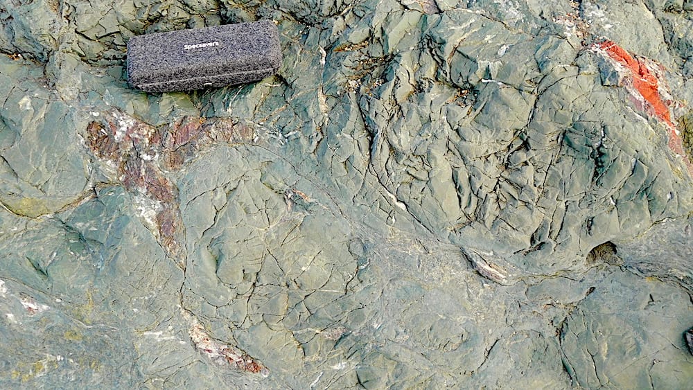
A large glacial erratic on the beach is composed of dark basaltic pillow lavas. The pillows are outlined by the coloured material (including red jasper) deposited later due to hydrothermal activity. The source for this erratic would be from the pillow basalt units of the Gwna Group, carried there by the Irish Sea Ice Stream.
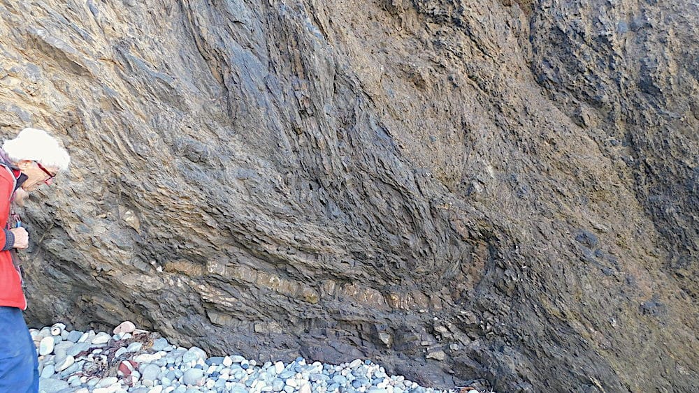
Inspecting the Lleyn shear zone. A tight fold and extensive disruption is visible on the exposed rock face.
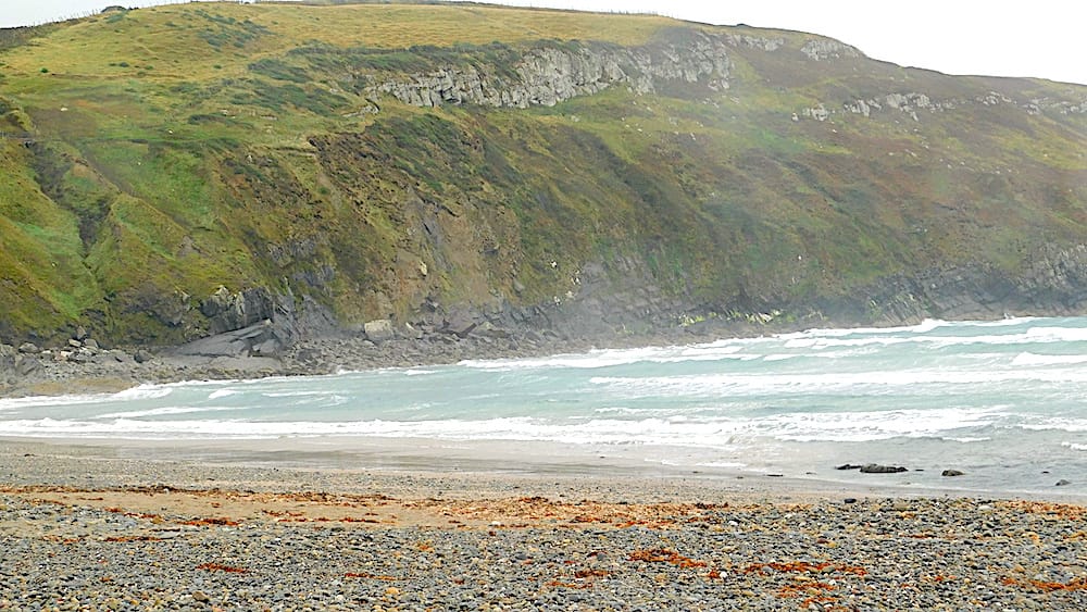
A general view of the eastern side of Porth Neigwl. The very gently dipping pale Ordovician quartzites of the St Tudwal's Formation at the top are sitting unconformably on northeastward-dipping Cambrian rocks, of the Hells Mouth Formation, below.
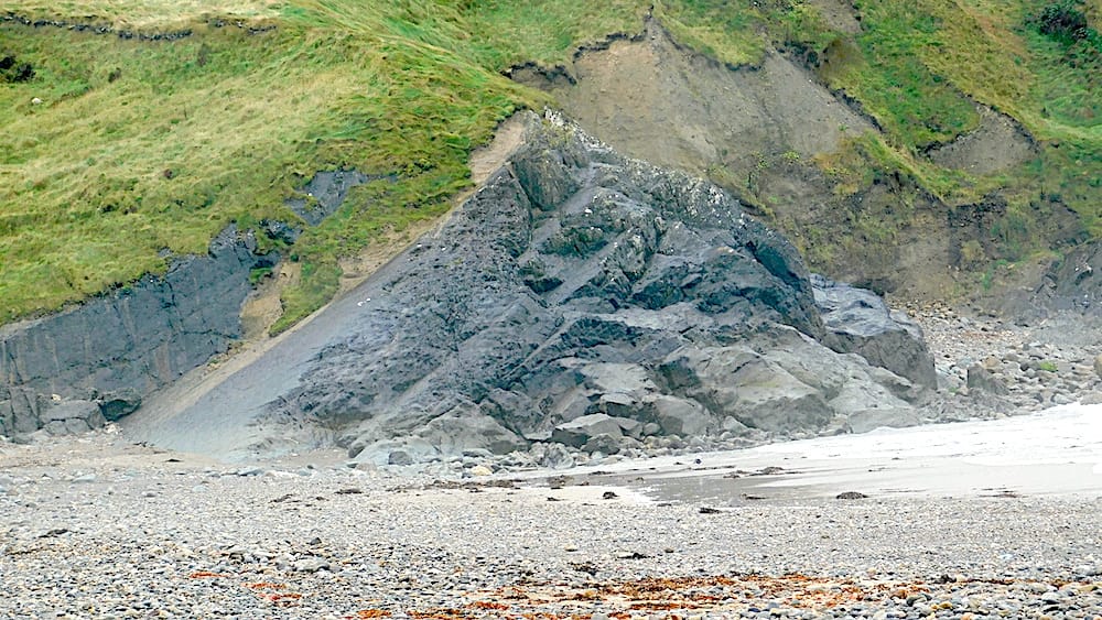
The area of exposed Cambrian rocks seen at sea level immediately left of the previous photo, showing steepening of the northward dips.
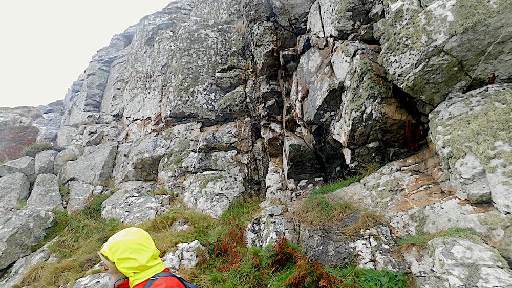
The quartzites of the St Tudwal's Formation are brittle, and plentiful vertical cracks have developed which then get filled by quartz veins, as seen in the centre of the picture
On Monday morning we looked at the volcanic rocks on the shore NE of Llanbedrog. There is a succession of ash deposits with quite differing appearances in each layer; plus one flow of solid, vesiculated lava. (The scale on the photos is a spectacles case.)
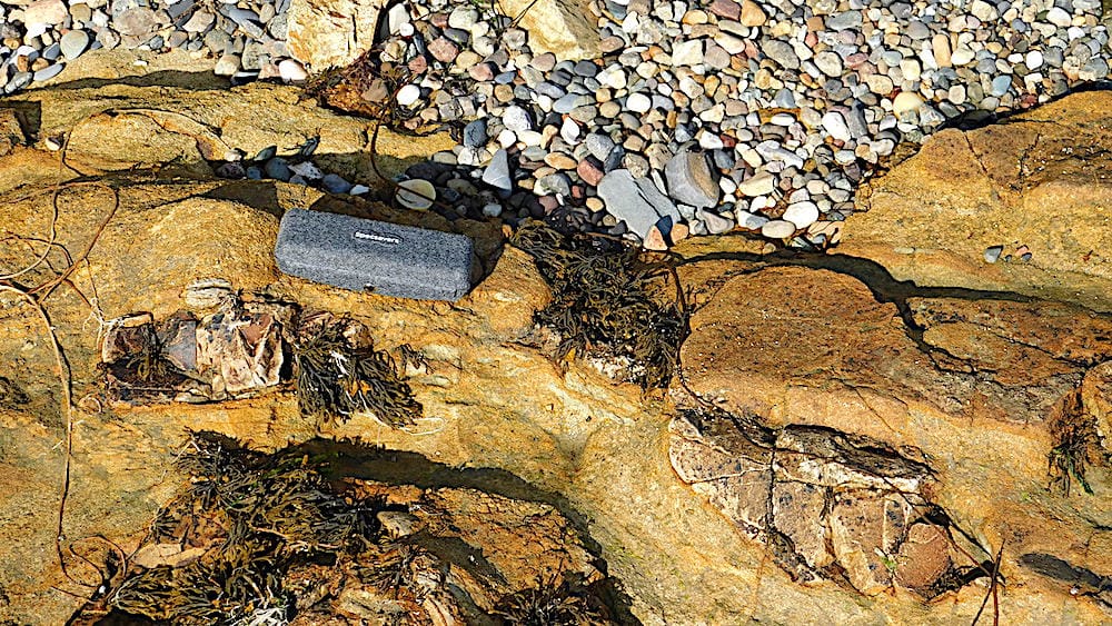
fine yellowish ash with large volcanic “bombs”.
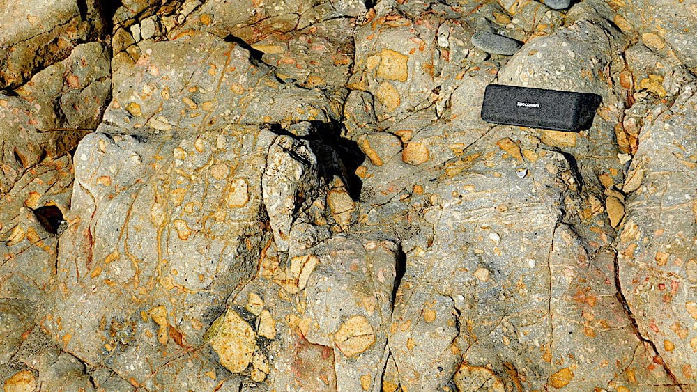
pale ash with predominantly yellow clasts, very variable in size.
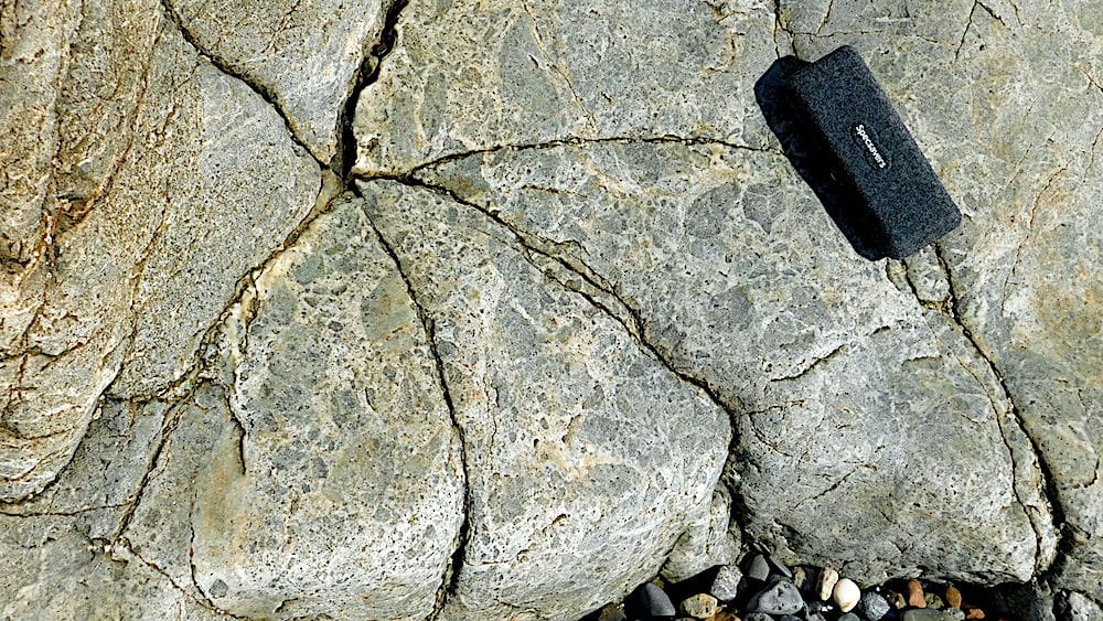
dark clasts predominate with relatively little ash.
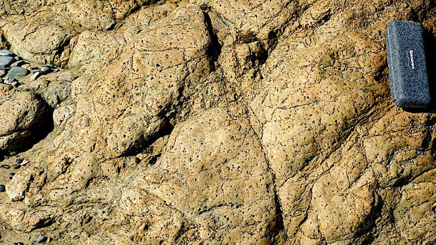
a solid flow of vesiculated lava
Many thanks to Rob for a very informative weekend despite the weather.
All text and photographs by Dr.Chris Simpson Secretary MWGC