Field Trip To Criggion  Quarry

Field Trip To Criggion Quarry

A joint field trip to Criggion Quarry involving members from Mid Wales Geology Club and the Shropshire Geological Society took place on 12th April. We were shown round the quarry and the associated stone crushing equipment by the manager who is both a geology enthusiast and the possessor of an OU geology degree.
We were given a hand-out with the background geology of the site which is available online: Proceedings of the Shropshire Geological Society, 4 24-26. The rock being quarried is an albitised olivine dolerite of Lower Caradocian (upper Ordovician) age. It was intruded into the shales and volcanic tuffs of the Breidden Hill inlier.
The quarry is currently removing around 600,000 tons per annum which is crushed, sorted into different sizes and then sold, almost entirely for road stone. Apart from a few veins of quartz and calcite, the stone is very uniform with a polished stone value (PSV-a measure of how quickly an aggregate will polish or become worn smooth under the action of vehicle tyres) of 62. Interestingly, even the dust remaining after the quarrying and crushing is collected, as it is sold to the manufacturers of asphalt – so the Criggion Quarry product forms the stone base of our roads, and also forms part of the surface layer.

chris DSCN6975 copy.jpg
The eastern face of the quarry with a pick-up as the scale. Only 12 years ago, they started working the first bench near the skyline, which gives an indication of the amount of stone removed per year.

chris DSCN6968 copy.jpg
The western face of the quarry with some of the visitors for scale. The variation across the face is evident with a localised area of high iron content towards the left. There is widespread columnar jointing present consistent with an intrusion of molten lava; but there is no single orientation pattern present.

chris DSCN6971 copy.jpg
A closer view of the colunar jointing

chris DSCN6983 copy.jpg
The western side of the intrusion forms the exposed edge of the hillside, and was presumably where the surrounding country rock once sat. This particular intrusion is, however, fault-bounded, so there is no obvious contact to be seen today. Nevertheless, the columnar jointing is clear at right angles to the periphery at the edge of the intrusion.

chris DSCN6987 copy.jpg
There are occasional large faults within the exposed quarry faces. Here is a long, curved fault running from near the top at the right, past the heads of two visitors, and then gently curving up to the left hand margin.


Summer Weekend 2024 Field Trip to the Lleyn Peninsula led by Dr. Rob Crossley

Summer Weekend 2024 Field Trip to the Lleyn Peninsula led by Dr. Rob Crossley

The club’s annual weekend away took place at the western end of the Lleyn Peninsula, led by Rob Crossley from Geomôn.
On Friday night, we had a presentation from Rob including information about the effects of the last glaciation and how it would affect what we were going to see. The western Lleyn Peninsula includes a major shear zone and several different unconformities with time gaps ranging from 8Ma to 64Ma.

On Saturday, we explored the shores of Aberdaron Bay.

On Sunday, we explored the shores of Porth Neigwl (Hell’s Mouth), but we had to cut it short due to bad weather.
Returning home on Monday morning, we visited the Llanbedrog volcanics.

24,000 years ago, at the height of the last glaciation, most of the UK was covered by ice. But it was not a single ice sheet. The large Irish Ice Sheet covered Ireland and almost the whole of the Irish Sea, and was continuous with the ice flowing south from more northern parts of the UK. There was also a much smaller, separate, Welsh Ice Sheet covering most of Wales with a small part of the adjacent Irish Sea.
These two ice sheets were adjacent. The boundary between the two ran over the Lleyn peninsula. Aberdaron was under the Irish Ice Sheet. Abersoch was under the Welsh Ice Sheet.
They each carried rocks from the ground that they flowed over, which are now visible as glacial erratics. This is the explanation for the marked difference in the glacial erratics seen at Aberdaron compared to those seen at Abersoch.

chris lleyn DSCN6576 copy.jpg
The group heading East along Aberdaron Bay from Aberdaron. The cliffs are formed of glacial boulder clay overlain by fluvio-glacial outwash deposits. The large boulder on the right on the beach is a glacial erratic, left behind as the sea erodes the glacial deposits.

chris lleyn DSCN6580 copy.jpg
The glacial outwash forming the cliffs is mainly composed of sandy material and clay minerals with some larger rocks. On a dry day, the horizontal bands rich in clay minerals stand out because they retain water.

 chris lleyn DSCN6588 copy.jpg
A large glacial erratic on the beach is composed of dark basaltic pillow lavas. The pillows are outlined by the coloured material (including red jasper) deposited later due to hydrothermal activity. The source for this erratic would be from the pillow basalt units of the Gwna Group, carried there by the Irish Sea Ice Stream.

chris lleyn DSCN6596 copy.jpg
Inspecting the Lleyn shear zone. A tight fold and extensive disruption is visible on the exposed rock face.

chris lleyn DSCN6619 copy.jpg
A general view of the eastern side of Porth Neigwl. The very gently dipping pale Ordovician quartzites of the St Tudwal's Formation at the top are sitting unconformably on northeastward-dipping Cambrian rocks, of the Hells Mouth Formation, below.

 chris lleyn DSCN6621 copy.jpg
The area of exposed Cambrian rocks seen at sea level immediately left of the previous photo, showing steepening of the northward dips.

 chris lleyn DSCN6622 copy.jpg
The quartzites of the St Tudwal's Formation are brittle, and plentiful vertical cracks have developed which then get filled by quartz veins, as seen in the centre of the picture

On Monday morning we looked at the volcanic rocks on the shore NE of Llanbedrog. There is a succession of ash deposits with quite differing appearances in each layer; plus one flow of solid, vesiculated lava. (The scale on the photos is a spectacles case.)

chris lleyn DSCN6657 copy.jpg
fine yellowish ash with large volcanic “bombs”.

chris lleyn DSCN6634 copy.jpg
pale ash with predominantly yellow clasts, very variable in size.

chris DSCN6654 copy.jpg
dark clasts predominate with relatively little ash.

chris lleyn DSCN6650.jpg
a solid flow of vesiculated lava

Many thanks to Rob for a very informative weekend despite the weather.

All text and photographs by Dr.Chris Simpson Secretary MWGC


Evening Field Trip to The Roundabout SJ274130 July 2024 led by Tony Thorp

Evening Field Trip to The Roundabout SJ274130 July 2024 led by Tony Thorp

On Wednesday 17th July 2024 we enjoyed our "traditional" evening field trip taken to make better use of the long evenings out of doors. The weather was good and we explored "The Roundabout", an enigmatic feature on the River Severn north of Welshpool. (OS ref. SJ274130)

Note that "The Roundabout" is on private land and permission is necessary from the nearby landowner at Maesyderw Farm before visiting.

This is the third feature of the River Severn which we have studied. We have looked at the "Gravels" at Llandinam where the river has historically been in an unstable condition, moving between a braided and a meandering planform. At Caersws, only a few miles downstream, it is very clearly meandering and extremely active, moving at about a metre a year.

The "Roundabout" is different in that, although its planform is extremely meandering, enigmatically, it has been stable for over 150 years! Just why is it so different?

map-1-
The "Roundabout" by Open Street Map Open Data Commons Open Database License (ODbL) https://www.openstreetmap.org/copyright

After assembling at the road junction off the A483 we drove to the car park provided for anglers and started our walk from there. The immediate surroundings are devoid of any relief, other than an embankment which is followed by the Offa's Dyke Footpath. In an area lacking any significant elevation, this embankment offers an opportunity to have a look-around.

1-Members-near-inaccesssible-river--at-neck-of-loop------Tony-suggests-copy
Members near inaccessible river at neck of loop.

The Roundabout is in a flat area surrounded by hilly eminences. South and east is the rounded length of the Silurian Long Mountain, east to north is the prominent andesitic peak of Moel-y-Golfa and the dolerite intrusion of Criggion Quarry, while to the northwest is the Ordovician high ground of Meifod and the Berwyns.
It is easy to imagine the scene after the glacial maximum, when melting ice would have contributed to a massive flow of water, ice and rocky debris funnelled through the gorge north of the Breiddens before disgorging onto the Shropshire plain. At that point the bedload would have been deposited with the water backing up and forming the proposed Lake Trederwen. To the north and west the rivers Vyrnwy and Tanat would have been undergoing a similar process and dropping their bedload, contributing to a very large glaciofluvial fan. It is established that the present valley floor is some 61m above the bedrock and this probably represents the height of the fan. When the resultant lake filled with sediment, it would have provided a zero gradient plain over which the present river could meander.

This explains the present very meandering planform of the river but does nothing to explain the extraordinarily stable behaviour here compared with the rapidly evolving  situation at Caersws.

3-Shingle-deposits-on-point-bar-viewed-from-inner-path-copy
shingle deposits on point bar viewed from inner path

A hundred metres further on we arrived at the neck of the Roundabout where there is barely 10 metres of ground remaining. On either side the river flows on a tight radius, within 5 or 6 metre deep banks which are heavily wooded with mature willow trees. Some effort had been made to reduce erosion by dropping boulders and concrete rubble down the bank. (We understood from the landowner that on occasion some flow had occasionally occurred across the neck.).

4-Muddy-point-bar-viewed-from-inner-path-copy
Muddy point bar viewed from inner path

From there, walking anticlockwise round the inside perimeter and following the river round, we saw a number of places where erosion was occurring by multiple faulting with terracettes developing. Where we could descend to water level we examined the sediments in the bank. Below the top few inches of fine silt multiple channel deposits were visible each comprising small pebbles to silt, sometimes massive and occasionally showing repeated laminations of a few inches thickness. It was difficult to see consistent patterns because of the fragmentation of the bank which had been somewhat amplified by cattle!

5-exTony-RoundaboutTerracettes-copy
*** Roundabout Terracettes***

Another notable feature was the degree to which willows had adopted some stretches, some being unusually mature with trunks in the order of a metre diameter. Although willow is a short lived tree these must have been around their half century! Some were seen stabilising terracettes which had become islands.

ErodingBankWithChannelDeposits-copy
Eroding bank with channel deposits

2-River-bank-heavily-fortified-by-willows-copy
river bank heavily fortified by willows

At one point a collection of particularly large rocks was visible in the bed of the river but it was not obvious whether they were human, water or bedrock derived.

After completing a pleasant evening walk there was hardly time for a post-trip discussion and comparison with the Cearsws meanders, which would be a suitable subject for debate at a future indoor meeting.

One immediate observation is that, whereas at Caersws, the banks are only thinly vegetated, here they are overgrown by large mature willows. Willows are much used in the UK for bank stabilisation because they really enjoy having their feet wet. It could be that there is some feedback mechanism here which explains the contrasting stability compared to that at Caersws.

3-Shingle-deposits-on-point-bar-viewed-from-inner-path-copy-1
shingle deposits on point bar viewed from inner path

There could be a positive feedback relationship with willows. Stable banks allow willows to grow leading to more stable banks. Also, the banks are some 5m high and, once established, the deeper and older the sediment, the more indurated it becomes. Here we have a mechanism whereby stability becomes reinforced, only to be disrupted by extreme events. In which case a combination of natural randomness, variation of the rates of accretion and erosion, with a bit of feedback could explain the varying planforms.

All-in-all, we had a pleasant summer evening walk with a geological theme which posed more questions than there were answers.
Text by Tony Thorp and Photos by Bill Bagley (MWGC)


Summer Weekend 2023: Field Trip to Ynys Môn, led by Rob Crossley

Summer Weekend 2023: Field Trip to Ynys Môn, led by Rob Crossley

Club members enjoyed a weekend of fascinating geology on 10th – 11th September. We were led by Rob Crossley from Geo Môn geopark who had picked out some of the best areas of the island for us to visit.

On the Friday evening we assembled in the Heritage Centre in Cemaes. Dr Rob Crossley introduced himself as a solid rock geologist presently with Geomon but previously with Robertson Research.
Rob outlined the deep basement geology of Anglesey with reference to the now available mapping of the whole area including the North Sea and Irish Sea. He noted the deep seated west-east dislocations which underlie the predominantly northeast-southwest Caledonian grain and which are of importance to defining the structure of the exploited oil bearing basins. They do incidentally influence the position of the North Wales coastline.
He then introduced the early geologists who studied Anglesey, notably J.S.Henslow, Edward Greenly and his wife, Annie. Henslow was a geologist way ahead of his time, otherwise famous as a tutor of Darwin. He published a comprehensive "Geological Description of Anglesey" in 1822, the result of a brief exploration with accurate sketches and a map which is surprisingly similar to Greenly's which was produced a hundred years later and is still the basis of present mapping.
Rob distributed a comprehensive handout covering the proposed two day excursions and a third for participants to follow on Monday, on the way home.

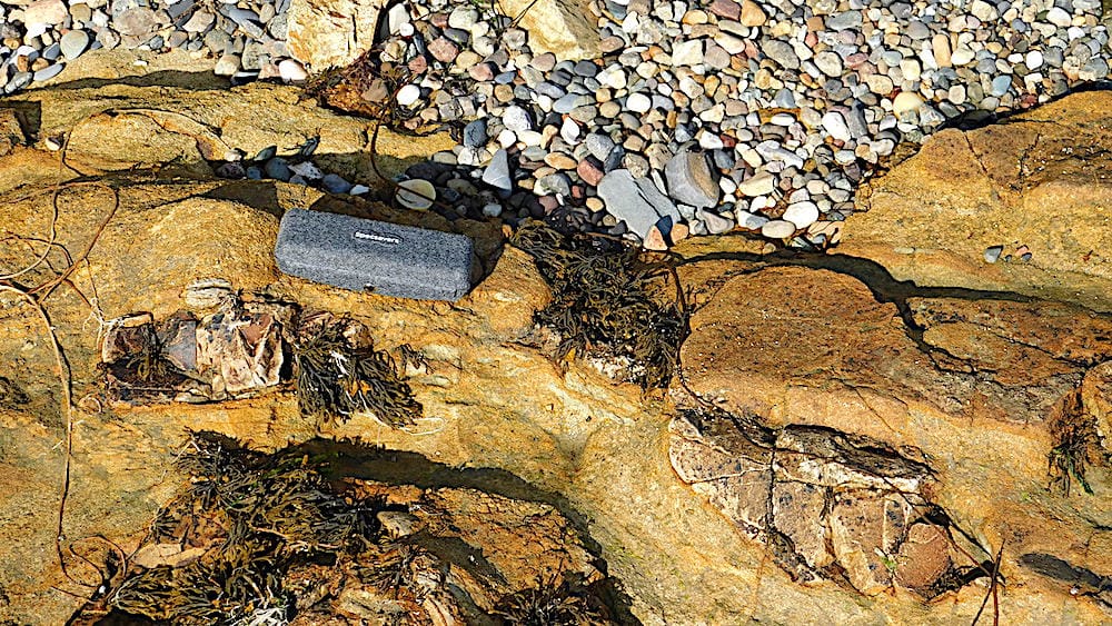
One of the most important features of Môn geology is the Gwna Melange, described and published by Edward Greenly in 1919. This was the first melange described, and still attracts geology students from all over the world. (Wikipedia describes a melange as “a large-scale breccia, a mappable body of rock characterised by a lack of continuous bedding and the inclusion of fragments of rock of all sizes, contained in a fine-grained deformed matrix. The mélange typically consists of a jumble of large blocks of varied lithologies. Both tectonic and sedimentary processes can form mélange.”)

text by Tony Thorp and Chris Simpson - photos by Chris Simpson

Day 1
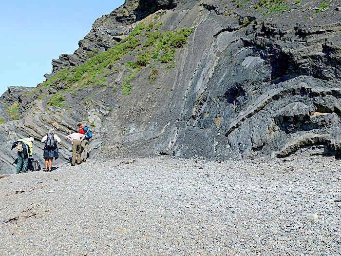
The first location was just east of Wylfa power station, facing a cliff exposure in which the Gwna Group melange, containing large quartz clasts, was cut by a dyke exactly as shown in an accurate sketch by Henlow. We surmised that he probably stayed at the large house nearby which had been demolished when the power station was built.
As we walked back to Cemaes we could see further along the coast one of the famous enormous limestone clasts in the melange in which Margaret Wood had found fossil stromatolites, the oldest fossils in Wales.

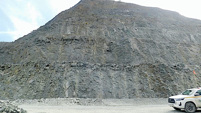
Next location was Parys Mountain, the spectacular remains of what was once the largest copper mine in the world. It contains a vast open cast pit and a mass of shafts and galleries. It remains a source of highly acidic mine effluent which was still flowing out. The various complex iron oxides and hydroxides with their colours ranging from ochres to reds and purples give the residual tips their "out of this world" character as made use of in scenes from Dr Who. We could see the tight overturned folded structure of the bedding, within which the richest ore was extracted by open cast mining.
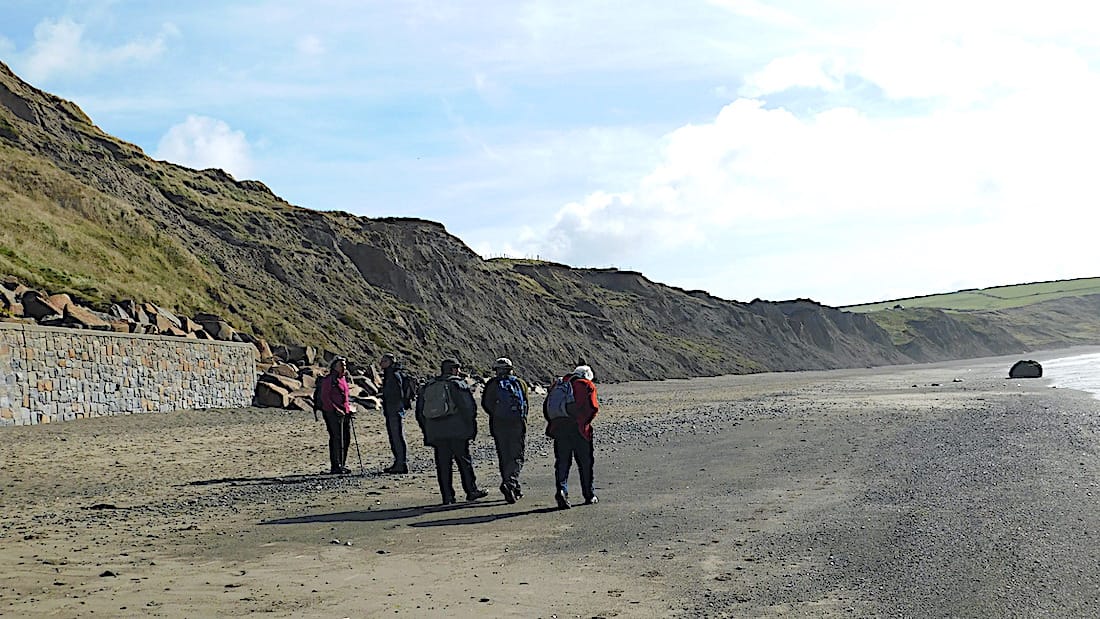
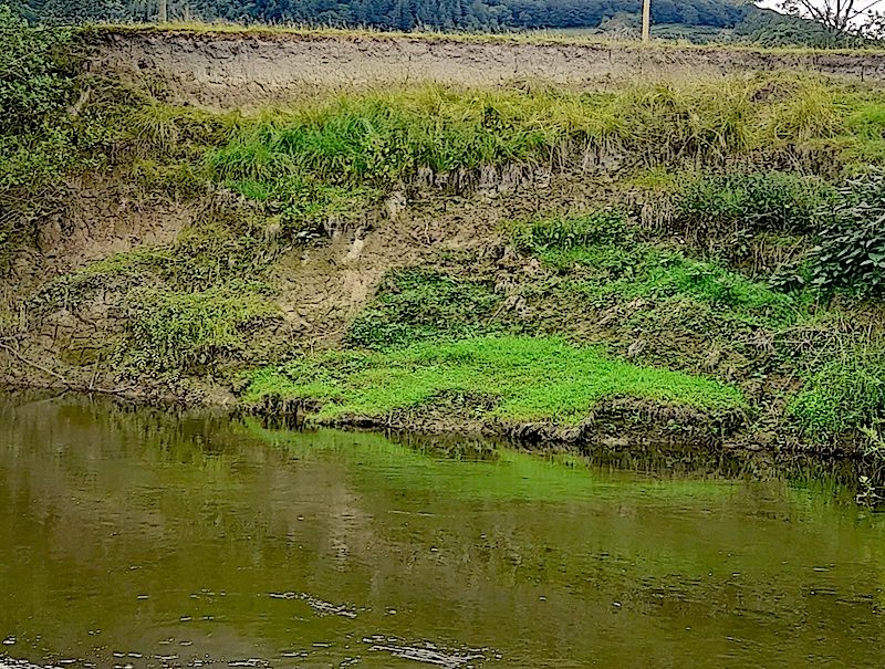
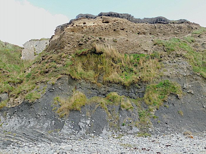
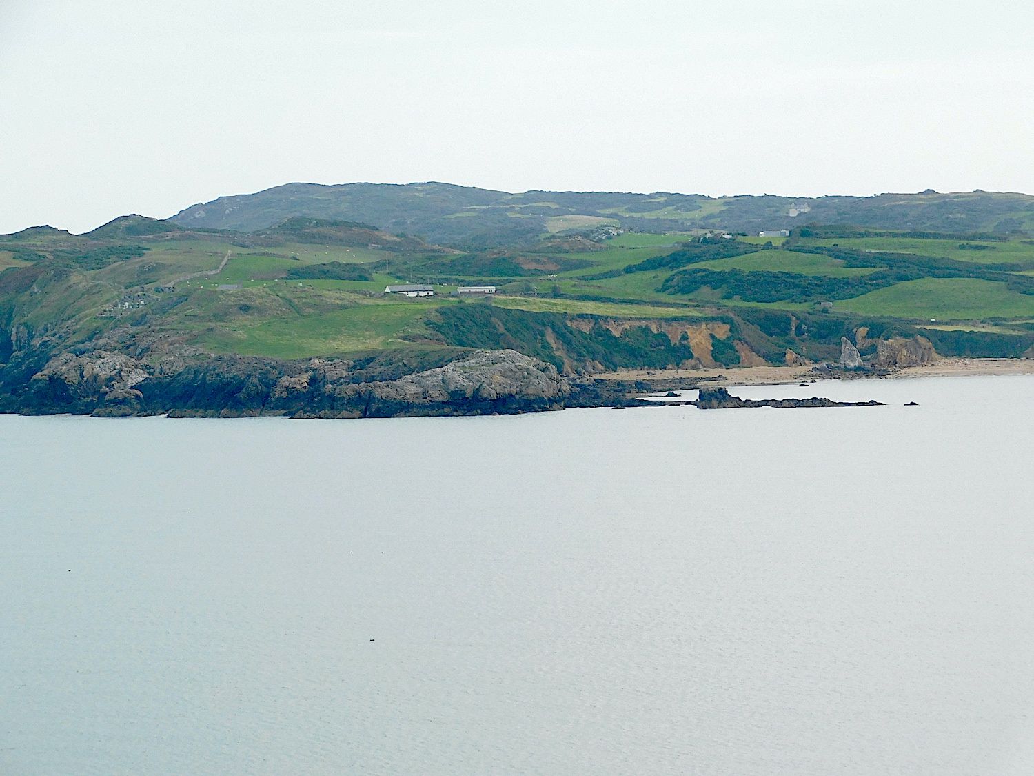
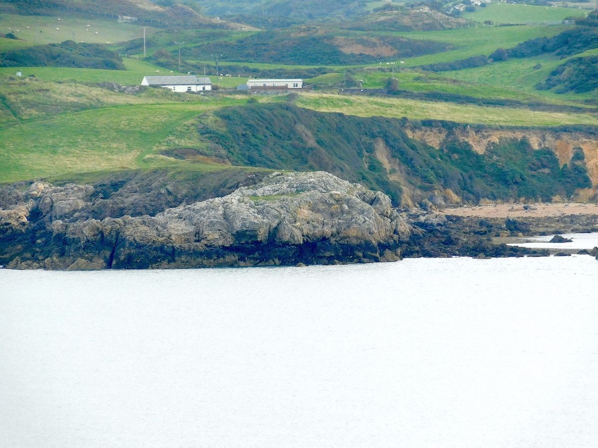
The last location of the day was the cliff section at Lleiniog, near Beaumaris. This is a section through Quaternary till and gravel deposits. The gravel initially looks like the deposits of outwash streams and rivers, but further examination shows that they are more likely sub-glacial meltwater channel deposits. These are under hydraulic pressure and can therefore change directions in three dimensions. Even so, it was difficult to interpret some of the changes in level. On the beach below the cliff were pebbles and boulders eroded out of the till, some showing striae and some coming from northern England with the Irish Sea Ice Stream. There were also large more local limestone ones from the limestone quarried nearby at Penmon

chris-anglesy-fig-1copy-1
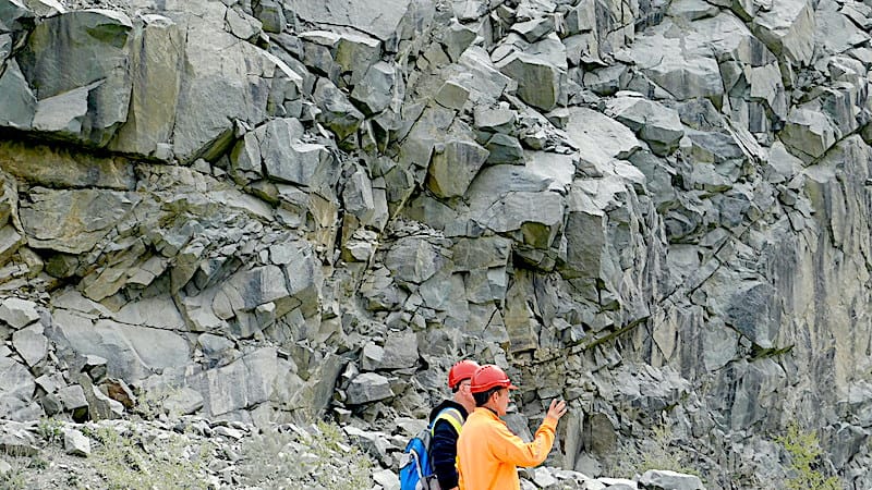
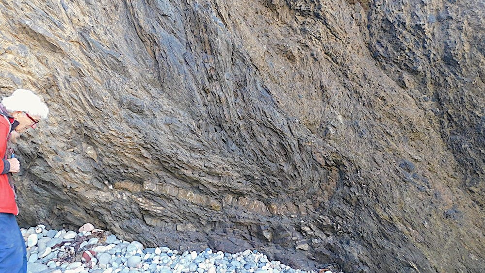
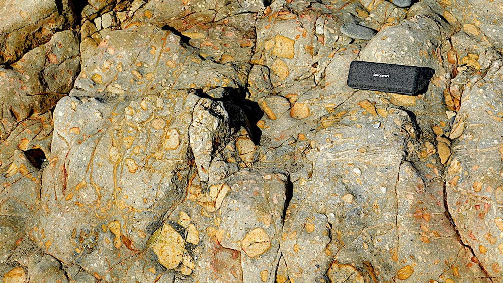
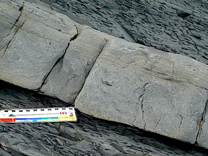
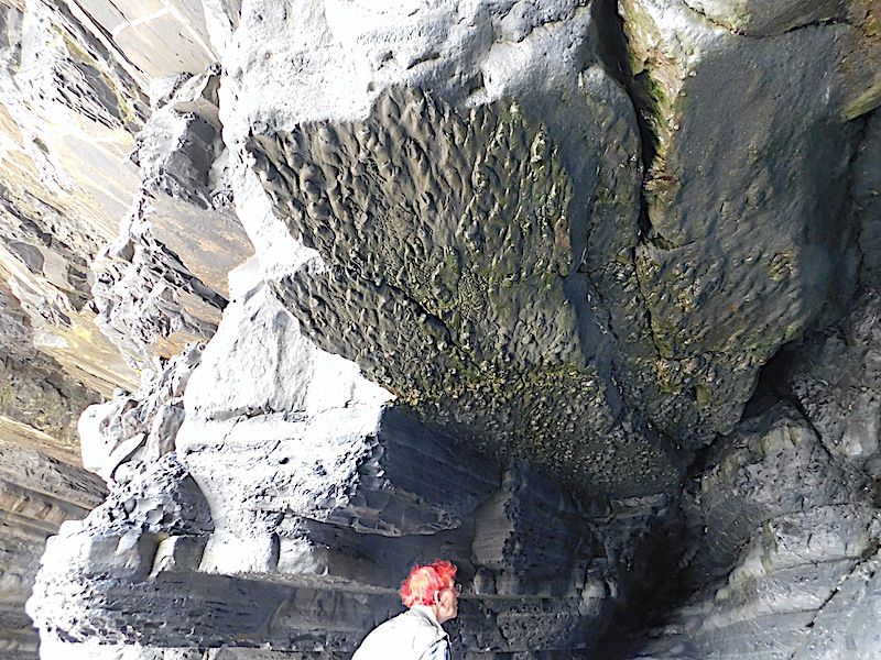
On Wylfa Head, just North of the nuclear power station. The vertical rock face behind Rob has four separate lithologies

chris-anglesey-fig-2copy-1
A closer view showing how different the colours and textures of the various melange components are.

chris-anglesy-fig3-copy-1
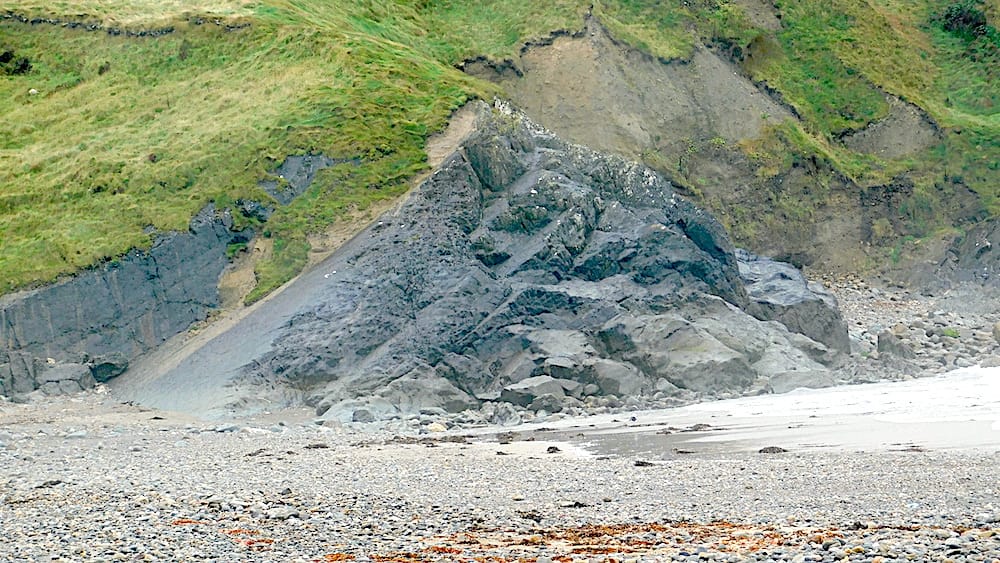
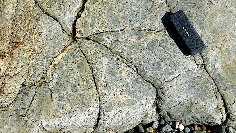
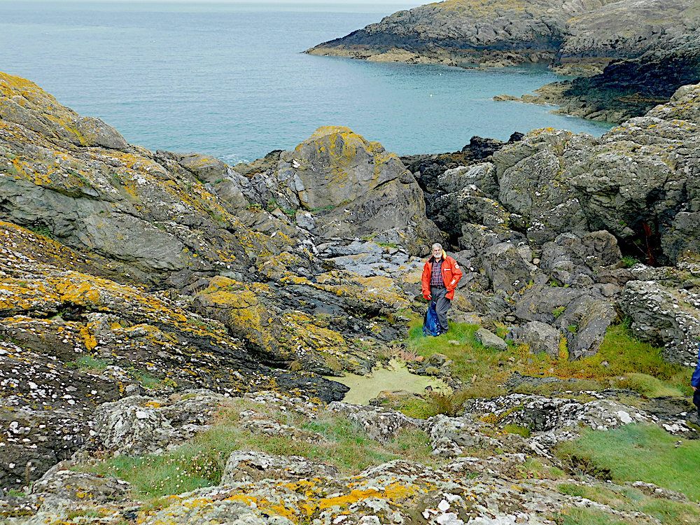
A little further North on Wylfa Head. A distance view with a power boat for scale. Just right of the centre, there are some lighter coloured rocks in the distance

chris-anglesey-fig-4-copy-1
A closer view shows several adjacent large pale blocks of quartzite with no relationship to the surrounding darker schists.

chris-anglesy-fig-5-copy
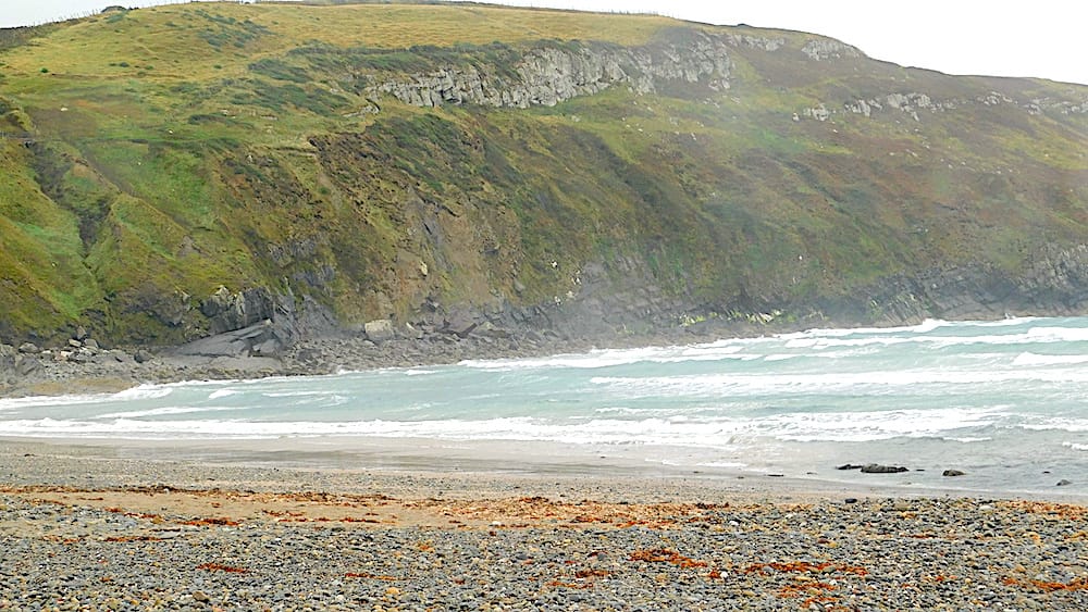
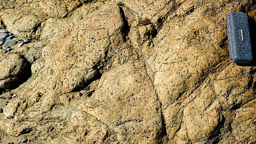
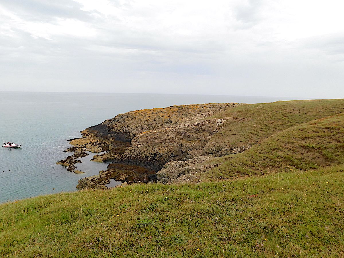
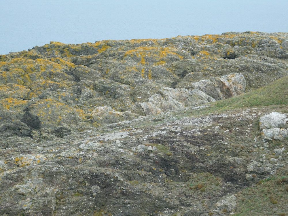
Looking across Cemaes Bay from Wylfa Head. There is a well-demarcated white area of rock at sea level in the centre of the picture, about 1.5km away.

chris-angllesy-fig-6-copy
At closer view this pale area of rock is in fact a single large block of limestone, several hundreds of metres across, making up part of the melange

Day 2
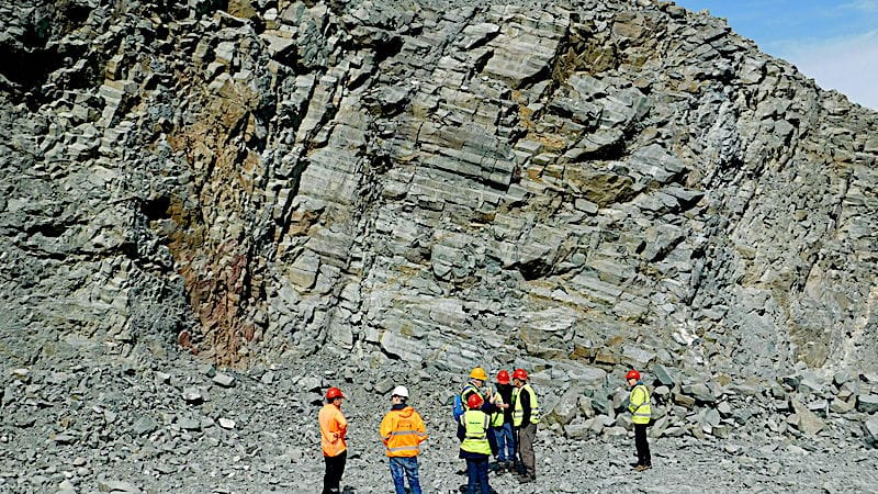
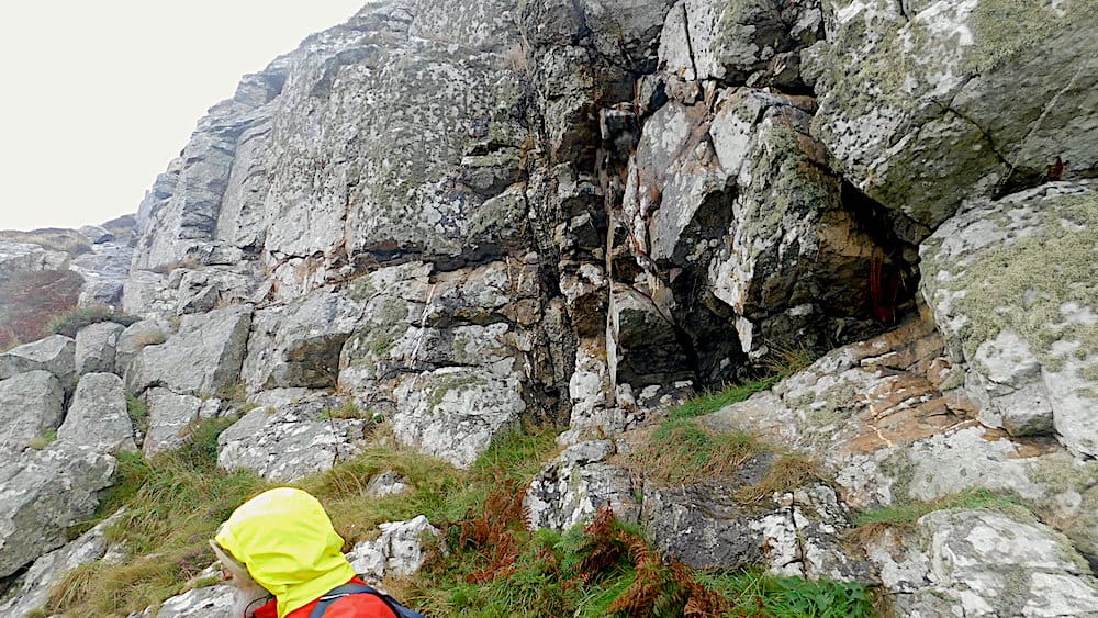
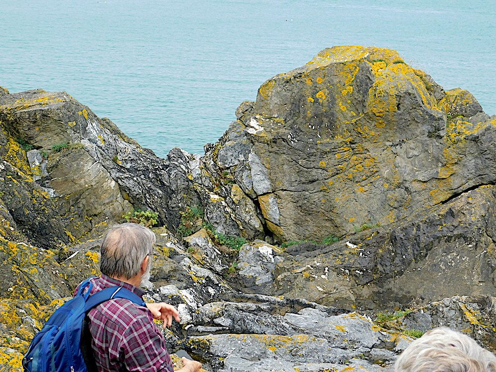
On day 2 we met at the small RSPB car park just south of the main visitor centre. We took a short walk to the clifftop where the South Stack formation cliffs are intersected by a major dyke. Looking along the line of the dyke to where it cut the opposite cliff we saw how it made a dog-leg inland. This led to an object lesson on how dykes interact with the grain of the bedrock. The line of a dyke is determined at depth and, if it lies at a low angle to the grain, it has to progress en echelon with a dog-leg at intervals.
We took the clifftop path towards the reserve and Ellin's Twr, a good viewpoint of South Stack lighthouse and the section in he cliff below before returning to the car park and motoring around the headland to park near to the Holyhead Harbour Breakwater. This was built in the 1850s with a strong substructure of large blocks of local Holyhead quartzite topped by Carboniferous limestone. Fossil brachiopods and and corals were exposed on the limestone capping walkway. Apparently there was a move to use limestone for the structure but it was more subject to erosion.

Our final location was Llanddwyn Island.
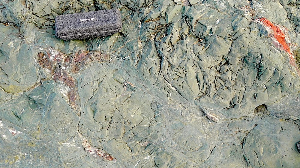
This offers the most spectacular exposures of the Gwna group lavas which were erupted underwater forming pillows with infill and strands of jasper between them. Where the rocks had been washed clean, the Gwna melange showed up the different colours and textures of its varied clasts with pink and red chert and quartzite cobbles contrasting with green schists.
The sand dunes are constantly shifting and the exposures were more extensive than the last time we visited.

chris-anglesey-fig-7.-copy
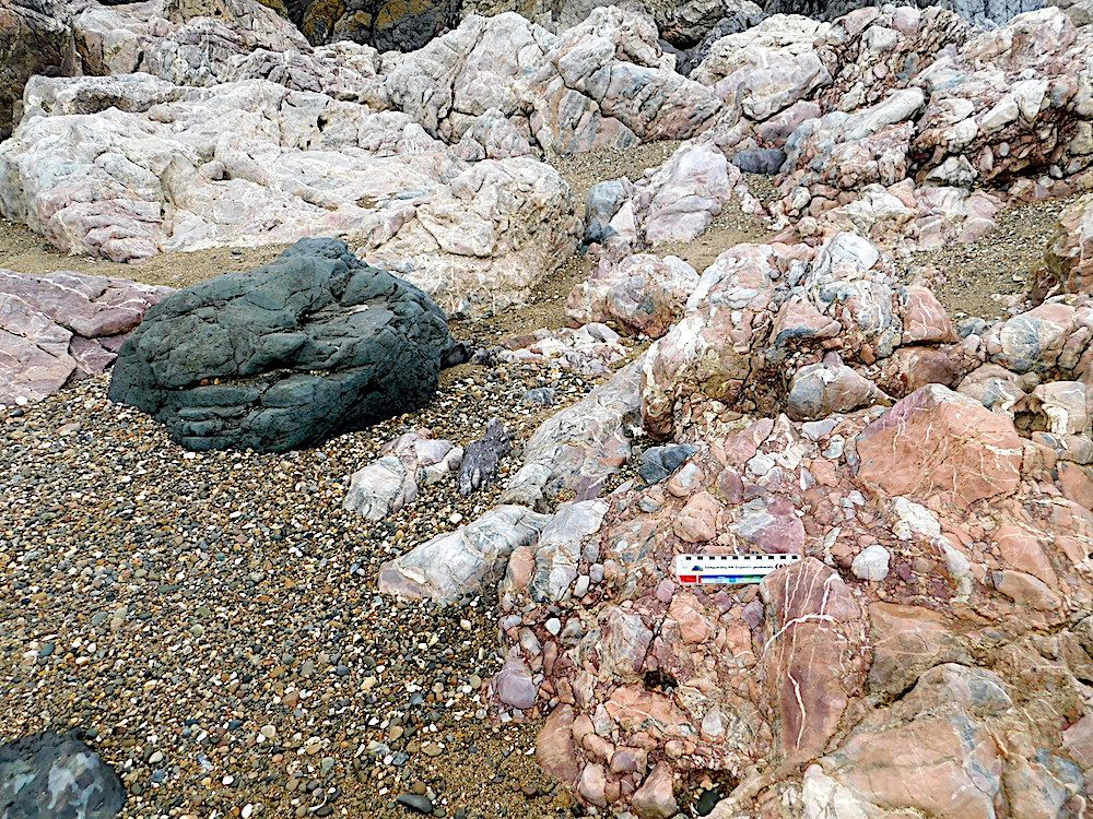
At the Western edge of Llanddwyn Island, this is another part of the melange with a much smaller scale mixture of components compared to Wylfa Head.

chris-anglesy-fig-8-copy
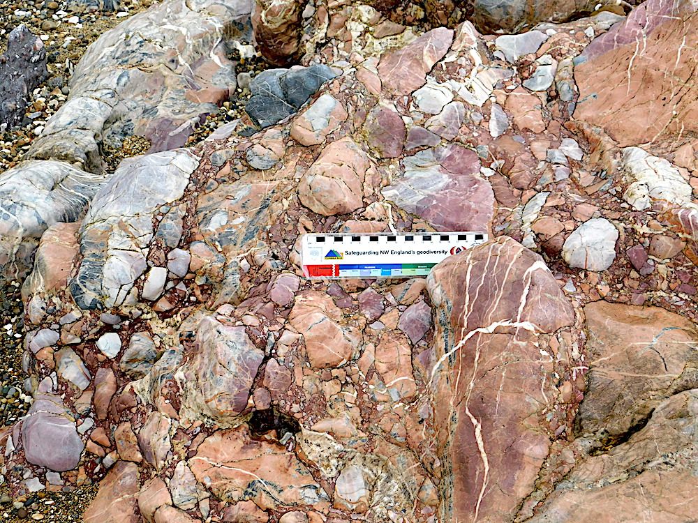
A closer view of the same area.

chris-anglesey-fig9-copy
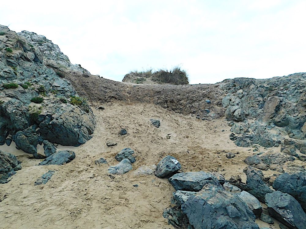
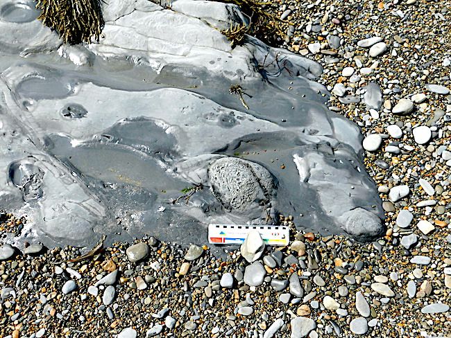
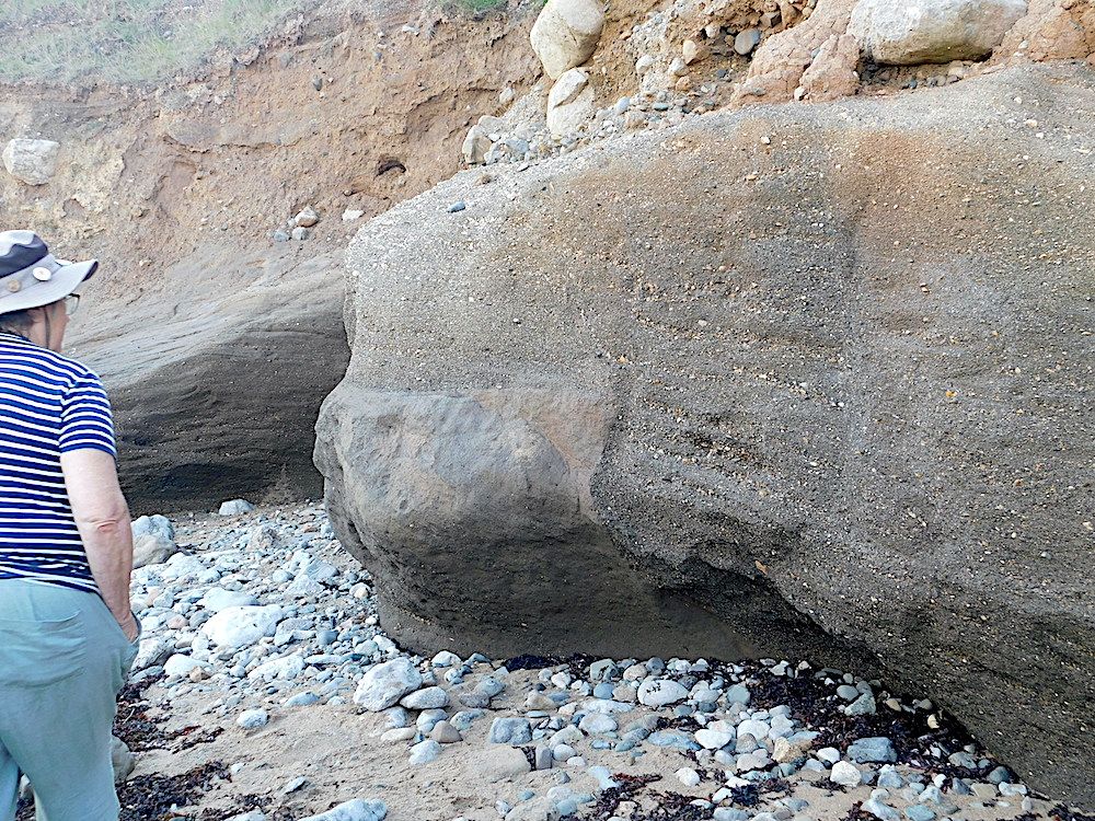
An area of boulder clay from the last glaciation sitting between two pillow lava outcrops. This had previously been covered over (and protected) by dune sand.

chris-anglesy-fig-10-copy
A closer view with pillow lavas on the right. The boulder clay also contains pillow fragments, consistent with its glacial origin. Now it has been exposed, it is likely that this remnant from the last ice age will have been completely eroded away in a few years.

chris-anglesey-fig-11-copy
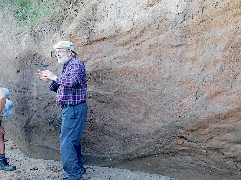
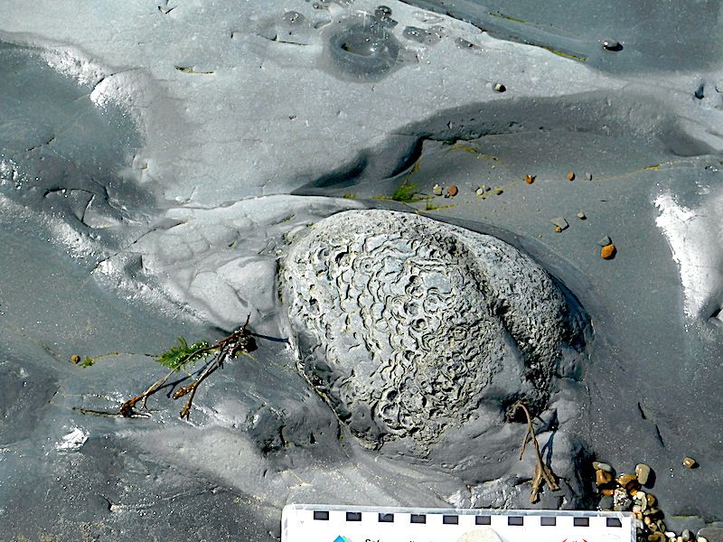
Rob Crossley explain how these structures formed. Note the black structures in the cliff face immediately above his hands.

chris-anglesey-fig-12-copy
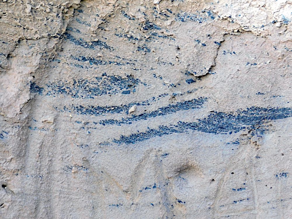
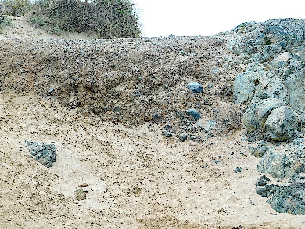
A closer view shows that these are coal fragments within the sandy/pebbly matrix. Their orientation gives clues about the direction of flow under the glacier.

chris-anglesey-fig-13-copy
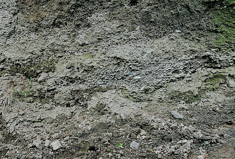
This slide shows the range of clast size seen in the cliff face. But how did the vertical interface in the lower centre of the picture between the pebbly matrix area and pebble-free area develop? We did not have a definitive cause for this unusual appearance!

Day 3
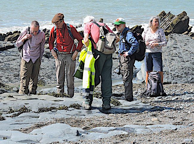
Rob had given us an itinerary to follow on our way back via Menai Bridge and Caernarfon. First stop was at the blueschist exposure round the Marquis of Anglesey's column. This was a disappointment as the car park and access was full of plant. The only access was a small path up from the main road. At one side was a small collection of blueschist hand specimens (Thank you, if you left it there!) but the column itself was barricaded off. The large exposures were still exposed and pieces of blueschist were scattered around in the wood.
A mile or so further along the A5, Telford's 1826 Menai Bridge is worth visiting in its own right. The supporting towers in Carboniferous limestone show some good fossils with rather lovely corals. Rocky Carboniferous exposures below were not very clear from the roadway but could be better exposed at low water.

The final location was the along the low cliffs near Plas Menai Sports Centre just off the Caernarfon road. A major Tertiary dyke intersects the coast here with smaller offshoots cutting the cliffs between it and the sports centre. The pebbly to cobbley conglomerate varies from grey where it was cooked by the intrusion to red nearer the centre.

That rounded off a most rewarding visit to Anglesey where we enjoyed good weather and some interesting and spectacular geology.


Field trip to Aberystwyth and Clarach led by Dr Charlie Bendall August 23rd 2023

Field trip to Aberystwyth and Clarach led by Dr Charlie Bendall August 23rd 2023

Field trip to Aberystwyth and Clarach with Dr Charlie Bendall to investigate sedimentary structures in the Aberystwyth Grits Sunday 20th August 2023

chris-aberystwyth
Some of the group on the beach with Charlie Bendall

Our August field trip, led by Dr. Charlie Bendall, followed the coast from Aberystwyth to Clarach. This coast is famous for its sedimentary structures, including "Turbidites". Charlie had provided copious background information on Gravity Flows of all sorts for prior study and, after members assembled at The Castle, he broadly outlined the full range of terrestrial and marine slides, slumps and other gravity movements, often described confusingly by a proliferation of ill or loosely defined terms.

chris-aber-fig1
A marked degree of folding at the base of Constitution Hill, Aberystwyth. Charlie explained that there was no evidence that this folding was tectonic in origin. He thought it was an extreme degree of soft sediment deformation before complete lithification.

We then walked down to the first location.
This was a 3m deep cutting below the castle alongside the promenade where a series of thin to medium bedded sandy and silty couplets was exposed. These were good examples of turbidites which could be classified in terms defined by Bouma. They clearly had an erosive base with a normally graded sandy Bouma unit A, grading into a finer unit B with some parallel lamination and a unit C with some cross lamination.

Walking to the north end of the promenade, the cliffs below Constitution Hill expose more Aberystwyth Grits folded in a conspicuous plunging anticline, with associated faulting. The bedding was somewhat thicker here with sandier beds alternating with darker shales.

chris-aber-fig-2
Alternating sandstone and mudstone beds at the foot of Constitution Hill. Some of the sandstone beds are very thin, hardly disturbing what would otherwise have been a single thick mudstone bed.
Also visible just above the thick basal sandstone unit is a distinct layer of concretions within the overlying mudstone bed

chris-aber-fig-3
A closer view of the concretions

The second part of the trip was to explore the cliffs north of Clarach. Most of the group took the cliff walk but Bill and I took the easy option of driving and avoiding the long walk back to the car.

chris-aber-fig-4
An example of soft sediment deformation within a sandstone bed

A small detour took us to the south of the bay where we (probably) located a thin bentonite which had been noted from earlier research. Such beds are the result of volcanic eruptions which distribute ash into the sea over a wide area so they are good marker units for dating.
This bed was not too obvious as it was obscured by a black algal deposit. It also seemed quite hard, but this can happen during diagenesis.

chris-aber-fig5
A thick sandstone bed at the Southern end of Clarach Beach showing Bouma A and Bouma B units.

Crossing the bridge over the river, we continued along the beach.

chris-aber-fig6
The cliff face underneath the coast path at the Northern end of Clarach.
At the base are beds of the Aberystwyth Grits. Above that is a grey layer, and above that a brown layer. These are both of glacial origin. The grey layer is material arising from Welsh glaciers, while the brown layer is material arising from an Irish glacier. The Irish glaciers eroded rocks with a high iron content, so the brown colouration is a useful marker for glacial material arising from an Irish glacier

As the tide was falling we could clamber round to another inlet and a cave where the undersides of beds could be observed. There flute casts and burrows had been beautifully preserved. In higher beds nearby concretions had developed in a thicker shaley mudstone. The way these develop is not fully understood. Sometimes they start from a visible nucleus, possibly a bit of fossil, but often there is nothing visible. They could start with a crystalline particle which could be at a molecular scale and grow into the surrounding sediment, cementing it and, given space and stable conditions, develop a spherical structure. Interesting forms like "cone-in-cone" can be produced by the complex interaction of crystal growth with sediment particles.

chris-aber-fig-7
A cone in cone concretion within a sandstone bed at the Northern end of Clarach Beach.

chris-aber-fig-8
A higher power view of the concretion. (We later discovered a pebble on the beach which was an intact concretion, eroded out of the beach rock by wave action)

chris-aber-fig9
A cave at the Northern end of Clarach Beach. The base of the sandstone bed forming the roof of the cave shows prominent flute casts.

An enjoyable trip exploring Aberystwyth Grits, turbidites and Bouma interpretations with an accomplished leader wound up with a cliff walk back to Aberystwyth.

Photos by Chris Simpson and text by Chris Simpson and Tony Thorp