Summer Weekend 2023: Field Trip to Ynys Môn, led by Rob Crossley
Club members enjoyed a weekend of fascinating geology on 10th – 11th September. We were led by Rob Crossley from Geo Môn geopark who had picked out some of the best areas of the island for us to visit.
On the Friday evening we assembled in the Heritage Centre in Cemaes. Dr Rob Crossley introduced himself as a solid rock geologist presently with Geomon but previously with Robertson Research.
Rob outlined the deep basement geology of Anglesey with reference to the now available mapping of the whole area including the North Sea and Irish Sea. He noted the deep seated west-east dislocations which underlie the predominantly northeast-southwest Caledonian grain and which are of importance to defining the structure of the exploited oil bearing basins. They do incidentally influence the position of the North Wales coastline.
He then introduced the early geologists who studied Anglesey, notably J.S.Henslow, Edward Greenly and his wife, Annie. Henslow was a geologist way ahead of his time, otherwise famous as a tutor of Darwin. He published a comprehensive "Geological Description of Anglesey" in 1822, the result of a brief exploration with accurate sketches and a map which is surprisingly similar to Greenly's which was produced a hundred years later and is still the basis of present mapping.
Rob distributed a comprehensive handout covering the proposed two day excursions and a third for participants to follow on Monday, on the way home.
One of the most important features of Môn geology is the Gwna Melange, described and published by Edward Greenly in 1919. This was the first melange described, and still attracts geology students from all over the world. (Wikipedia describes a melange as “a large-scale breccia, a mappable body of rock characterised by a lack of continuous bedding and the inclusion of fragments of rock of all sizes, contained in a fine-grained deformed matrix. The mélange typically consists of a jumble of large blocks of varied lithologies. Both tectonic and sedimentary processes can form mélange.”)
text by Tony Thorp and Chris Simpson - photos by Chris Simpson
Day 1
The first location was just east of Wylfa power station, facing a cliff exposure in which the Gwna Group melange, containing large quartz clasts, was cut by a dyke exactly as shown in an accurate sketch by Henlow. We surmised that he probably stayed at the large house nearby which had been demolished when the power station was built.
As we walked back to Cemaes we could see further along the coast one of the famous enormous limestone clasts in the melange in which Margaret Wood had found fossil stromatolites, the oldest fossils in Wales.
Next location was Parys Mountain, the spectacular remains of what was once the largest copper mine in the world. It contains a vast open cast pit and a mass of shafts and galleries. It remains a source of highly acidic mine effluent which was still flowing out. The various complex iron oxides and hydroxides with their colours ranging from ochres to reds and purples give the residual tips their "out of this world" character as made use of in scenes from Dr Who. We could see the tight overturned folded structure of the bedding, within which the richest ore was extracted by open cast mining.
The last location of the day was the cliff section at Lleiniog, near Beaumaris. This is a section through Quaternary till and gravel deposits. The gravel initially looks like the deposits of outwash streams and rivers, but further examination shows that they are more likely sub-glacial meltwater channel deposits. These are under hydraulic pressure and can therefore change directions in three dimensions. Even so, it was difficult to interpret some of the changes in level. On the beach below the cliff were pebbles and boulders eroded out of the till, some showing striae and some coming from northern England with the Irish Sea Ice Stream. There were also large more local limestone ones from the limestone quarried nearby at Penmon
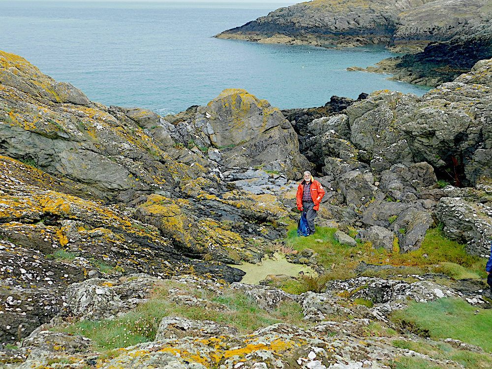
On Wylfa Head, just North of the nuclear power station. The vertical rock face behind Rob has four separate lithologies
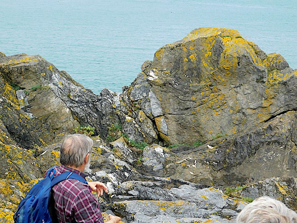
A closer view showing how different the colours and textures of the various melange components are.
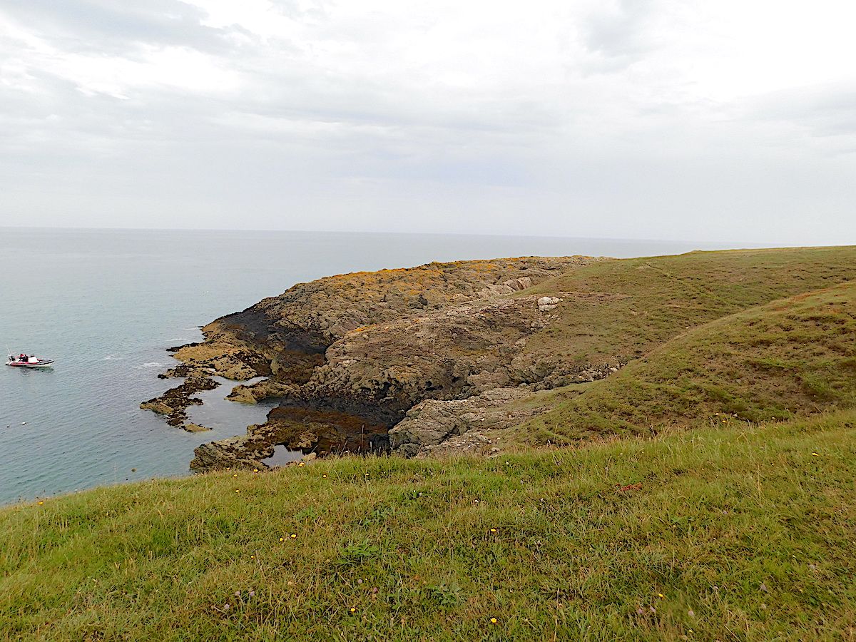
A little further North on Wylfa Head. A distance view with a power boat for scale. Just right of the centre, there are some lighter coloured rocks in the distance
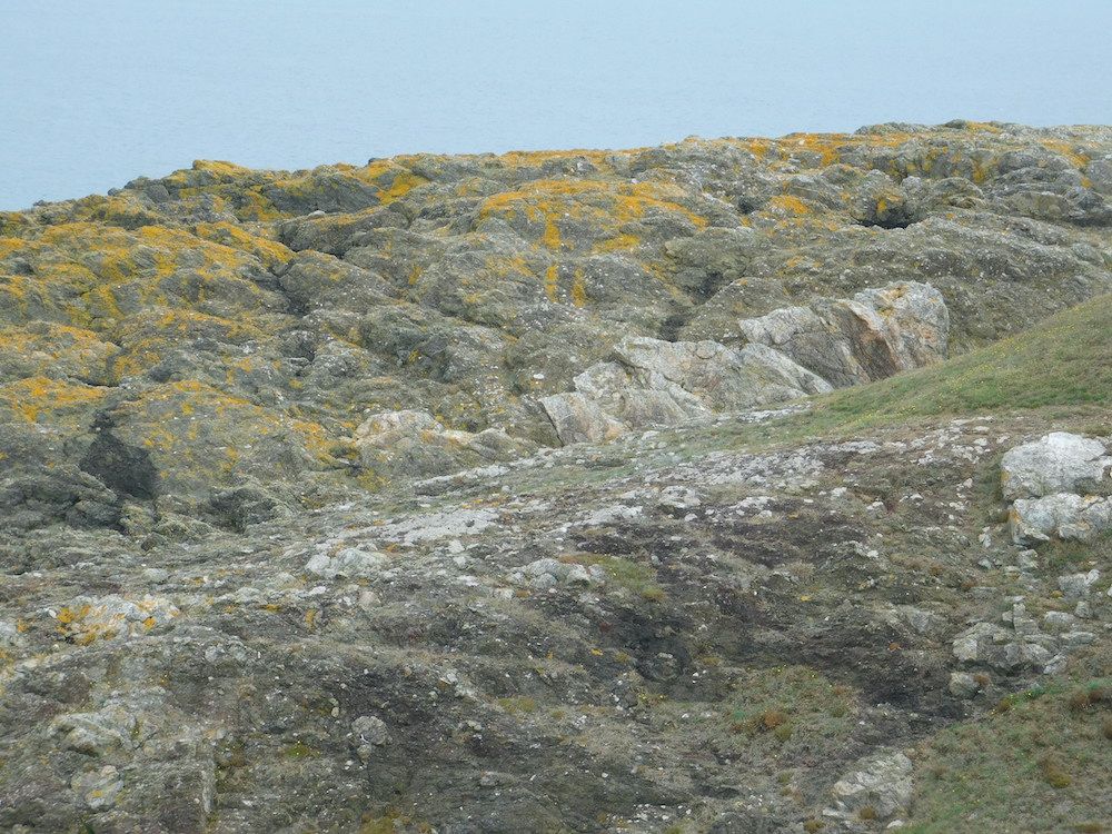
A closer view shows several adjacent large pale blocks of quartzite with no relationship to the surrounding darker schists.
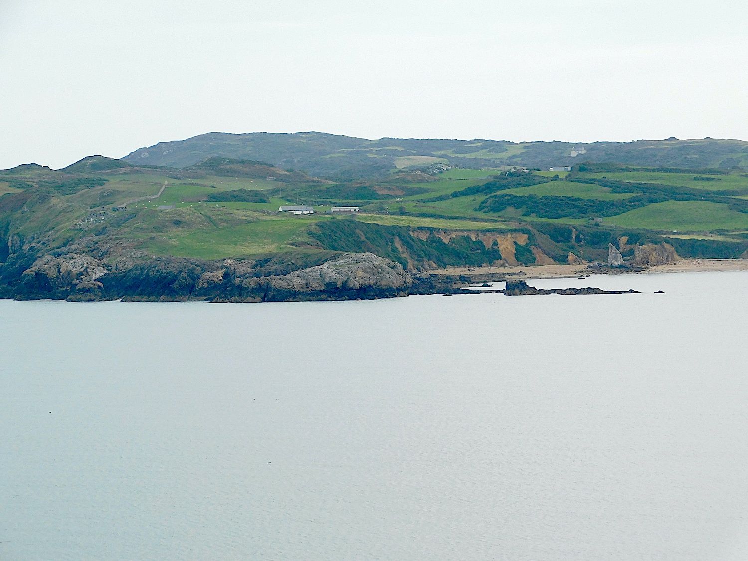
Looking across Cemaes Bay from Wylfa Head. There is a well-demarcated white area of rock at sea level in the centre of the picture, about 1.5km away.
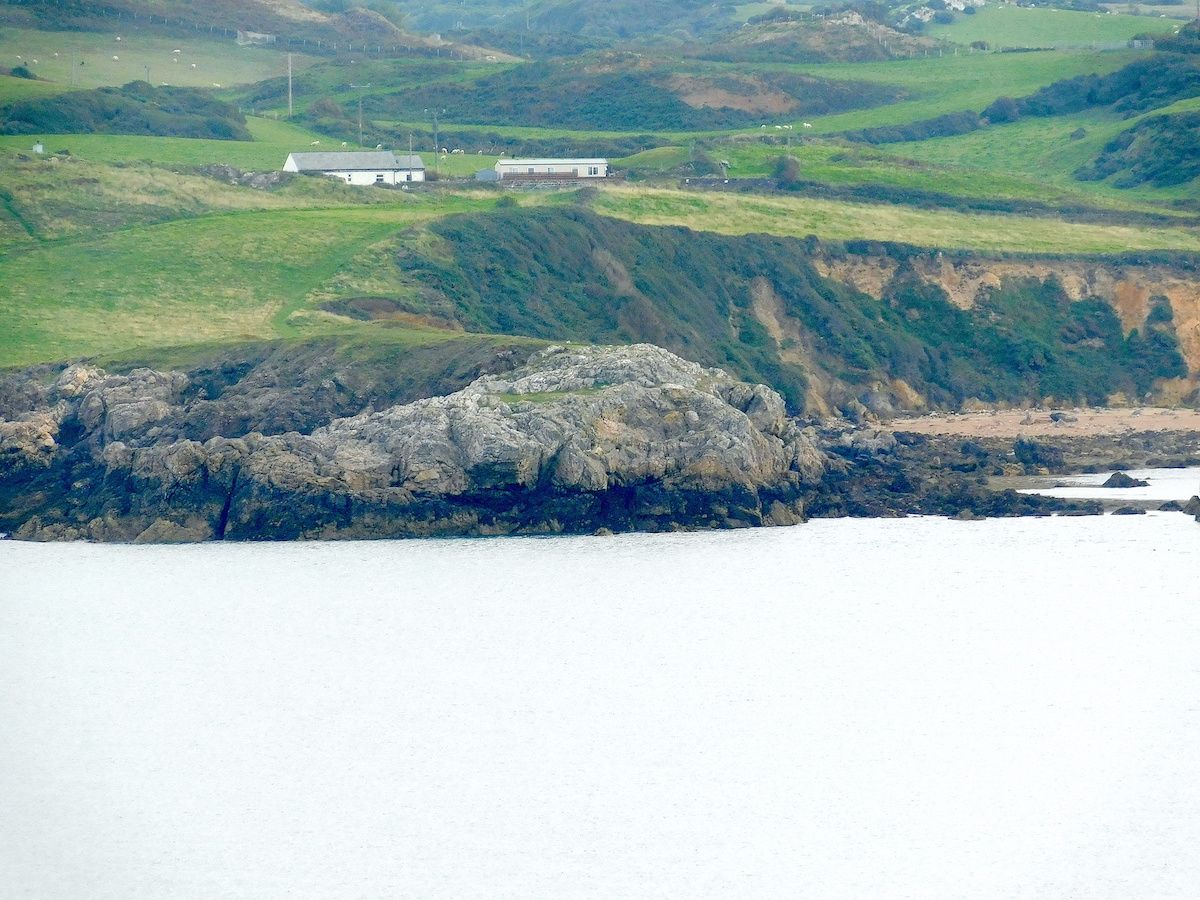
At closer view this pale area of rock is in fact a single large block of limestone, several hundreds of metres across, making up part of the melange
Day 2
On day 2 we met at the small RSPB car park just south of the main visitor centre. We took a short walk to the clifftop where the South Stack formation cliffs are intersected by a major dyke. Looking along the line of the dyke to where it cut the opposite cliff we saw how it made a dog-leg inland. This led to an object lesson on how dykes interact with the grain of the bedrock. The line of a dyke is determined at depth and, if it lies at a low angle to the grain, it has to progress en echelon with a dog-leg at intervals.
We took the clifftop path towards the reserve and Ellin's Twr, a good viewpoint of South Stack lighthouse and the section in he cliff below before returning to the car park and motoring around the headland to park near to the Holyhead Harbour Breakwater. This was built in the 1850s with a strong substructure of large blocks of local Holyhead quartzite topped by Carboniferous limestone. Fossil brachiopods and and corals were exposed on the limestone capping walkway. Apparently there was a move to use limestone for the structure but it was more subject to erosion.
Our final location was Llanddwyn Island.
This offers the most spectacular exposures of the Gwna group lavas which were erupted underwater forming pillows with infill and strands of jasper between them. Where the rocks had been washed clean, the Gwna melange showed up the different colours and textures of its varied clasts with pink and red chert and quartzite cobbles contrasting with green schists.
The sand dunes are constantly shifting and the exposures were more extensive than the last time we visited.
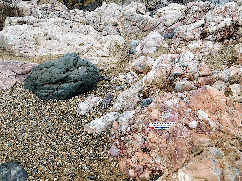
At the Western edge of Llanddwyn Island, this is another part of the melange with a much smaller scale mixture of components compared to Wylfa Head.
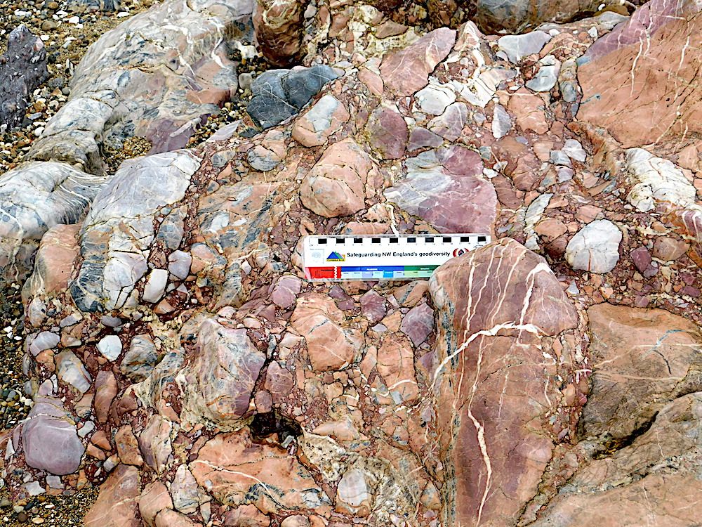
A closer view of the same area.
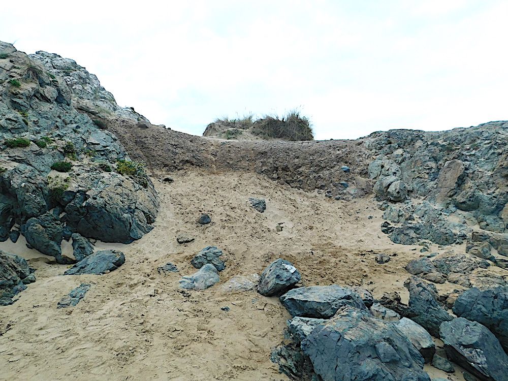
An area of boulder clay from the last glaciation sitting between two pillow lava outcrops. This had previously been covered over (and protected) by dune sand.
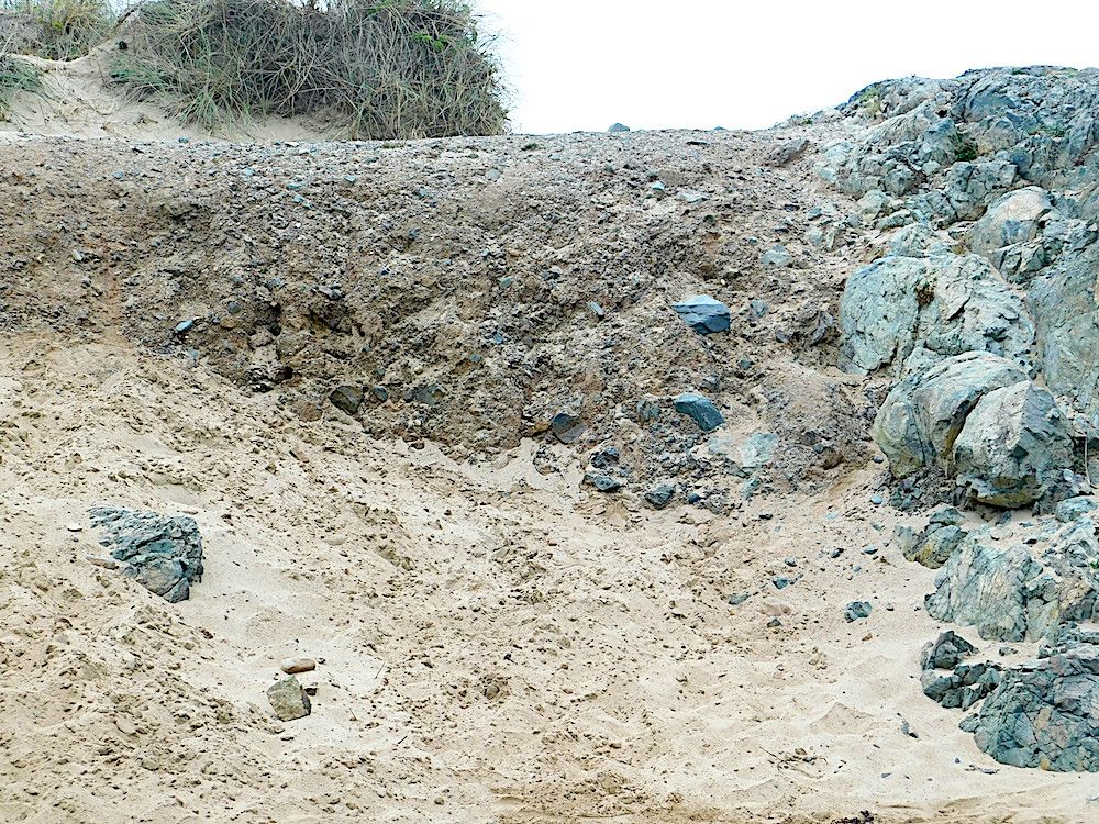
A closer view with pillow lavas on the right. The boulder clay also contains pillow fragments, consistent with its glacial origin. Now it has been exposed, it is likely that this remnant from the last ice age will have been completely eroded away in a few years.
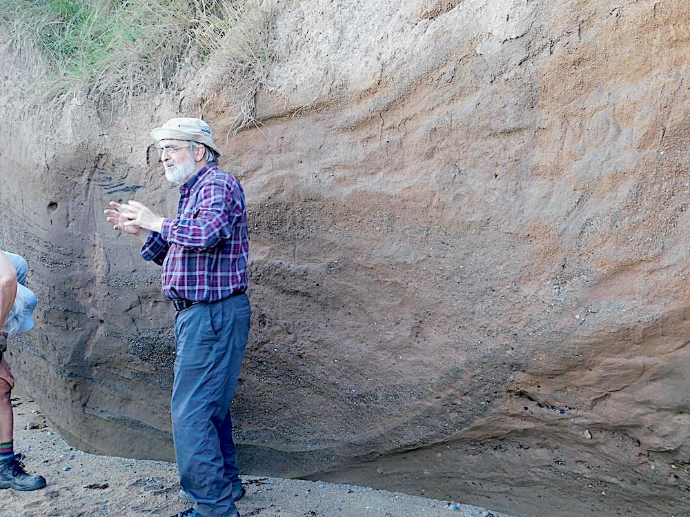
Rob Crossley explain how these structures formed. Note the black structures in the cliff face immediately above his hands.
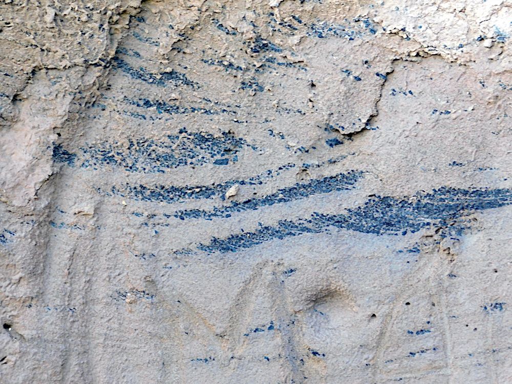
A closer view shows that these are coal fragments within the sandy/pebbly matrix. Their orientation gives clues about the direction of flow under the glacier.
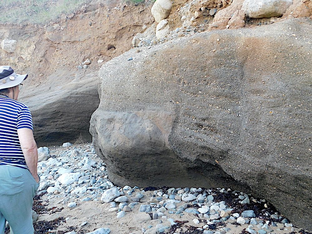
This slide shows the range of clast size seen in the cliff face. But how did the vertical interface in the lower centre of the picture between the pebbly matrix area and pebble-free area develop? We did not have a definitive cause for this unusual appearance!
Day 3
Rob had given us an itinerary to follow on our way back via Menai Bridge and Caernarfon. First stop was at the blueschist exposure round the Marquis of Anglesey's column. This was a disappointment as the car park and access was full of plant. The only access was a small path up from the main road. At one side was a small collection of blueschist hand specimens (Thank you, if you left it there!) but the column itself was barricaded off. The large exposures were still exposed and pieces of blueschist were scattered around in the wood.
A mile or so further along the A5, Telford's 1826 Menai Bridge is worth visiting in its own right. The supporting towers in Carboniferous limestone show some good fossils with rather lovely corals. Rocky Carboniferous exposures below were not very clear from the roadway but could be better exposed at low water.
The final location was the along the low cliffs near Plas Menai Sports Centre just off the Caernarfon road. A major Tertiary dyke intersects the coast here with smaller offshoots cutting the cliffs between it and the sports centre. The pebbly to cobbley conglomerate varies from grey where it was cooked by the intrusion to red nearer the centre.
That rounded off a most rewarding visit to Anglesey where we enjoyed good weather and some interesting and spectacular geology.