Monday 17th October 2022
Stonehenge by Colin Humphrey
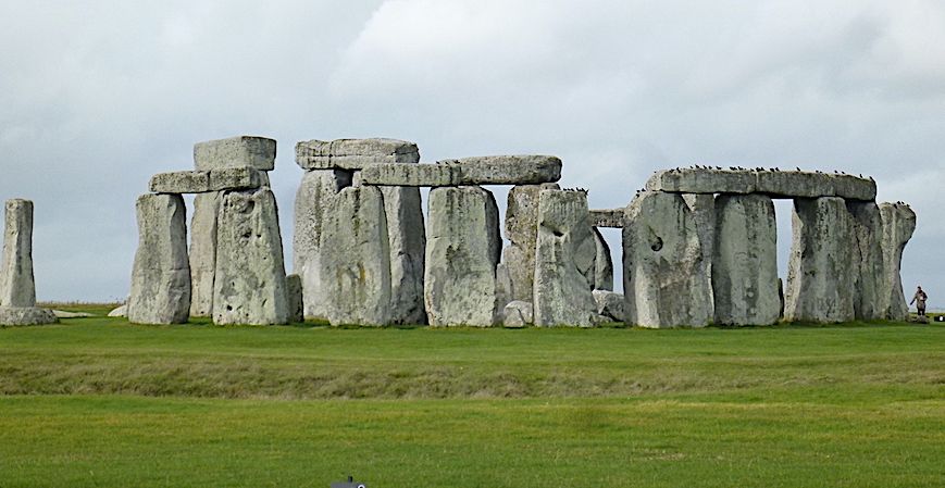
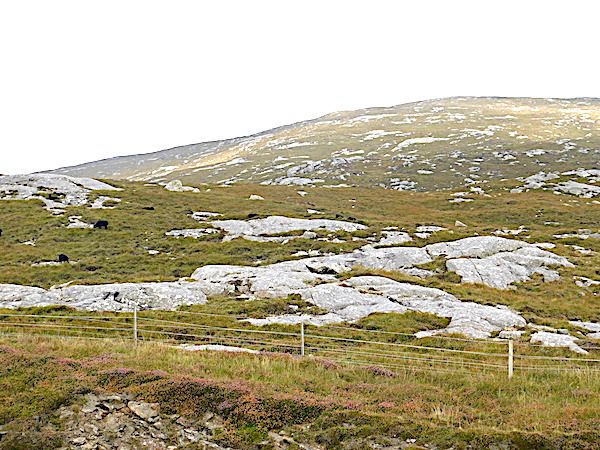
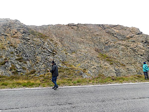
General view. The figure on the right illustrates the scale
On 21st September 2022 club member Colin Humphrey summarised the present understanding of Stonehenge, a World Heritage site on Salisbury Plain. The monument is composed of two very different building stones: the huge sarsens of the lintelled circle and its horseshoe of trilithons; and the much smaller bluestone inner circle and horseshoe; although only about half of nearly 150 orthostats (standing stones) remain. Sarsen is English Paleogene sedimentary rock; and bluestone is much older Welsh Ordovician igneous rock. The monument is clearly designed to allow the summer solstice sunrise to shine through several apertures between stones, and onto an altar stone.
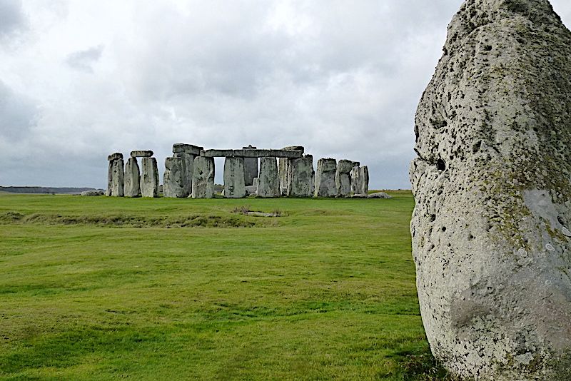
The sun must shine first through two heelstones (one is missing). Note root holes
The sarsens have long been assumed to come from the Marlborough Downs, 17 miles north of Stonehenge, the most abundant sarsen site in Britain. Recent X-ray fluoroscopy has definitely provenanced them to West Woods, just south of the Downs. Sarsen is silcrete, a silicified medium-to-coarse sandstone, very hard and erosion resistant. The sand was probably released by erosion of Lower Cretaceous Greensand (originally c100 Ma) exposed to the north, and conveyed by south flowing rivers to be deposited as the Reading Formation, sandy lenses on alluvial plains around 55 Ma ago in the early Cenozoic. Silcrete is found in many places across south-west Britain. The plains became vegetated and rootholes are frequent in the silcrete. Silicification probably occurred soon after, during the hot Paleocene-Eocene Thermal Maximum.
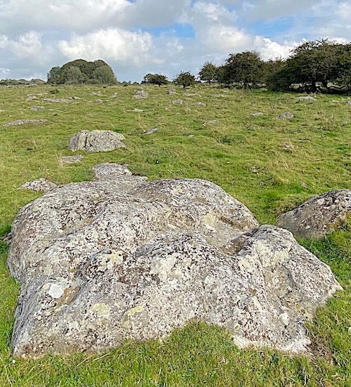
Silcrete boulders on Marlborough Downs
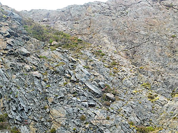
The bluestone comes from Mynydd Preseli, a small range of hills in north-east Pembrokeshire. Recent trace element analysis identifies various outcrops of 460 Ma intrusive dolerite, including some stones from Carn Goedog. There is a strong case that these and others were used to form a stone circle three miles west at Waen Mawn. The archaeologists now tentatively suggest, using several lines of evidence, that the Waun Mawn stone circle was then moved to Stonehenge. They also now conjecture that the local people carried their own stone circle to Stonehenge and remained there. It was a time of population movement; strontium analysis of cremation remains at Stonehenge include some people who were probably brought up on the rocks of west Wales. ‘Spotted’ dolerite (ie with phenocrysts) is not the only bluestone. There are others, including ‘unspotted’ dolerite and some extrusive rhyolite from the northern flank of Preseli at Rhosyfelin.
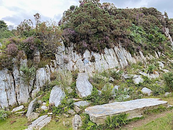
Rhosyfelin bluestone quarry
Around the outside of the present Stonehenge sarsen circle is a circle of now covered Aubrey Holes, named after its discoverer. We know from rock fragments and dating techniques that bluestones stood in these holes around 3000 BC. The much bigger sarsens were not installed until around 2500 BC, when the bluestones were then rearranged within the sarsens. Carbon dating of hearths at bluestone extraction sites in the Preseli hills suggest that a bluestone circle may have been constructed locally, at Waen Mawn for example, around 3400 BC. Stonehenge appears to have consisted of the smaller bluestones for hundreds of years before the more iconic sarsens arrived.
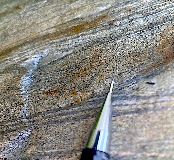
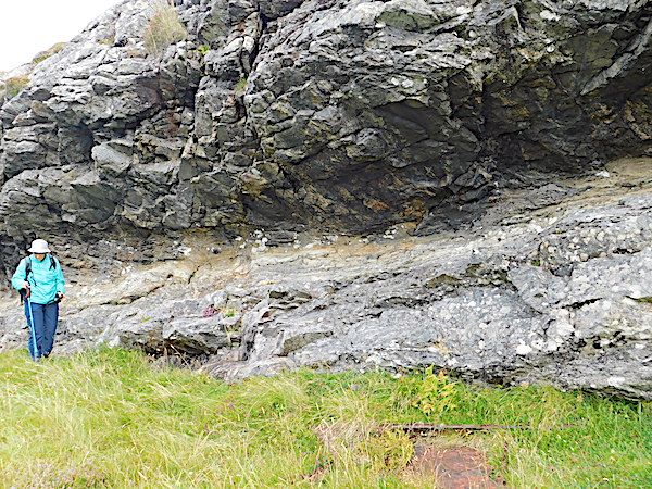
Rhyolite with fabric, a curious structure at Rhosyfelin
A dispute rages between a small number of people who believe the Welsh ice sheet transported the bluestones from Preseli at least to the Somerset Levels during the Anglian advance around 400.000 years ago. This has not been scientifically dismissed but the consensus now is that it is unlikely. Most glaciologists do not place the ice front far enough west and there is insufficient evidence of a train of large glacial erratics. Any argument that human transport is impossible is of course disproved by the movement of sarsens ten times the size, at least 15 miles.
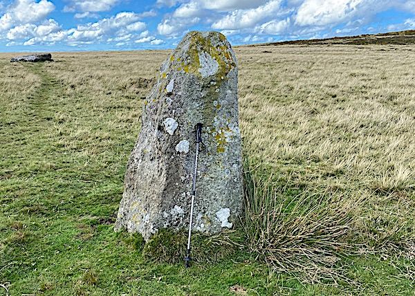
Solitary remaining standing bluestone at Waen Mawn circle in Wales. Possibly the previous site of the Stonehenge bluestones
Sunday 4th September 2022
Study of Church Stretton Fault near Gladestry. by Dr. Geoff Steele
At the last meeting Dr. Geoff Steele gave a very insightful talk on events along the Church Stretton Fault and the Welsh Borderland Fault System (WBFS).
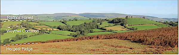
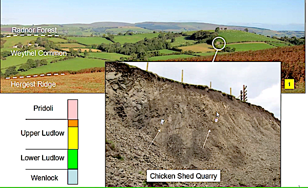
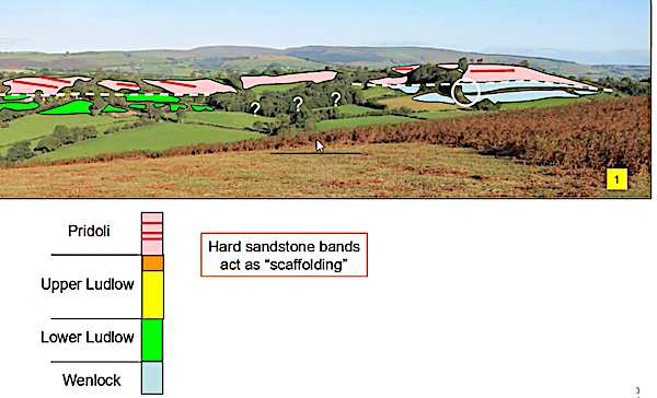
His study began with a question which was posed to him whilst on a geology field trip. The question asked “ why is Weythel Common a ridge when it consists of Raglan Marl whilst the other areas of Raglan Marl in the area form lowland?” This was in 2017 and led to Geoff studying the area in detail during his spare time. Weythel Common lies about 7km West of Kington,( grid reference OS235565.)
He presented his findings to us in this talk.
WBFS comprises the Tywi Lineament, the Pontesford Lineament and the Church Stretton Fault and forms the terrane boundary between the Cymru Terrane to the north west and the Wrekin Terrane to the south east. Various tectonic events have led to movements along the WBFS. One of these occurred during the late Ordovician in which the movement was dextral strike-slip. During the Silurian the movement was extensional as a normal fault with downthrow on the Welsh side. During the Devonian faults were reactivated as reverse faults and movement was sinestral strike-slip.
His fieldwork utilised three geology maps: one inch to 10 miles (1979); 1:50000 (2004); 1:250000 (1994). The section covering Weythel common on the latter map was scaled to the equivalent of the 1:50000 map from which differences in the mapped structure of the faults could be seen.
East side of Weythel Common
Line of east fault
Geoff went on to show that the Church Stretton Fault in the area under study has a break in it and showed that if a fault is not straight then a strike-slip movement producing transpression would lead to uplift of the strata in a “palm” structure whereas transtension would lead to basin formation “flower” structure. Therefore the structural hypothesis for this study was as follows: “if dextral strike-slip movements produce a transpressional high then sinestral strike -slip movements should produce a transtensional basin”
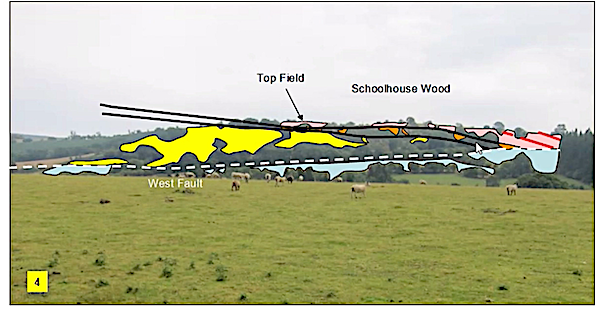
So Geoff underwent a detailed study of the area around Weythel Common. He looked at the stratigraphy, using easy to observe quarries and measured dip and strike of the area’s rocks. Using photography and field walking he could determine the line of the fault and also the pattern of some of the rocks just below the surface. The weather helped greatly in this latter endeavour, with snow melt indicating the trend of the fault and very dry and parched fields showing the underlying vertically orientated sandstones.
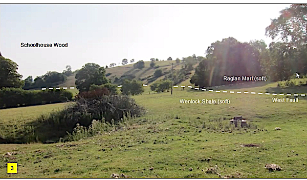
West side of Weythel Common
Line of west fault
From his findings Geoff was able to put together his own geological map of the area. His conclusions are as follows:
Weythel Common is a “tulip within a palm”
It is a hill because:
- Hard sandstone bands form a scaffold
- The surrounding Wenlock shale is more crumbly than the Raglan marl
It’s structure is an asymmetrical anticline and may be thrust faulted
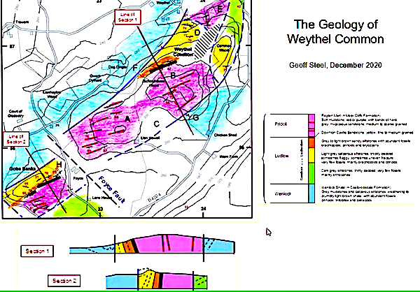
Geoff's final map from the fieldwork
Friday 17th June 2022
Introduction to Outer Hebrides Geology by Chris Simpson secretary of MWGC.
This talk is based on a guided trip round the Hebrides led by Chris Darmon and Colin Scofield from geosupplies (http://www.geosupplies.co.uk)
We took the ferry from Oban to the island of Barra at the southern end of the Hebrides. Then we worked our way north along the whole chain of islands, finally getting the ferry back from Stornoway to Skye. We had eight nights, staying at four different hotels. There was a lot of geology to see; and also, a lot of interesting non-geological sites such as the Calanais Stones – a Neolithic site erected around 2,900BC.
The islands are mainly composed of very old rocks including the oldest rocks seen in the UK. The following is a brief summary of the main aspects of Hebridean geology.
3Ba: first terrains formed, divided by faults between the islands.
2.8Ba: first metamorphosis to give predominantly meta-igneous rocks – the Badcallion event.
2.4Ba: widespread invasion by basaltic Scourie dykes.
? Age: second metamorphosis – re-worked the gneiss and converted the basaltic dykes into meta-basaltic dykes.
1.8 – 1.7Ba: pegmatitic dyke invasion.
~400Ma: Caledonian Orogeny which created the Outer Isles Thrust Fault.
The typical appearance of much of the island chain. Gneiss weathers to produce poor soil – so bare rock is very common.
The Outer Hebrides Thrust Fault is a major factor behind the geomorphology of nearly the whole island chain, being around 100 miles long. Most of the island rocks are gneiss in one form or another. Recent research is managing to differentiate the gneiss into different terrains; and also providing evidence of the precursor rock before it was metamorphosed into gneiss.
Sandstone, granite and basalt will all end up as gneiss if subjected to high-grade metamorphism – but they will retain the geochemistry of the original rock, especially the trace element geochemistry. So even after three billion years, we can still say that one area of gneiss came from Mid-Ocean-Ridge basalt, while another area of gneiss came from sandstone.
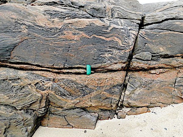
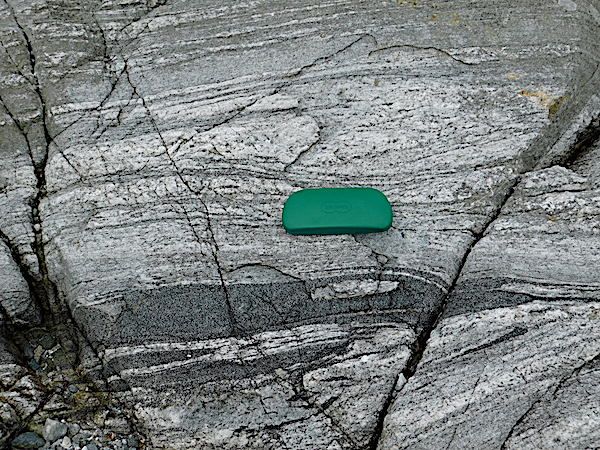
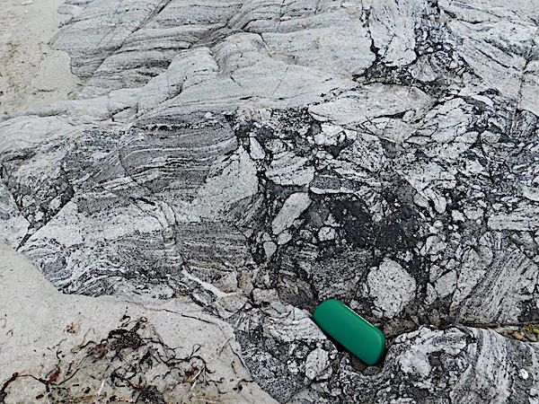
Banded gneiss. The appearance varies greatly from one area of the Hebrides to another, both in the shape and colour of the banding. There is no such thing as “typical” gneiss. (The scale is the green spectacles case.)
A closer view of the upper central part of the above photo
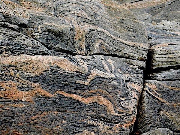
Increasingly complex gneiss banding.
Absolutely chaotic gneiss
Larger-scale banding and chaos.(Fence posts at the top of the picture give a scale.)
A recent dyke related to the Skye super-event approx 65Ma.The scale is an A6 field notebook
A pegmatitic dyke with huge quartz crystals.
On the geology map, this area is described as crushed gneiss and pegmatitic dykes near where thrust planes split.
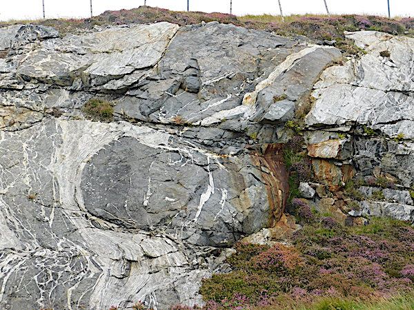
A road cutting where the Outer Hebrides Thrust fault runs. The fault line runs diagonally from the top near the left down to the bottom at the centre. All the rock to the right of that line is disorganised
A closer view view of the fault boundary.
The thrust fault on another island. Here it is nearly horizontal with a more obvious contrast between the top and bottom layers.
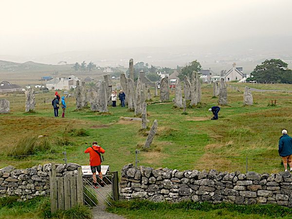
The Calanais Stones on the island of Lewis, 12miles west of Stornoway.
Many of the stones are composed of banded gneiss. (The scale is a camera lens cap.)
Text and photos Chris Simpson
Tuesday 7th June 2022
Anglesey GeoMôn Geopark
Mid Wales Geology Club members heard an excellent talk from Professor Cynthia Burek about the Geopark on the Island of Anglesey (Môn in Welsh) on 18th May. She is a director of the Geopark and represents it at Unesco Conferences.
Geoparks became international in 2000 with several European geoparks cooperating to ensure they could protect their geological heritage and encourage sustainable development and geotourism. In 2004, the 17 European Geoparks were joined by 8 Chinese parks.
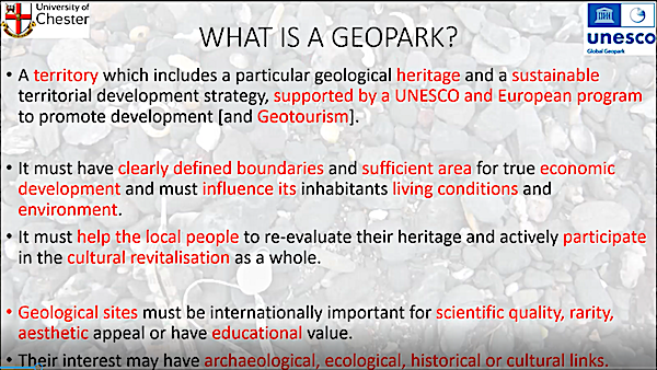
In 2015 UNESCO recognised Geoparks as one of their protected entities, joining World Heritage sites etc. A Geopark is a defined area of territory with a particular geological heritage, noted internationally for scientific quality, rarity or educational value. It also has to involve the resident population in active participation and, hopefully, economic development. By 2022, there were 177 designated Geoparks in 46 countries around the world. Europe has 88 spread around 26 countries. The UK has 8. In England: the English Riviera, North Pennines and Black Country Geoparks. In Wales: Fforest Fawr & Môn. In Scotland: Shetland and the North-West Highlands. In Northern Ireland there is the Marble Arch Caves/Cuilcagh Geopark.
GeoMôn was recognised as a Global Geopark in 2015; and recognised as the first tectonic island Geopark because it had every type of plate boundary with the associated rocks and structures. GeoMôn is the most diverse of the 8 UK Geoparks with over 100 different rock types formed over 1,800 Ma of time. Many of these rocks can be seen from the coastal path going all round the island – see the book Rocks and Landscapes of the Anglesey Coastal Footpath for details. All the main geological time periods are represented on the island apart from the Jurassic and the Cretaceous. The Geopark has produced a series of illustrated guides for walking trips to see aspects of the geology at specific locations around Môn which are suitable for both the general public and geologists.
We were shown photos of the oldest fossils in England & Wales – cyanobacteria at Llanbadrig at the Northern tip of the island – 860Ma on the latest research dating.
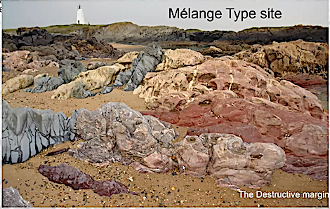
Llanddwyn Island, reachable at low tide from Newborough Sands, is the world type site for melange, where it was first described by Greenly. Amazingly, just a short distance away are pillow lavas formed at a constructive plate margin, rather than the destructive margin involved in the formation of a melange.
The Geopark has its headquarters in the Watch Tower Building at Amlwch, next to mica schists formed during the Caledonian Orogeny. It is open over the summer between the hours of 12noon and 4pm – but not Saturdays or Mondays. The exhibition in the building has been updated during lockdown, and the posters now cover Climate Change from Snowball Earth to modern times. Specimens of all the various rock types in the Geopark are also shown.
The South Stack formation rocks show the effects of the Caledonian Orogeny – Anglesey collided with Scotland and Eurasia as the Iapetus Ocean closed. This is an example of geodiversity supporting biodiversity, as the multiplicity of sedimentary rocks provides plenty of ledges for a wide variety of sea birds to nest safely.
The Geopark also features the best example of a thrust fault in Wales at Carmel Head, where Pre-Cambrian & Cambrian rocks have been thrust over the top of 450Ma Caradoc rocks.
Parys Mountain is well-known as having been the world’s largest copper mine in the 19th century. This is an area where the local geology led to economic activity significant in the UK and internationally.
All in all, there is an amazing variety and age of geological sites to see within the Geopark. Anyone interested in a good book covering the island’s rocks was recommended to buy Footsteps through Time – the rocks and landscape of Anglesey explained by Stewart Campbell, Margaret Wood and Brian Windley. Also worth visiting is the Geopark’s website: [https://www.geomon.co.uk]
Photos with kind permission of speaker
Monday 2nd May 2022
Landscape Evolution of south-west Wales
At the last meeting (20th April 2022) Prof. Peter Kokelaar gave a very interesting and informative talk on how the landscape of south-west Wales changed and evolved over time from the Carboniferous to the present day.
Although based on his work on the Gower peninsula the area covered by the talk comprised a larger area covering the south Wales coalfield, the Brecon Beacons and over to Carmarthenshire across the Southern Caledonian fold belt.
The stratigraphy of the area is dominated by Carboniferous rocks ranging from Carboniferous limestones through the Coal Measures to Pennant sandstones at the top of the sequence. It is underlain by Devonian quartz pebble conglomerates. These rocks were folded in early Permian with deformation coming from compression arising from the south. (Variscan orogeny.) Therefore the area was folded and uplifted from a southerly direction producing folding that propagated to the north. The uplifted material eventually being eroded.
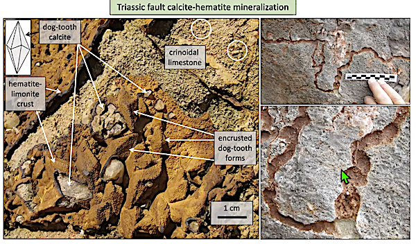
There are two sets of faults in the area, one associated with the folding, and the other occurring later during the Triassic period. The latter are N-S faults related to E-W crustal extension. Hydrothermal fluids flowed through these extending faults leading to mineralisation. With good examples of calcite-haematite mineralisation to be found. At Port- Eynon there is a vestige of Triassic outcrop left. Often fault fissures contain Triassic infill and the lack of development of a karstic landscape suggests that there was no dissolution of the limestone suggesting the landscape must have been arid.The one exception being at Worm’s Head where there is a pothole with infill, suggesting it must have formed below the water table which in turn suggests the onset of Jurassic sea-level rise. Although there is are no Jurassic rocks preserved on Gower there are Jurassic sediments found in other locations eg. in the Vale of Glamorgan. Cretaceous sediments are also absent.
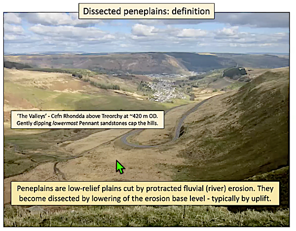
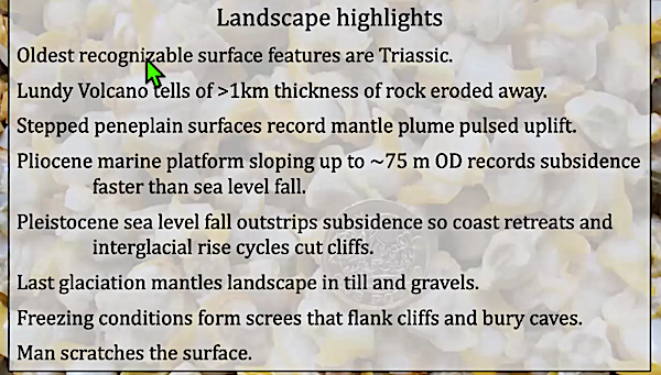
During Paleogene and Neogene (66Ma - 2.58Ma) times the area underwent cooling from a tropical climate to a temperate one. Global sea-level was falling and sub-arial weathering was occurring. At about 62Ma a mantle plume occurred under western Britain and Greenland causing uplift. But this uplift occurred in pulses. Therefore uplift and sedimentation associated with it must have also have occurred in pulses. It follows therefore that the peneplanation in steps that is seen in the landscape is reflecting the pulsed uplift from the plume. Observing various peneplains eg. Cefn Rhondda above Treorchy (420m OD) and Mynydd Epynt (420m OD) it becomes obvious that large volumes of rock must have been eroded over time. Similarly looking across what was the Caledonian Mountain belt it is obvious that huge areas have been eroded.
The uplift partly accounts for the tilt of Britain as the dynamic support was uneven being greatest in the west and lowest in the east. Further, at 54Ma the Atlantic opened which caused Britain to move away from the uplift of the plume due to sea floor spreading. Thus dynamic support diminished from 54-20 Ma. Proof of the loss of about 1km of rocks can be found when one observes Lundy Island ( Lundy volcano) as here the granite ( dated 60-57Ma) is now exposed.
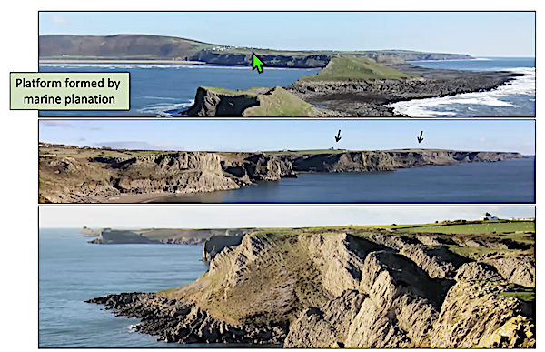
During the Pliocene (5.33-2.58Ma) the crust is cooling and becoming denser, land subsidence was greater than sea level fall so that a marine transgression occurs. As such the transgression led to the development of marine platforms formed by marine planation. During this time those areas not under water formed small islands with the areas in between undergoing planation. The planation is caused both by mechanical abrasion and chemical dissolution of the limestone.
During the Pleistocene ( 2.58-0Ma) the opposite is true in that sea level fall is greater than land subsidence which led to marine regression. This was related to glaciations which were interspersed with interglacial periods in which sea level would rise thus giving rise to cliff formation.
Using erratics Prof, Kokelaar also mapped the extent of the last glaciation on Gower (23,000 years ago) which was the Last Glacial Maximum when global sea level was 120m lower than it is today. Looking at “Arthurs Stone” which is on the limit of the Ilston lobe, the area has a high number of erratics which is due to the ice being forced to this level due to topographic barriers. Therefore the landscape has been moulded by the ice which has also left a mantling of till. Also during this time even if the ice was not present the temperature would be low causing freeze thaw action on the rocks producing screes which flanked cliffs and buried caves.
The final effect on the landscape of course are humans who change the landscape in various ways.
If you are interested in learning more and in much greater detail then I encourage you to Buy Prof. Kokelaar book “All Our Own Water: Landscape Evolution, Caves and Hdrogeology of Gower”. ISBN 978-1-3999-0335-6
Photos with kind permission of speaker