Wednesday 7th June 2023
Coming out of the Ice Age - by Tony Thorp
On Wednesday 17th May, At Plas Dolerw, Tony Thorp gave a talk on "Coming out of the Ice Age".
The talk focussed, not on the Ice Age as such, but on what is most visible now and on what we see still happening round us in our local area.
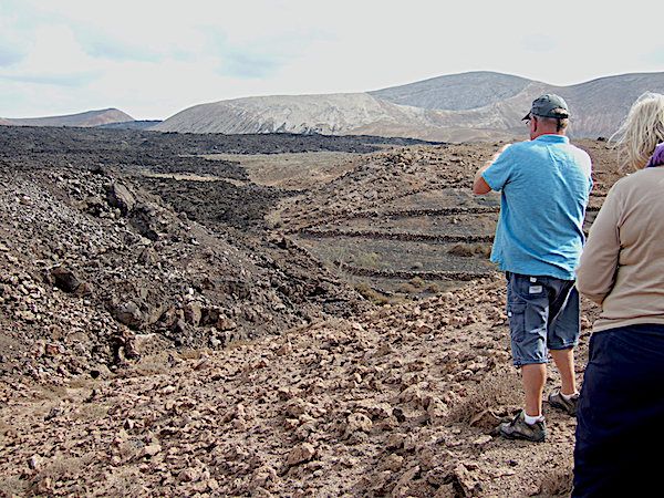
Rather than the image we were all taught at school of Alpine glaciers, "U" shaped valleys, hanging valleys and terminal moraines, we see more the residue from a waning, melting ice sheet depositing its load of dirty mud and rocky bits (very aptly described by the outdated term "boulder clay") on the existing rock terrain. Other than on hilltops, marshy bog must have been universal in the periglacial landscape. Its extent is well shown in the BGS "Solid and Drift" or "Bedrock and Superficial" series of geological maps by the pale blue "till" colouration. Tony took us to a few of his favourite neighbouring locations.
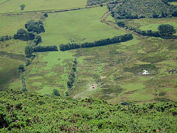
Crychell Moor
The first location was Crychell Moor, a broad flattish valley 2km west of Llananno, just off the A483, best viewed from the trig point on Ysgwd-ffordd, on a section of Glyndwr's Way. The floor of the moor is carpeted by a number of "ramparted depressions" outlined by rushes (Figs Palsa 1, 2). There has been some debate about whether these are relics of pingos or palsas. Pingos are ice-cored conical hills found in permafrost areas, whereas palsas are rather smaller scale freeze-thaw periglacial structures comprising peat and ice mounds which grow from a mire and eventually collapse, to be succeded by new ones and often developing into complex curvilinear patterns, very evident in Palsa 1. In Palsa 2 the grass and rushes had been cut, leaving the peaty boggy depressions proud. In some conditions the periglacial feature 'patterned ground' is visible through the turf near the trig point.
Palsa 1 by Tony Thorp
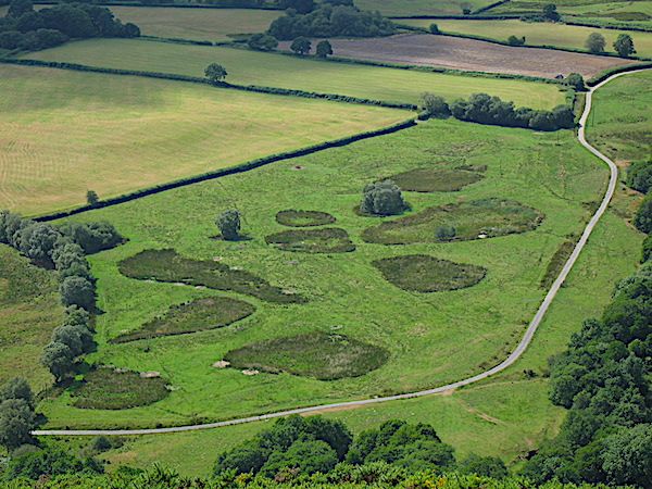
Palsa 2 by Tony Thorp
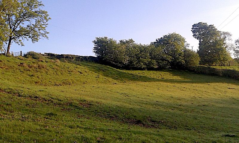
His own personal landslip!
As ice wanes and massive amounts of wet "Boulder clay" are deposited on the solid topography, which will often have been oversteepened by ice action, landslipping is endemic and very often it is still mobile today. Tony showed pictures of his own landslip which is still moving downhill towards the brook at the bottom. The narrow ridge at the top is all boulder clay (As evidenced by a series of bores made for recently planted telegraph poles.) and the top scar is the steep drop below the hedge. Below is a series of terracettes. At its toe the clay is quite plastic and discharges into the brook just below the trees he planted to try to stabilise it. Fenceposts keep moving downhill!
Scar of landslip by Tony Thorp
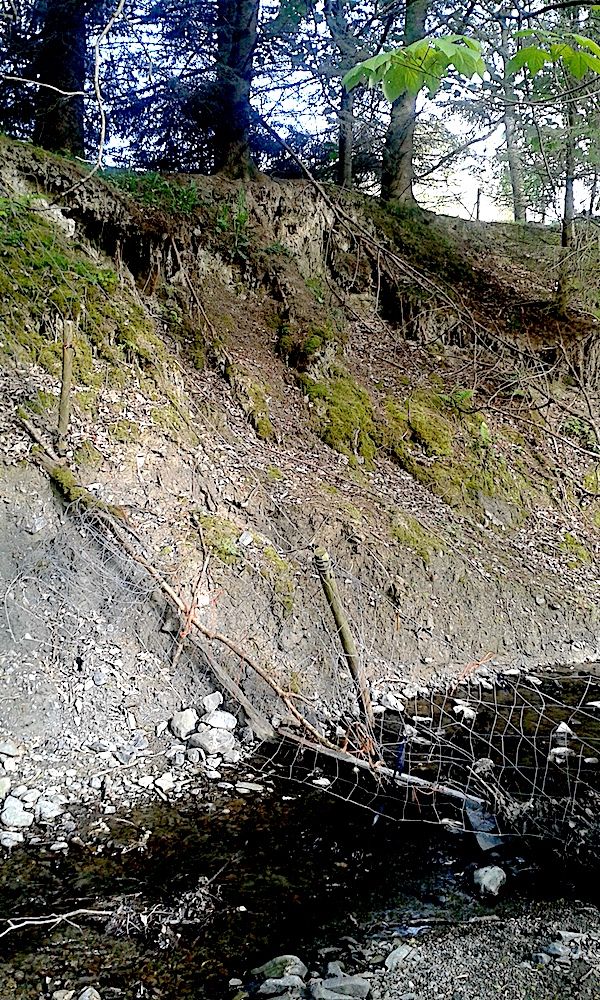
Toe of landslip by Tony Thorp
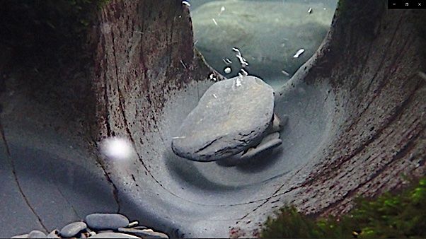
Elsewhere, the valley is a steep "V" shaped gorge, cut into the bedrock by rock-bearing meltwaters as the ice melted. Most times it is a quietly babbling brook, but every few years, after snowmelt, it can be as noisy as a jet engine and will move large boulders!
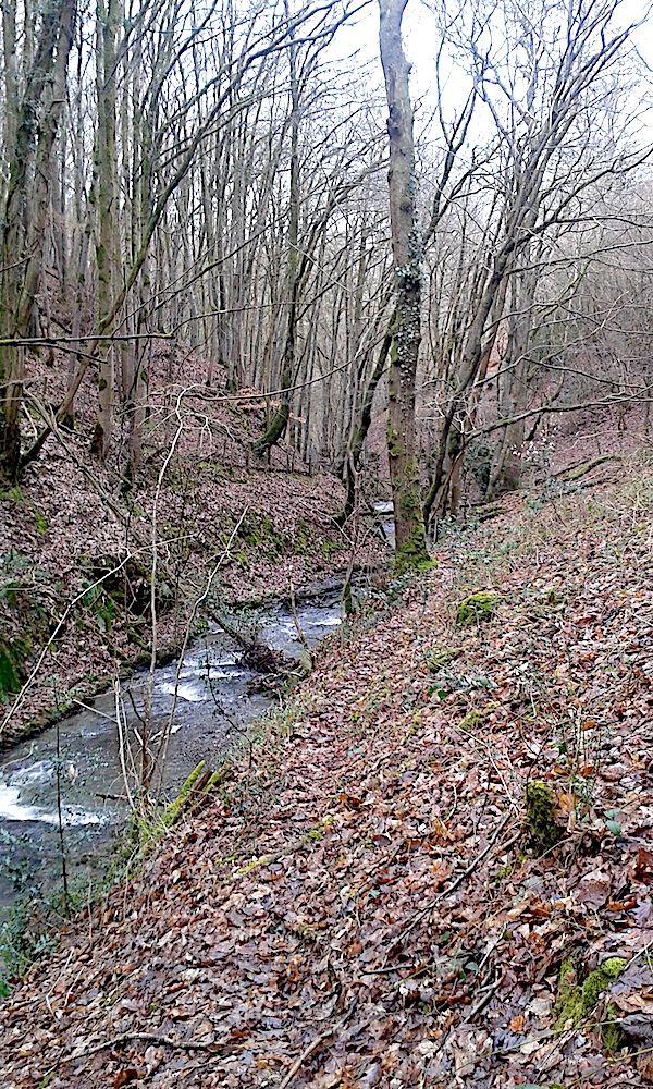
V-shaped valley by Tony Thorp
Severn Valley
The Severn Valley was the course of a significant ice stream moving faster than the rest of the cap in a northwesterly direction. It left a train of drumlins and glacially streamlined bedrock features along its length, very evident in the BRITICE Glacial Mapping Project V.2 (2017) (Ref 1). A significant drumlin, Trehafren Hill, is in Newtown and has a large landslip on its north side and a smaller one on the south. Such slips are a common feature and when Newtown was being developed in the 60s and 70s were the reason for the Development Board commissioning the BGS to produce a special six inch to the mile geological map. Sue Cain's 3D model based on that map shows them clearly and was examined by attendees in person at Plas Dolerw.
Black Gate
Black Gate is an interesting point along the Knighton road some two km out of Dolfor. It is within a stone's throw of the source of three rivers, the Mule which joins the Severn at Abermule, the Ithon which flows south to Llandrindod alongside the A483 and also the Teme, sourced less than a km southeast and flowing to Knighton and Ludlow. The amount of boulder clay in the Mule valley shows that the col between it and the Ithon was well covered by ice during peak glacial times and must have had a complex history in the multiple advances and retreats as the ice waned. As levels one side or the other may have been higher, meltwater would have flowed in either direction. This has left a complicated pattern of meltwater channels just north of the road.
Black Gate the view from the road looking northeast to the Mule valley with meltwater channels in the foreground and hints of lateral moraine in distance on the far side of the valley.
Sarn
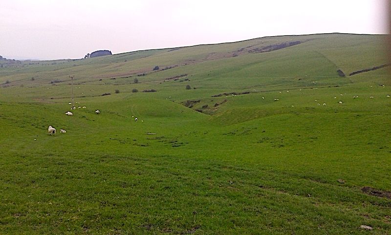
Sarn lies in a fertile flat bottomed valley running east through Kerry from Newtown. It is floored by shaley rocks with more resistant Bailey Hill Fm rocks forming the high ground north and south. During the last glacial it was home to a significant ice stream which, as it retreated, dumped a lot of morainic clays and gravels near Sarn. This obstructed the original river Mule forcing it to find a way north through the gorge near Abermule before joining the Severn. Its lower stretches remain as the now smaller Caebitra continuing on its former course to Churchstoke where another river diversion took place forcing it to go north, joining the Camlad and joining the Severn.
The valley is also home to a drumlin swarm just south of Bacheldre. This is more subdued than those in the Severn valley where they have been augmented by the grain of the rocks and the speed of the ice stream.
Drumlin by Tony Thorp
Tony ended with a small sad sequence showing the (probable) demise of a kettle hole on the Severn outwash plain near Shrewsbury as it was demolished by a 5 furrow plough! Never mind, perhaps the peat, the wet and the roots of rushes will re-establish!
Ref1 The BRITICE Glacial Mapping Project: version two (2017) accessible at:
https://shefuni.maps.arcgis.com/apps/webappviewer/index.html?id=fd78b03a74bb477c906c5d4e0ba9abaf
Thursday 11th May 2023
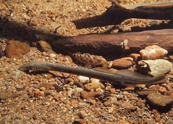
The River and the Rock: River Potholes of Wales By Dewi Roberts
At the last meeting Dewi Roberts gave a very interesting talk on the formation of fluvial potholes. His talk was accompanied by his superb photography taken both above and under the water and which had been taken mainly in welsh rivers.
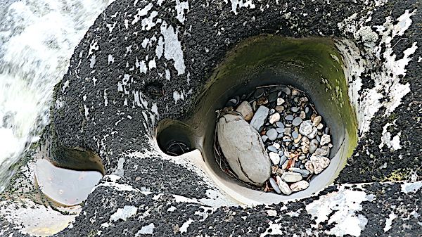
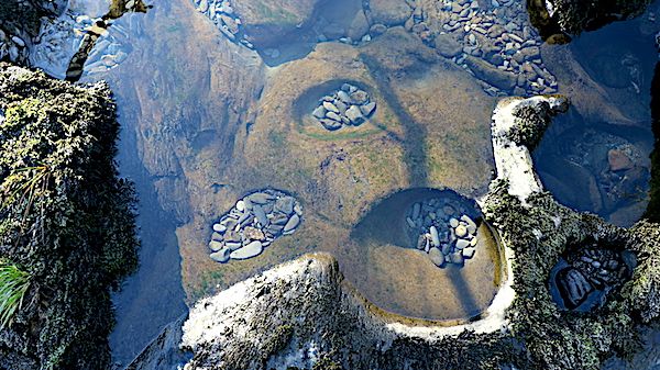
General View of a pothole by Dewi Roberts
Potholes are an erosional and very visible feature of a fluvial landscape and occur mainly in the upper reaches of a river were the flow of water has sufficient energy to carry the boulders, cobbles , pebbles and sand that are required to cause abrasion of the bedrock. Therefore one of the main factors in pothole formation is hydraulic. They are one of the ways in which rivers erode the landscape but they create superb river scenery.
Underwater image of turbulence moving cobble by Dewi Roberts
Formation begins with a minor depression in the bedrock. The turbulent flow of the river will then develop eddy currents which enter the depression. This will then cause the sediment to enter the depression and begin to abrade the sides and the bottom causing it to enlarge. A type of positive feedback mechanism which causes an increase in turbulence and eddy currents. The pothole will continue to deepen and widen over time unless the erosive effects are halted for some reason. The sediment particles involved in the erosion are known as tools.
Potholes on the Clywedog River by Dewi Roberts
If the pothole continues to erode overtime then eventually neighbouring potholes may coalesce which can lead to the development of an inner channel through which water can flow and produce areas of sculpted rock.
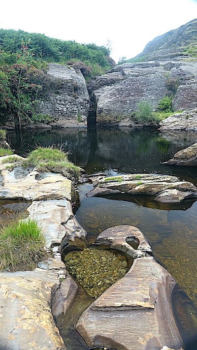
Abergwesyn Common by Dewi Roberts
Other factors that play a role in the formation of potholes will be the type of rock over which the river flows and the presence of joints, veins or dykes. The bedrock topography will have an influence on flow and turbidity and joints can lead to block quarrying which may limit the length of time available for pothole formation.
A thoroughly enjoyable talk especially as we were taken under the water to see the process at work.
Dewi along with Stephen Tooth and Hywel Griffiths have produced a book entitled:
River and the Rock, The - River Potholes of Wales
ISBN: 9781845278878
This should prove a very interesting read and the photography will be superb.
Dewi also has an exhibition at The Aberystwyth Arts centre:
Hydro Psyche
Wed 17 May 2023 to Sun 23 July 2023
“Inspired by the Rheidol, Ystwyth, Dulas and other Welsh rivers, Hydro Psyche explores the benefits of re-connecting with nature. A collaborative project by painter Karen Pearce, photographer and videographer Dewi Roberts and writer and performer Liz Pearce that fuses paintings, film, photography and sound to celebrate the beauty and power of rivers and the life within them.”
Wednesday 19th April 2023
The last talk which was given by Chris Darmon was on the geology of the Canary Islands. Chris has led and will be leading further field trips to the Islands. More can be found about his field excursions at https://www.geosupplies.co.uk/geological-supplies-company.php
The Canary Islands are a group of seven main volcanic Islands located off the north-west coast of Africa trending in a south-west to north-east direction. They are located on ancient oceanic crust of the African plate and are a good example of intra-plate volcanism. The ages of the islands varies between the youngest El Hierro at 1.12Ma in the south west to Fuerteventura at 20.6Ma in the north east. It has been suggested that like the volcanism in Hawaii the islands have been produced by the presence of a volcanic plume over which the African plate moves in a direction from west to east although other ideas have been put forward and the topic is controversial.
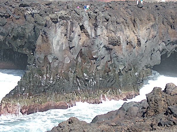
Lava flow Lanzarote with columnar jointing by Chris Simpson MWGC
The canary Islands form what is known as the Canary Volcanic Province but this is not the only area on the African plate that is volcanic as the area around Madera is also volcanic and known as the Madeira Volcanic Province and volcanism is also around Cape Verde islands. ( Cape Verde Volcanic Province) But all of these are linked to a much larger area of seamounts and these cover an area that is approx 1300 km long and 350 km wide which is known as the Canary Islands Seamount Province. The sea mounts vary in age with the oldest in the region of 142Ma.
Aa Lava flow Lanzarote by Chris Simpson MWGC
The Canary Islands similar to the Hawaiian Islands, show different stages in their development over time. Firstly there is the submarine stage, followed by shield-building, declining, erosive and rejuvenation stages. The stages commence with the submarine seamount stage which contain submarine sediments and for example, alkali basalt pillow lavas and dyke swarms. This is followed by the emergent stage i.e. the stage at which the volcano is at the surface. It then begins to develop into a large shield volcano characterised by subaerial alkaline basalt and trachybasalt lava flows. As the volcano begins to decline then rocks like phonolite begin to appear. This stage is followed by erosion. Here there is little or no volcanic activity and there is vast erosional removal of previous lavas and ashes. Finally there is rejuvenation with minor volcanic activity and the formation of rocks such as nephelinites. Thus these structures need at least 10-15 million years to go through the various stages.
Multiple balsaltic dykes Fuerteventura by Chris Simpson MWGC
So what are the arguments for the formation of these islands. Firstly the idea that there is a large mantle plume over which the African plate moves but there are many arguments against this idea. Another suggestion is that they are related to a propagating fracture associated with the Atlas tectonic chain. Objection to this hypothesis is that there is no evidence of continuous faults connecting the two areas.
A third idea put forward by Paul van de Bogaard in 2013 is as follows: "shallow mantle upwelling beneath the Atlantic Ocean basin off the NW African continental lithosphere flanks produced recurrent melting anomalies and seamounts from the Late Jurassic to Recent, nominating the Canary Island Seamount Province as oldest hotspot track in the Atlantic Ocean and most long-lived preserved on earth.” (van den Bogaard, P. The origin of the Canary Island Seamount Province - New ages of old seamounts. Sci Rep 3, 2107 (2013). https://doi.org/10.1038/srep02107)
The geology of these islands appears to be complex with much more research necessary to understand their geology.
Saturday 11th March 2023
What triggered the Cambrian Explosion by Prof Rachel Wood University of Edinburgh
At the beginning of the Cambrian period there was a huge evolutionary burst of life markedly increasing the diversity of animals which includes many of the major groups of life we see today. The question has always been: “what triggered this event?”. The talk by Prof Rachel Wood” ( University of Edinburgh) on February 13th shows just how much work has gone into that question and that answers are finally being found. What is proposed is that the roots of the Cambrian explosion are not in the Cambrian but in the Ediacaran.
Prof. Wood explained that for the vast majority of time the planet was dominated by unicellular life. Then between 575-540Ma organisms on the sea floor changed dramatically. These organisms - the Ediacara biota, were much more complex but at what point the first animal appears is actually still disputed. Although if one looks at various characteristics that suggest complexity eg. burrowing, surface locomotion or biomineralisation, it can be seen that they do start to appear in the Ediacaran. Then at about 540Ma a huge abundance and diversity of life appeared. This being the “Cambrian Explosion”.
Prof. Wood and her multidisiplinary team along with international collaborators have been working on this problem for many years. The main location for their field work is in Namibia. The reason this area is so important is due to the ability to a.) date the ash beds to a narrow time sequence of between 547 - 538 Ma a critical 10 million year period where they find these first fossils that are known to be bilaterians b)the area is divided into two basins, c) the necessary outcrops are present and vegetation free.
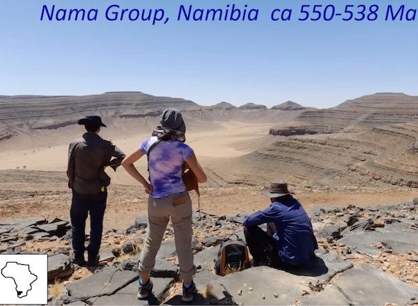
Research site in Namibia
One fossil find they have named Nomacalathus shows bilateral symmetry which suggests it is an animal and although from the Ediacaran biota is very similar to the Entoprocta found in China from about 520Ma. Therefore she suggests that they are now pulling the Cambrian Explosion down into older rocks.
One suggestion as to the cause of this increase in diversity is related to changes in oxygen levels. When oxygen levels increase it leads to an increase in cellular energy production. This could lead to a development of greater complexity with an increase in size, more complex body structures and enable more energy-intensive movements.
Part of the work in this area is in tracking anoxia. For this they use proxies one being the iron speciation paleoredox proxy which can distinguish three major oceanic redox states - oxygenated, ferruginous and euxinic. Anther proxy is the Cerium anomaly which can track manganous conditions. These two provide detail necessary to understand oxygen distribution in the basins under study.
From this work they discovered that the organisms only lived in well oxygenated areas of the basins. To begin these areas were very restricted but as oxygen levels increased so did habitable area which itself allowed spread into new areas and also an increase in diversity. Not only is change in habitat important but most probably nutrient levels will play a part but is difficult study. Individual animal physiology and adaptability will also play a part.
Prof. Wood then summed-up the talk with the following conclusion:
Late Ediacaran metazoans restricted to well-oxygenated, but dynamic, oases
There were differential turnovers and body size changes within the Cambrian
- may have been structured by intervals of dynamic shallow marine
redox/nutrient input.
Physiology may cause differing responses to these drivers
-created distinct record of early metazoans during the Cambrian Explosion, and also the form of its demise.
Oxygenation expanded habitats - dynamic chemocline - and governed ecological complexity
Cambrian Radiation was not linear, but cyclic, driven by oxic pulses
Wednesday 2nd November 2022
Evolution of the eye
At the last meeting 19th oct Tony Thorp gave the second of his very interesting talks on the Evolution of the Eye.
To begin he gave a summary of the previous talk which had taken the time-line of evolution back to the late Cambrian.
Eyesight began with light sensitive cells which could detect light but not direction, images or shapes. The next step was the development of pits covered in photoreceptors. These were able to detect direction of light but not images or shapes. This allowed development of phototropism. Further evolutionary change led to deepening of the pit and the cavity becoming fluid filled and eventually covered over. The narrowing of the aperture produced the “pinhole camera eyes” as in Nautilus. This increased directional detection and some shape detection but not colour or depth.
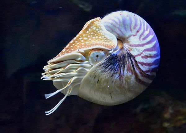
Nautilus by Archibald Tuttle Creative Commons https://creativecommons.org/licenses/by-sa/4.0/deed.en
Eventually the eye developed a lens so that now there was a fluid filled eye with lens and cornea which allowed image focusing which was followed by the development of the hard lens we know today which can focus light much more accurately. Tony concluded the summary of the first talk by talking about lamprey vision. The lamprey split off from the rest of the vertebrate group about 500MA. What is of interest is the rods and cones of the lampreys utilise the same mechanism of photo-transduction as other vertebrates therefore suggesting the mechanisms used in vision emerged very early on.
Western Brook lamprey bu US Fish and Wildlife Service Creative Commons
https://en.wikipedia.org/wiki/en:Creative_Commons
In the second half of his talk Tony showed that the development of vision could be shown to have evolved even further back than the Late Cambrian.
In order to understand evolution of vision we first have to understand the biochemical pathway of photo-transduction. The pathway involves a cGMP (cyclic guanosine mono-phosphate) - gated mechanism which alters the flow of ions across the cell membrane. Each photo-pigment molecule consists of the trans-membrane G -receptor protein opsin and a chromophore 11 cis -retinal, the whole known as rhodopsin. When light is absorbed the rhodopsin becomes enzymatically active which causes a cascade of events which culminates in the decrease in cGMP concentration which causes closure of the cGMP - gated channels on the plasma membrane. Sodium and calcium channels in the plasma membrane of the outer segment are kept open in the dark by a high level of cGMP. A decrease in cGMP leads to a decrease in influx of the cations into the cell and therefore hyperpolarization of the cell membrane. This neuronal signal is then transmitted to the brain.
Research has shown that there are two classes of opsin. Type I opsin, common in bacteria, evolved separately from type II opsin that are common in animals. Opsin is a member of large family of detector proteins, called the 'G-protein coupled receptors' (GPCRs).
Further, all known visual pigments in Neuralia ( the clade containing Cnidaria,eg. Corals and jellyfish; Ctenophora- Comb Jelly; and Bilateria -animals with bilateral symmetry) are composed of an opsin and a light-sensitive chromophore, usually retinal. Also these opsins can be classified into the same three subfamilies into which the bilaterian opsins are classified: the ciliary, rhabdomeric, and go-coupled plus retinochrome, retinal G protein-coupled receptor (Go/RGR) opsins.
It has been found that opsins only evolved after sponges had diverged from other animals, but before the split between Bilateria and Cnidaria. Within this time there is one animal lineage i.e the Placozoans which are very simple organisms and do contain opsin although cannot detect light.
Therefore it is thought that opsin itself evolved at some point between 755-711MA with it’s ability to detect light evolving somewhere between 711 and 700MA