Friday 20th September 2024
The talk covered two field trips run by Chris Darmon at Geo Supplies in Sheffield. (Text and photos by Chris Simpson)
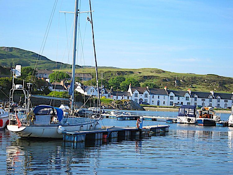
The first trip was to the Mull of Kintyre and the adjacent islands of Islay and Jura, which all lies between the Great Glen fault and the Highland Boundary fault. The second trip was to the Ayrshire coast, which is part of the Midlands Valley (Central Lowlands) terrain. These trips covered adjacent terrains, and enabled contrasts and comparisons to be made.
The Highland Boundary fault runs just south of the Mull of Kintyre. The basement for the whole of the Grampian terrain is the Rhinns complex – but it is only seen on the surface on Islay.
Typical “pink” gneiss of the Rhinns complex seen at Portnahavan.
(The scale is an A6 field notebook)
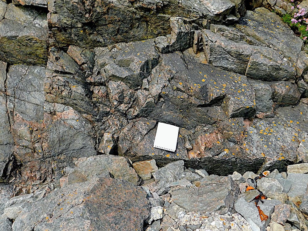
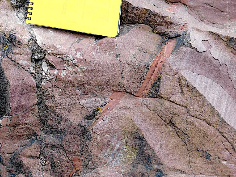
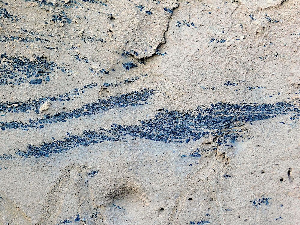
The commonest rocks on the surface are Dalradian schists which are seen from Islay in the west to Fraserborough on the east coast of Scotland. The degree of metamorphism is variable, but often low. This means that residual sedimentary features can be seen.
Dalradian schists at the side of Loch Caolisport. Original shale bed between two original sandstone beds.
(The scale is an A6 field notebook.)
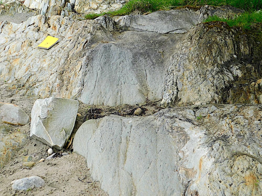
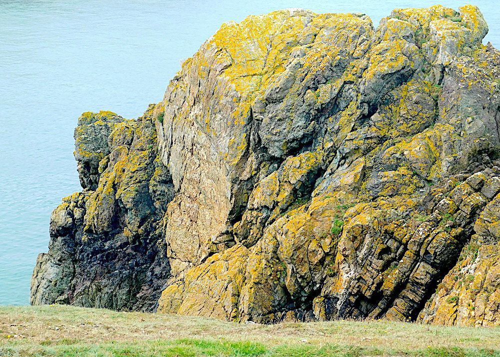
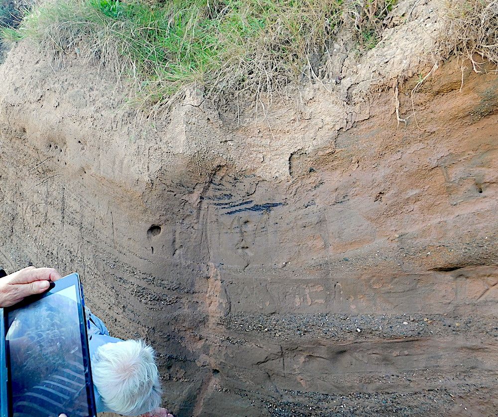
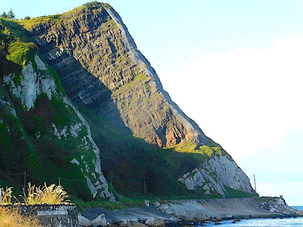
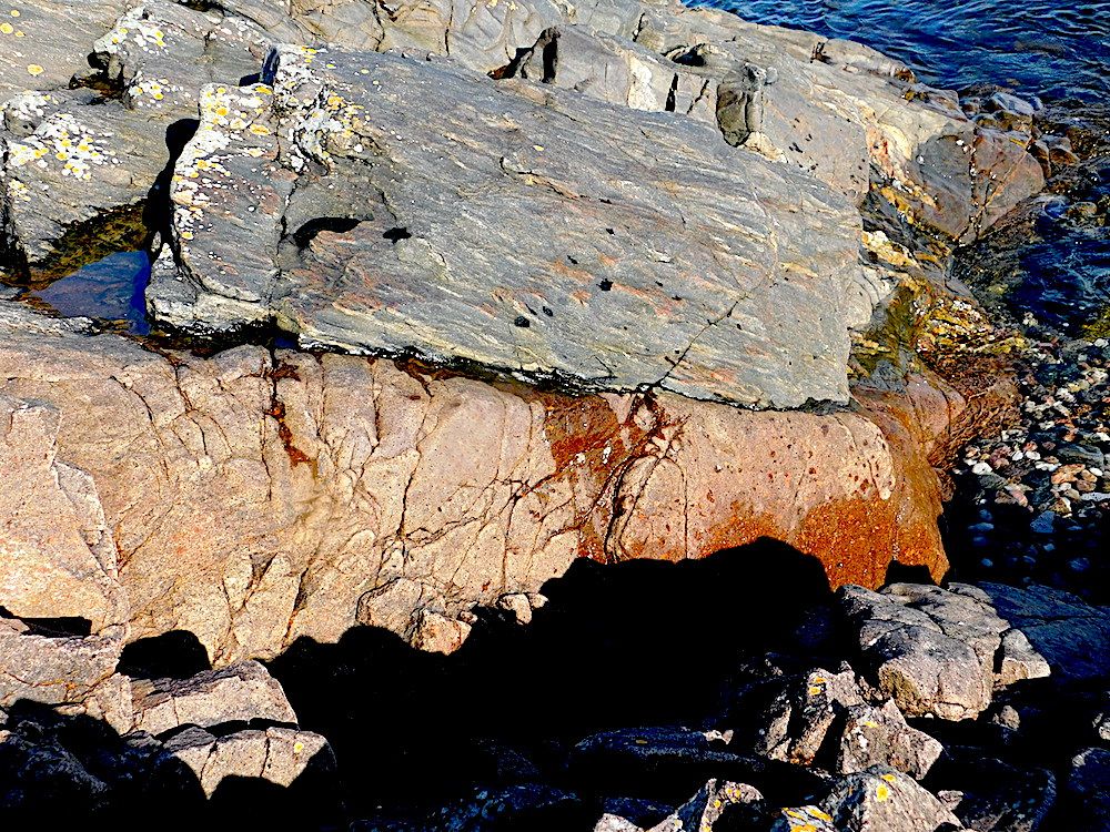
Kiel Point at the southern tip of the Mull of Kintyre is a localised resistant rock standing out from its surroundings. It is a volcanic agglomerate within a volcanic pipe. The matrix is volcanic ash, and the clasts are pieces of the original country rock. The volcano came up through an area of Devonian sandstones.
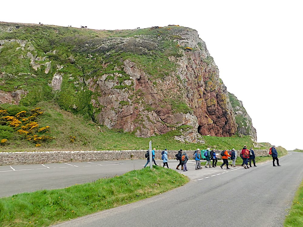
Kiel Point standing above the coast road
A closer view of the exposed rock face.
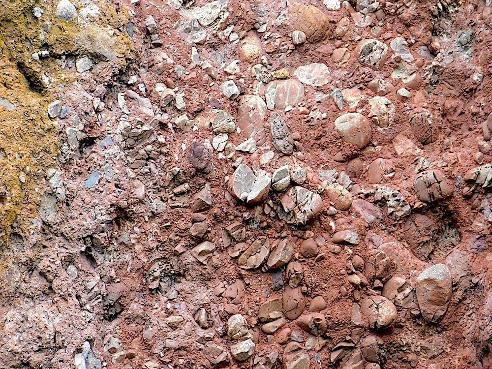
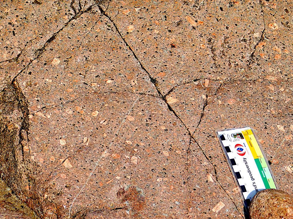
Devonian sandstones on the beach close to the plug show mechanical disruption. A micro-fault is visible.
(Scale is an A6 field notebook)
The Midlands Valley (Central Lowlands) is a rift valley which was mainly filled by a variety of sedimentary rocks, but also shows evidence of widespread volcanic activity.
The North Ayrshire region has a base of Old Red Sandstone rocks with some volcanics: basaltic lava flows and 2 sets of dykes, Tertiary and Permo-Triassic. Further south, there is an ophiolite complex at Ballantrae.
A lava flow on the Eastern bank of the Firth of Clyde just south of Hunterstone
Columnar jointing is evident on the exposed rock faces.
At the beach south of Largs.
There is a dyke on the right which has come through conglomerates.
Pillow lavas on a beach south of Ballantrae.
The lava is vesiculated.
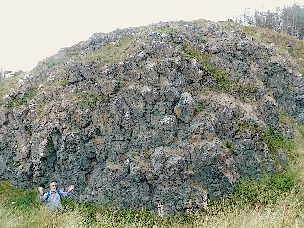
Ailsa Craig lies about 8 miles out from Girvan. We had a day trip there, landing and walking over the eastern side of the island, and then sailing right round. It is a Tertiary granitic inclusion, around 60Ma, formed at the time of the sudden opening of the Northern Atlantic Ocean. Similar intrusions are present on Arran and in Northern Ireland. It is an unusual intrusion because many of the cliffs show prominent pseudo-columnar jointing.These are not regular columnar joints and often only have three faces and are the result of the intersections of different joint faces.
Multiple doleritic dykes are also present.
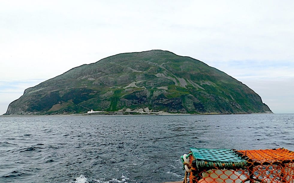
The eastern coast of Ailsa Craig where previous quarrying took place.
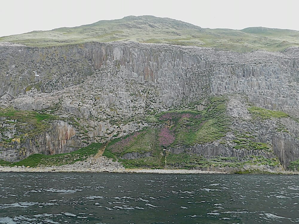
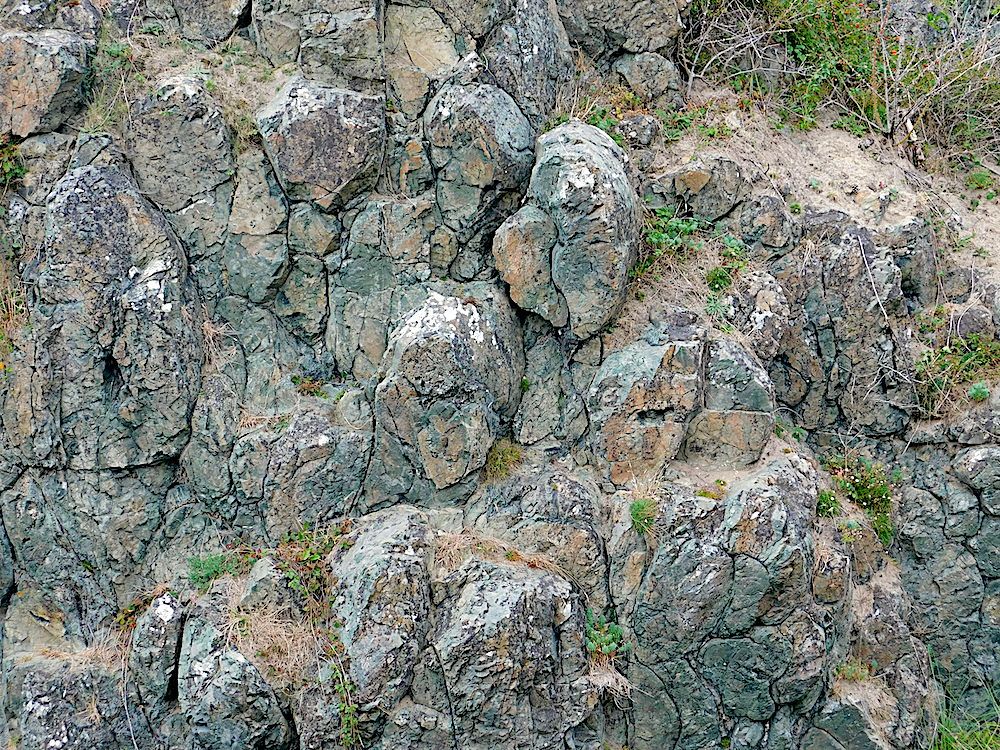
The western side of the island with tall sheer cliffs
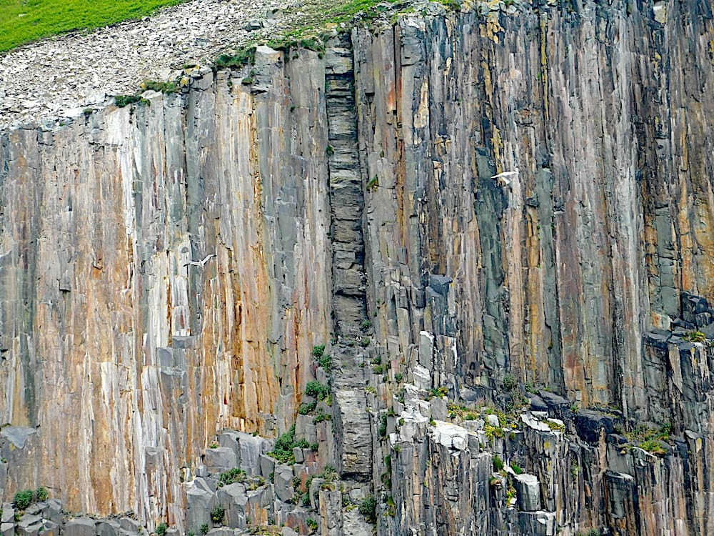
The vertical dyke in the centre is darker than the surrounding granite; and shows columnar jointing at right angles to the jointing seen in the rest of the cliff face.
Sunday 25th August 2024
The Geology of Islay and Jura
Talk by Geoff Steel, Wednesday 21st August 2024
Text and photos by Geoff Steel
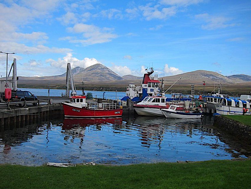
There is no greater contrast between two Scottish islands than Islay and Jura. Yet they are so close that they're nearly joined. Why so different? The answer is limestone. Islay has it and Jura does not. The fertile soil of Islay has always brought prosperity: towns, villages, woodland, farms and cattle grazing in fields. Jura is almost entirely made of quartzite. Nothing grows on quartzite. It's a vast empty wilderness of bogs, boulders and remote hills. The only road is the A846 which is a single track with grass in the middle.
Islay Loch Ballgrant
The rocks are of late Precambrian age and referred to as Dalradian. Most of the Dalradian strata were intensely folded and metamorphosed during the Ordovician which makes it difficult to reconstruct their original form. But in Islay and Jura, and also on the mainland coast opposite, the deformation was less severe. Reconstruction shows a series of listric (curved) normal faults. This was crustal extension and was the opening of the Iapatus Ocean.
Islay Port Ellen
Timing of the Dalradian is poorly constrained. Neither the base nor the top are clearly defined. However there is a prominent marker horizon which potentially allows correlation with other parts of the world. It is the Port Askaig Tillite. Arriving on Islay it's the first thing you see, at the back of the ferry terminal. The tillite is a glacial deposit with dropstones from floating ice set in a muddy matrix. It is from one of the three "Snowball Earth" events: Gaskiers (580Ma), Marinoan (635Ma) or Sturtian (720Ma). But which one? Most references say Marinoan so timing of the Dalradian has been estimated accordingly. But in 2006 a paper was published in Ireland (where the tillite is also visible) which suggested Sturtian. That's almost a hundred million years earlier. It would require a drastic revision of the timing.
Jura Loch Tarbert
On the subject of ice the recent glacial maximum has shaped the topography of both islands. On Jura the ice reached a thickness of 750m which would have left the tops of the mountains just clear. The ice was forced to flow around them and rejoin on the other sides. One of the joins, on Beinn an Oir, formed a medial moraine. It is an exact straight line of boulders more than two miles long, an astonishing feature, hard to believe it's not man-made. Melting of so much ice removed a great weight from the land. The resulting isostatic uplift has formed an impressive line of raised beaches along the west coasts of Islay and Jura.
Jura seen from Port Askaig
Finally, a few days before this talk, a paper was published about work on the Garvellach Islands just north of Jura. The Port Askaig Tillite is well exposed there. And the paper gives a date: 720Ma. If correct this would confirm the Irish paper. Watch this space!
Thursday 27th June 2024
Rob Crossley from GeoMôn gave this catchily-titled talk to Mid Wales Geology Club members in Newtown and elsewhere via Zoom on 19th June 2024. Rob started off by telling us of his international geological experience which started off with a PhD thesis in the East African Rift Valley. He then moved on to what we know about geological events in several other moons and planets of our solar system. Obviously we don’t know much, but we have seen evidence of lava flows and water channels which took place in the distant past. There does not, however, seem to be anything like the range of geological appearance we see here on Earth.
Rob moved on to the diversity of the geology within Ynys Môn, and how it had been captured on previous maps, starting with Williams Smith’s 1815 map. Then on to John Henslow’s map published in 1822, in which he managed a very detailed and accurate map after just one summer of exploration. Finally we had the Greenly’s map of 1919, which is virtually the same as current BGS maps. Edward Greenly introduced the term mélange to geology with his description of the Gwna mélange.
In the latter part of his talk, Rob illustrated the wide range of geodiversity within the island starting with the last Ice Age and then working back through various geological periods to the late Precambrian. At the end of the talk, the audience were happy to answer the question in the title with a resounding YES.
Part of the Gwna melange seen near the Wylfa nuclear power station. This exact location had been accurately sketched and annotated by John Henslow in 1821 with the large block of pale quartzite centre left and the dyke intruding near the bottom right.
The northern side of the Menai Straits at Lleiniog. The best example of a sub-glacial tunnel valley in the UK
A closer view of the above shows small fragments of coal trapped within the material.
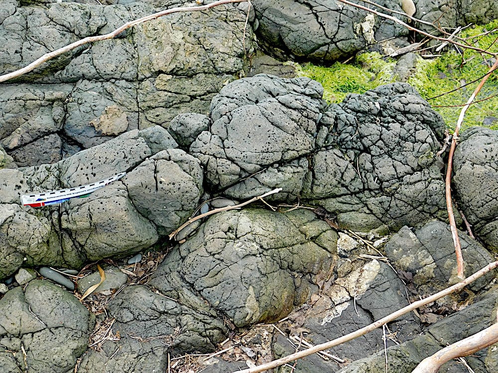
The following two photos depict pillow lavas on Llanddwyn Island. Speaker used for scale in first photo.
Closer view of the pillow lavas
Text and photos by Dr. Chris Simpson MWGC
Saturday 15th June 2024
The Geology of Oman by James Cresswell based on one of James’ tours.
James gave a really interesting talk about the fascinating geology to be found in Oman. The talk concentrated on the geology of the northern part of the country with the tour commencing at Muscat, travelling north to Sohar, then to Nizwa, on to Sharqiya Sands (Wahiba Sands), and then over to the coast at Sur before returning to Muscat.
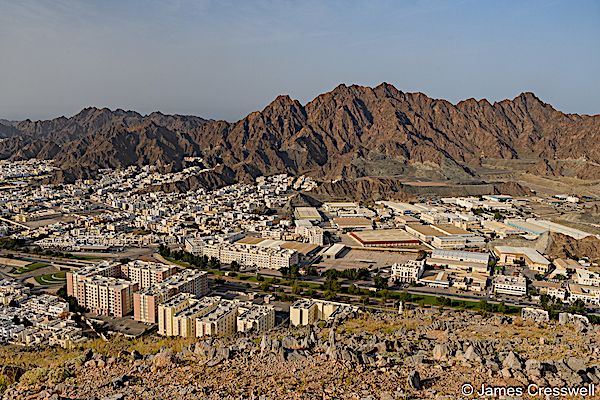
A view over the capital city of Muscat. In the background, the mountains are made of peridotite which was once part of the mantle, whilst the city sits on the Kabir Fault, which was once a former subduction zone.photo by James Cresswell
Oman sits on the north-eastern portion of the Arabian plate at the convergence zone between the Arabian and Eurasian plates. At this point the oceanic crust of the Oman Sea is subducting under the lithosphere of the Eurasian Plate.To the north the Arabian plate is rifting away from the African plate at a divergent margin.
The main focus of the geo-tour was the Semail Ophiolite which is the world’s largest and best preserved ophiolite. The ophiolite is a vast thrust sheet of Cretaceous ocean crust and upper mantle emplaced onto the Arabian continental margin during late Cretaceous times. It is 500km long 50-150km wide and 15 km thick. New findings suggest that it was formed above an active NE dipping subduction zone
James then went on to describe the structure of the ophiolite along with the locations at which the various components may be found.
- The metamorphic sole amphiboles beneath the Semail thrust plane that carries the entire ophiolite above.
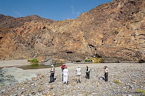
The rocks of the metamorphic sole were visited at Wadi Hawasina.The Metamorphic sole is suggested to have been formed as material moving down the subduction zone underwent metamorphism and finally being obducted onto the surface.The degree of metamorphism producing amphibolite and greenshist.
Beneath the metamorphic sole of the ophiolite is a series of thrust sheets (nappes) including the Haybi Complex comprising distal sedimentary and volcanic rocks, Late Triassic alkali basalt and limestone seamounts and mélanges. Below the Haybi Complex is the Hawasina complex, a series of 4–7 thrust sheets of basin to shelf slope sediments.
- The mantle sequence peridotites and the Moho Transition Zone with dark wehrlites and pale coloured gabbros intruding harzburgites.
These rocks including pale coloured dunites and brown harzburgites, can be found at Wadi al Abyad. Mantle,rock (peridotite) can be found at the base of a cliff with a clear line separating them from layered gabbros above. The clear line separating the two is the Moho ( boundary between the mantle and the earth’s crust). At Wadi Hawasina mantle peridotites of the Semail ophiolite may also be found along with heavily folded marine sediments of the Hawasina nappe. Peridotites of the Semail Ophiolite may also be found around Muscat.
The Moho at Wadi al Abyad. This is the best place in the world to see the Moho (The Mohorovičić discontinuity) – the boundary between the earth’s crust and mantle.Photo by James Cresswell
-
Layered lower crustal gabbros inter-banded with dark coloured mantle peridotites could be seen at Wadi al Abyad. The layering is due to differential crystallisation in the magma chamber
-
At Sohar sheeted dykes which form part of the classic ophiolite sequence can be seen. The complex consists of swarms of basaltic dykes which are the feeder dykes for the overlying pillow basalts.
Also at Sohar there is a fossilised Black Smoker that formed on the ocean floor as part of the ophiolite complex. This was a vent for superheated water loaded with dissolved sulphides and a high concentration of copper, zinc and manganese. This is a now a large ore body that is likely to be exploited. It is actually placed within the Geotimes Unit but is partially covered by the Tholeiitic Unit. Close to this site is another site known as the Umber sediments which are rich in iron and manganese and were formed in association with the Black Smoker. The metal enrichment is due to precipitants from the Black Smoker settling on the mud of the ocean floor. They are un-metamorphosed and cover the pillow basalts of the ophiolite.
At a second site close to Al Ghizayn is a fossilised White Smoker. Similar to the Black Smoker but has much lower temperatures and therefore less metal enrichment but contains lots of opaline silicate.
-
The Geotimes unit lower V1 pillow lavas at Wadi Jizzi are considered to be the best outcrop of this kind in the world.The basalts were erupted onto the seabed and formed the pillow structures as they were cooled by the surrounding sea water. They are fed by dykes rising from the sheeted dyke complex. The pillows have a glassy outer skin ( basaltic glass). These particular pillow basalts are elongate in shape suggesting they were oozing outwards and downwards onto a slope and have a diameter of 0.5-1m.
Geochemical analysis of immobile trace elements like titanium have shown that volcanics found in hotspots are geochemically very distinct from those erupted at mid-ocean ridges and both of these are very distinct from andesitic lavas found in island arcs. Using this technique it was shown that the lavas of the Semail ophiolite were erupted in two different phases. The Geotimes unit was erupted at a spreading ridge but the later lavas included a rock known as boninite which is always found above subduction zones. Therefore it is suggested that to begin with the Geotimes basalt would have formed due to spreading but as subduction proceeded and increased in depth the chemistry of the melt changed producing the different lavas as seen. These other lavas have been mapped as the Tholeiitic Alley and Boninitic Alley Pillow lavas.
The tour not only focused on the ophiolite but explored many other aspects of the wonderful geology present. One of these sites, near Sur,is named "The Mother of all Outcrops”. Here, folded and faulted, red radiolarian chert is interbedded with white porcellanite ( an impure chert containing clay and carbonates). These sediments were deposited in water 4,000-4,500 metres deep, and were thrust onto Arabia as part of the Batain Nappe (along with Oman’s other ophiolite, the Masirah Ophiolite), 15-20 ma after the emplacement of the main Semail Ophiolite.
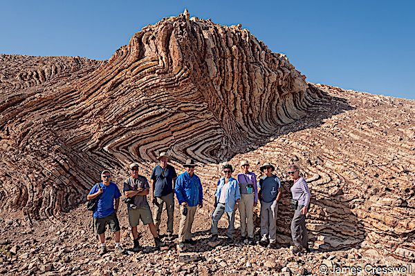
The GeoWorld Travel group at the so-called ‘Mother of All Outcrops’ which are tightly-folded, alternating layers of radiolarian chert and porcellanite. These were folded with the obduction of Oman’s other ophiolite, the Masirah Ophiolite. photo by James Cresswell
Another site near to Sur is of Precambrian crystalline basement (800-1,000 million years old). Here there are granites that formed as terranes, were accreted together and then cut by huge gabbro dykes that were intruded as the basement went through a later period of extension. All these rocks are themselves intruded by granitic pegmatite dykes
Another fascinating geological structure is the Wadi al Mayh mega sheath fold. It is the best exposed sheath fold in the world and is 15km long. The rocks record progressive burial and exhumation of the thinned and stretched leading margin of the Arabian continental crust down a subduction zone to depths of up to 80-100km.
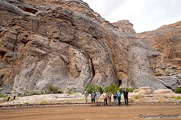
A large isoclinal fold, Part of the mega sheath fold at Wadi al Mayh photo by James Cresswell
In addition to all the above, the tour covered areas related to periods of “Snowball Earth” at Wadi Haslan; a viewpoint of Jebel Shams, Oman’s highest peak (3,028m) and of Wadi al Nakhr, which is also known as the “Grand Canyon of Arabia” and a visit to Wadi Shab, a magnificent canyon cut into Eocene limestone, which is considered by many to be Oman’s most beautiful Wadi. There were also some archaeological sites that the tour visited for example south eastern Arabia's most important Neolithic rock engravings, at Hasat Bin Salt also known as Coleman’s Rock and “The Aflaj Irrigation System of Oman”. This irrigation system is up to 4,500 years old and is seen as one of the driving forces behind the formation of Oman as a nation as it provided the reason for nomadic societies to settle down. Both of these are World heritage sites.
This was a super talk about a country with fascinating geology.
If you would like to know about James Creswell’s tours his website is as follows:
[http://www.geoworldtravel.com]
If you would like to know more about the geology of Oman then the following book will be of interest:
Field Guide to the Geology of Northeastern Oman edited by Gosta Hoffman, Martin Meschede, Anne Zack and Mohammed Al Kindi. ISBN:978-3-443-15099-0
Wednesday 24th April 2024
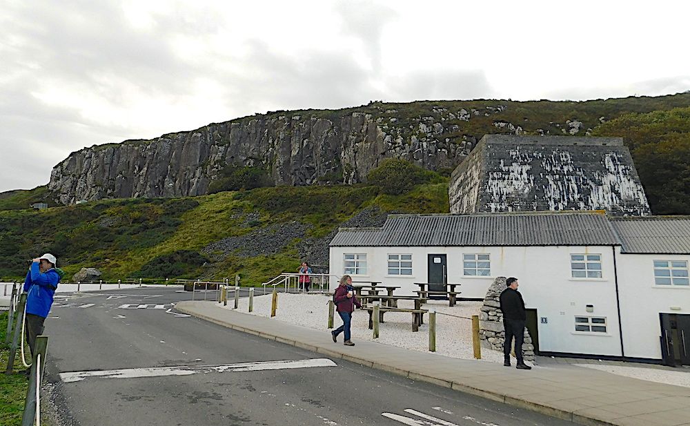
The club was treated to a detailed summary of what Northern Ireland has to offer to anyone with even a passing interest in geology by karen Parks Geology Teacher at Methodist College Belfast. Karen imagined a visitor arriving in Belfast and their journey round the Antrim coast ending up in Port Rush, and showed us the wide variety of interesting sites they would pass through.
Several of the terrains and major fault systems in Scotland carry on over the Irish Sea and re-emerge in Northern Ireland. These rocks that are known to those of us familiar with UK mainland geology are supplemented by large areas of volcanic rocks forming part of the North Atlantic Igneous Province and the fascinating NE Antrim inlier – a block of Carboniferous age rocks uplifted to the level of the lower tertiary basalt. The Iapetus suture, which marks the site of closure of the previous Iapetus Ocean, traverses the island of Ireland.
Karen showed us the website of the Geological Survey of Northern Ireland, which includes an interactive geological map where details of bedrock geology anywhere in Northern Ireland can be viewed at the click of a mouse.
https://mapapps2.bgs.ac.uk/gsni_geoindex/home.html
The following pictures are examples of the geology shown to us by Karen.
Just North of Carnlough. A characteristic example of a rotational slide. The chalk is lying on lias clay. Water can penetrate the clay and lead to it becoming, in effect, a lubricant to allow the overlying chalk and basalt to slump down with rotation.
Cushendall. Dalradian schists, circa 550Ma, at the top with cross-cutting Devonian dykes composed of microgranite, circa 390Ma underneath. The microgranite may be seen in the image below
close-up of the microgranite
The town of Ballycastle is built on the Antrim lava plateau
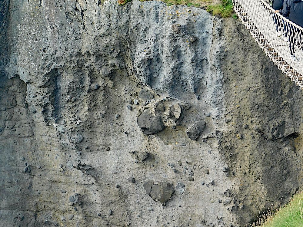
Carrick-a-Rede volcano – reached by a rope bridge walkway. The photo shows a close-up view of the vent material, including large volcanic bombs (the bridge at top right gives the scale).
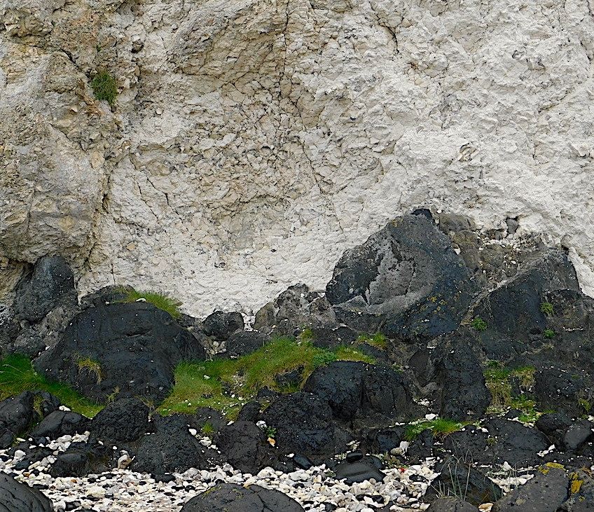
Smaller vents further along the coast. Here the dark volcanic material is coming up through chalk. Note the brecciated appearance of the chalk.
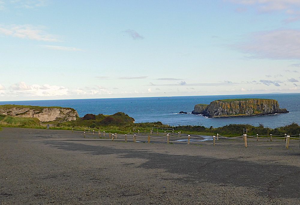
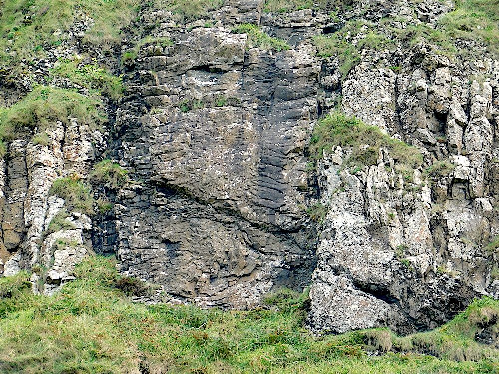
A small offshore island which is part of a basalt lava flow which passed over the chalk visible at the left. The vertical columnar jointing is clear in the closer view of the photo below.
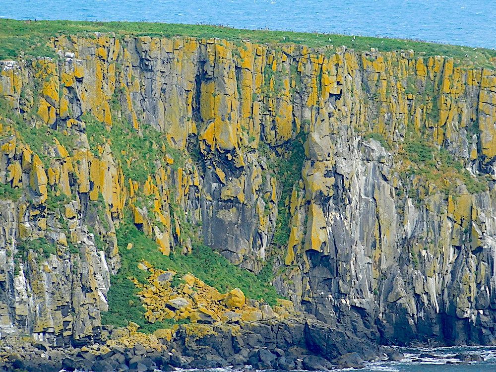
The same lava flow as seen in the Antrim coast south of the island
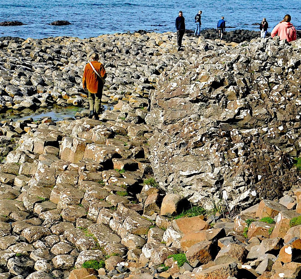
The Giants Causeway. It is not all regular hexagons! Look at the irregular mass of cooled basalt on the right of this photo. The site is extensive, and requires several hours to do it justice.
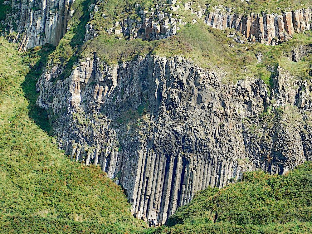
There were multiple layers of basalt lava – at least 8. Some cooled slowly and show excellent columnar jointing as in the organ pipes seen in the centre. The lava flow above is much more irregular, indicating more rapid cooling.
If you look carefully, you will notice several dykes cross-cutting the basalt lava flows. The horizontal columnar jointing and darker colour show the true nature of this dyke – but they are easily missed!
A Wonderful tour of Northern Island geology.
Text and photos by Dr. Chris Simpson MWGC