Study of Church Stretton Fault near Gladestry. by Dr. Geoff Steele
Study of Church Stretton Fault near Gladestry. by Dr. Geoff Steele
At the last meeting Dr. Geoff Steele gave a very insightful talk on events along the Church Stretton Fault and the Welsh Borderland Fault System (WBFS).
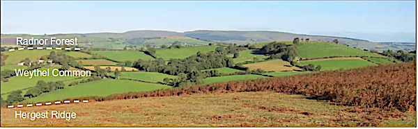
His study began with a question which was posed to him whilst on a geology field trip. The question asked “ why is Weythel Common a ridge when it consists of Raglan Marl whilst the other areas of Raglan Marl in the area form lowland?” This was in 2017 and led to Geoff studying the area in detail during his spare time. Weythel Common lies about 7km West of Kington,( grid reference OS235565.)
He presented his findings to us in this talk.
WBFS comprises the Tywi Lineament, the Pontesford Lineament and the Church Stretton Fault and forms the terrane boundary between the Cymru Terrane to the north west and the Wrekin Terrane to the south east. Various tectonic events have led to movements along the WBFS. One of these occurred during the late Ordovician in which the movement was dextral strike-slip. During the Silurian the movement was extensional as a normal fault with downthrow on the Welsh side. During the Devonian faults were reactivated as reverse faults and movement was sinestral strike-slip.
His fieldwork utilised three geology maps: one inch to 10 miles (1979); 1:50000 (2004); 1:250000 (1994). The section covering Weythel common on the latter map was scaled to the equivalent of the 1:50000 map from which differences in the mapped structure of the faults could be seen.
East side of Weythel Common
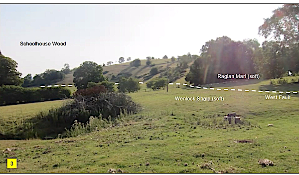
Line of east fault
Geoff went on to show that the Church Stretton Fault in the area under study has a break in it and showed that if a fault is not straight then a strike-slip movement producing transpression would lead to uplift of the strata in a “palm” structure whereas transtension would lead to basin formation “flower” structure. Therefore the structural hypothesis for this study was as follows: “if dextral strike-slip movements produce a transpressional high then sinestral strike -slip movements should produce a transtensional basin”
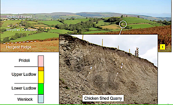
So Geoff underwent a detailed study of the area around Weythel Common. He looked at the stratigraphy, using easy to observe quarries and measured dip and strike of the area’s rocks. Using photography and field walking he could determine the line of the fault and also the pattern of some of the rocks just below the surface. The weather helped greatly in this latter endeavour, with snow melt indicating the trend of the fault and very dry and parched fields showing the underlying vertically orientated sandstones.
West side of Weythel Common
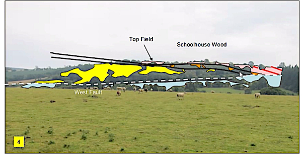
Line of west fault
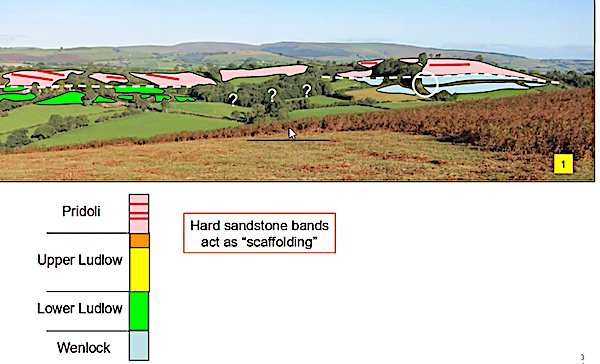
From his findings Geoff was able to put together his own geological map of the area. His conclusions are as follows:
Weythel Common is a “tulip within a palm”
It is a hill because:
- Hard sandstone bands form a scaffold
- The surrounding Wenlock shale is more crumbly than the Raglan marl
It’s structure is an asymmetrical anticline and may be thrust faulted
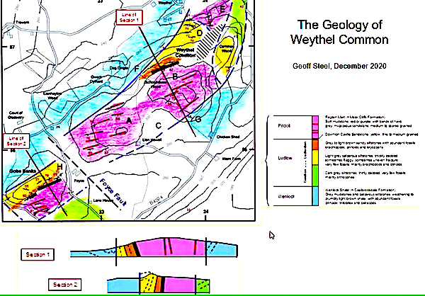
Geoff's final map from the fieldwork