Northern Ireland – Travel through geological time to see a range of fieldwork sites with wonderful geodiversity by Karen Parks (Northern Ireland)
The club was treated to a detailed summary of what Northern Ireland has to offer to anyone with even a passing interest in geology by karen Parks Geology Teacher at Methodist College Belfast. Karen imagined a visitor arriving in Belfast and their journey round the Antrim coast ending up in Port Rush, and showed us the wide variety of interesting sites they would pass through.
Several of the terrains and major fault systems in Scotland carry on over the Irish Sea and re-emerge in Northern Ireland. These rocks that are known to those of us familiar with UK mainland geology are supplemented by large areas of volcanic rocks forming part of the North Atlantic Igneous Province and the fascinating NE Antrim inlier – a block of Carboniferous age rocks uplifted to the level of the lower tertiary basalt. The Iapetus suture, which marks the site of closure of the previous Iapetus Ocean, traverses the island of Ireland.
Karen showed us the website of the Geological Survey of Northern Ireland, which includes an interactive geological map where details of bedrock geology anywhere in Northern Ireland can be viewed at the click of a mouse.
https://mapapps2.bgs.ac.uk/gsni_geoindex/home.html
The following pictures are examples of the geology shown to us by Karen.
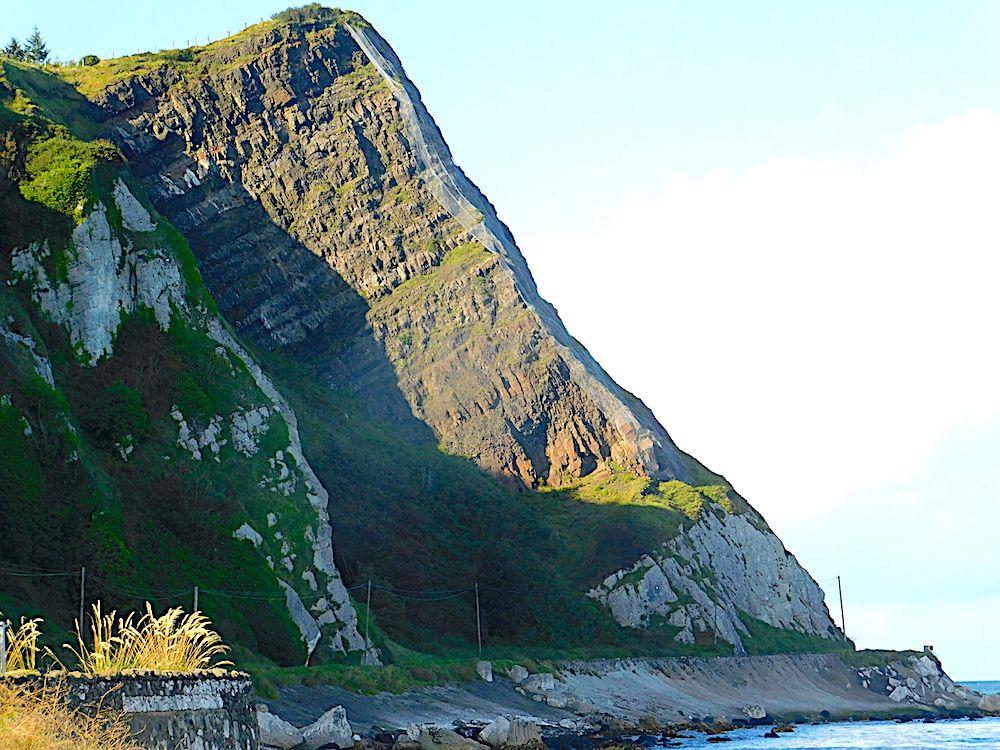
Just North of Carnlough. A characteristic example of a rotational slide. The chalk is lying on lias clay. Water can penetrate the clay and lead to it becoming, in effect, a lubricant to allow the overlying chalk and basalt to slump down with rotation.
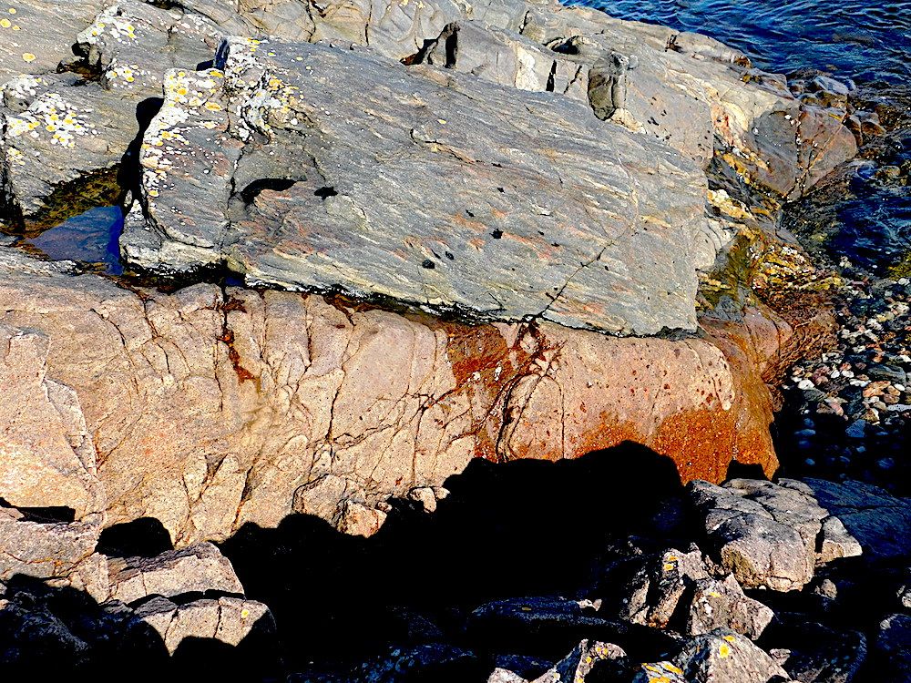
Cushendall. Dalradian schists, circa 550Ma, at the top with cross-cutting Devonian dykes composed of microgranite, circa 390Ma underneath. The microgranite may be seen in the image below
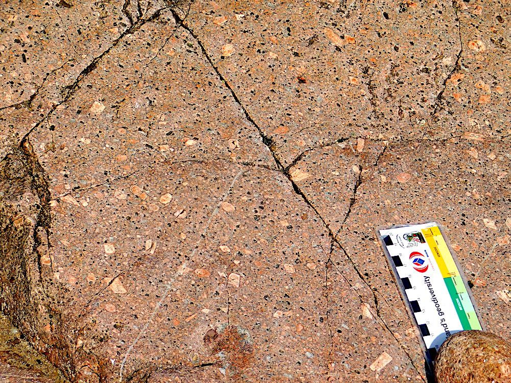
close-up of the microgranite
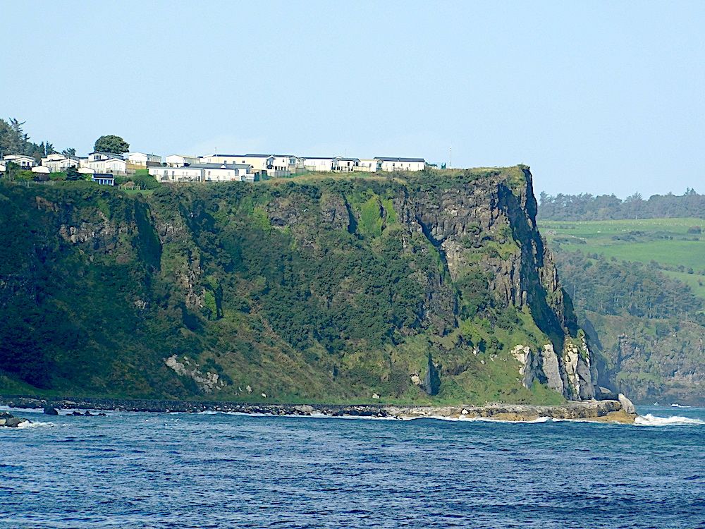
The town of Ballycastle is built on the Antrim lava plateau
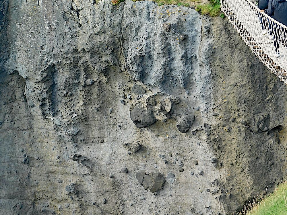
Carrick-a-Rede volcano – reached by a rope bridge walkway. The photo shows a close-up view of the vent material, including large volcanic bombs (the bridge at top right gives the scale).
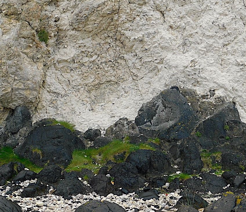
Smaller vents further along the coast. Here the dark volcanic material is coming up through chalk. Note the brecciated appearance of the chalk.
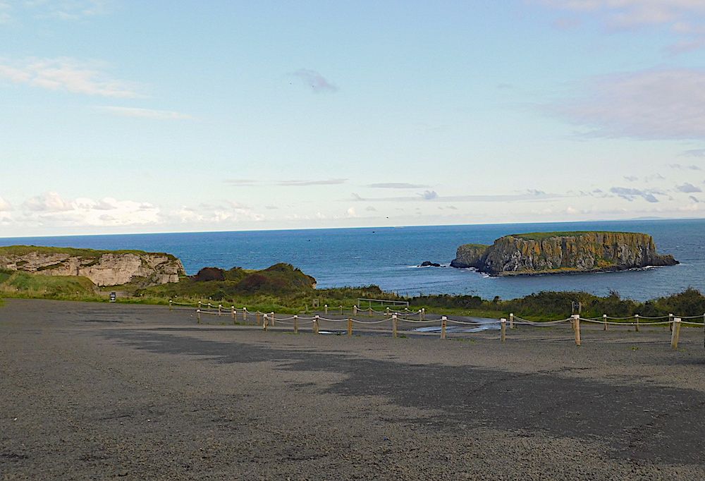
A small offshore island which is part of a basalt lava flow which passed over the chalk visible at the left. The vertical columnar jointing is clear in the closer view of the photo below.
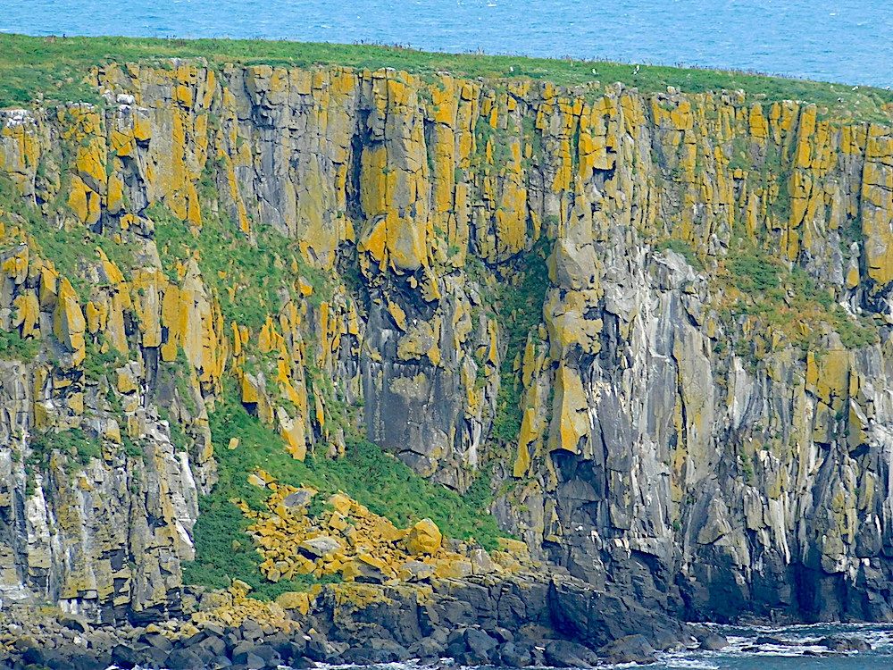
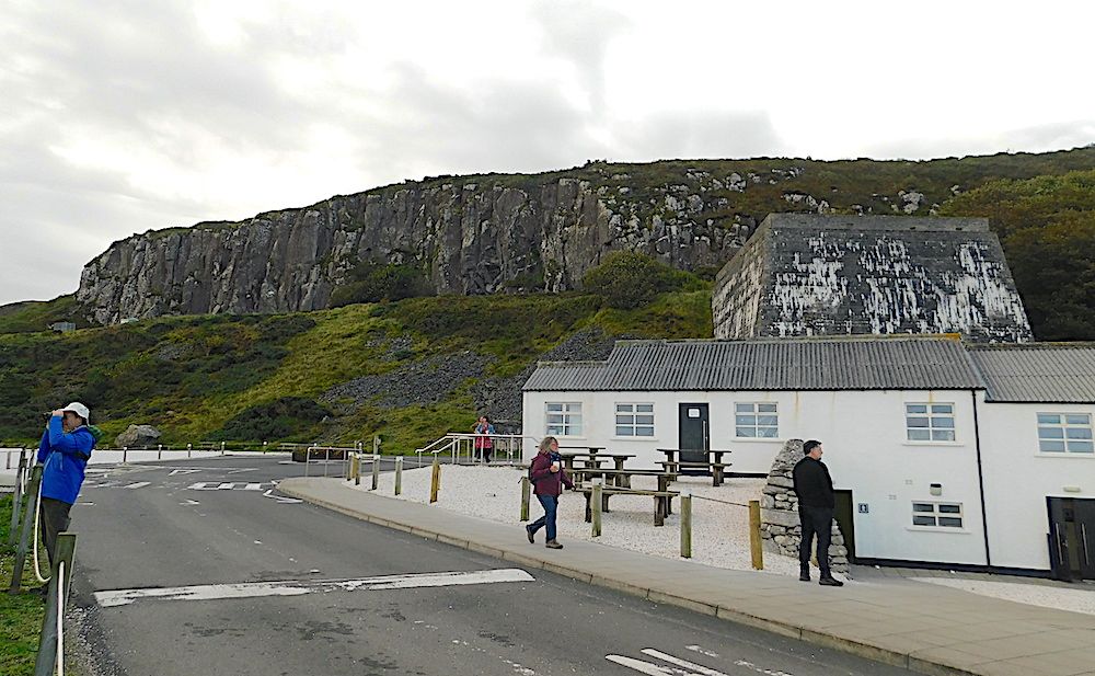
The same lava flow as seen in the Antrim coast south of the island
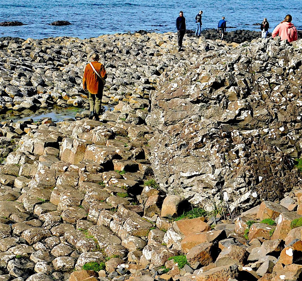
The Giants Causeway. It is not all regular hexagons! Look at the irregular mass of cooled basalt on the right of this photo. The site is extensive, and requires several hours to do it justice.
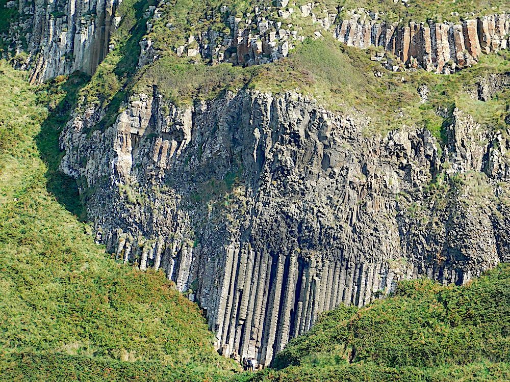
There were multiple layers of basalt lava – at least 8. Some cooled slowly and show excellent columnar jointing as in the organ pipes seen in the centre. The lava flow above is much more irregular, indicating more rapid cooling.
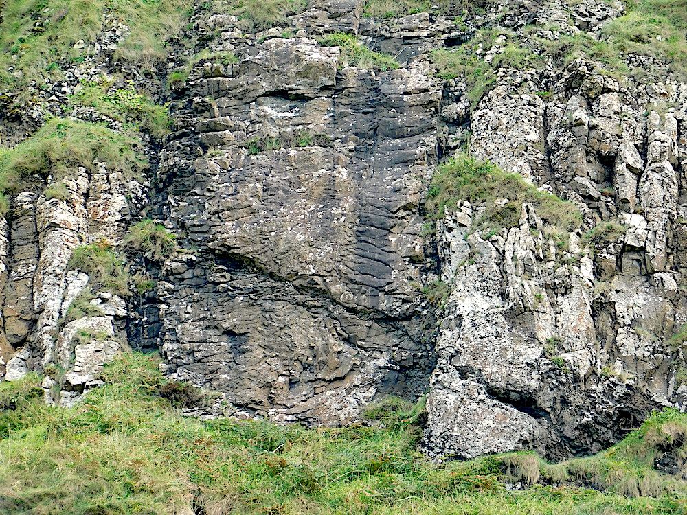
If you look carefully, you will notice several dykes cross-cutting the basalt lava flows. The horizontal columnar jointing and darker colour show the true nature of this dyke – but they are easily missed!
A Wonderful tour of Northern Island geology.
Text and photos by Dr. Chris Simpson MWGC
