Geology of the Canary Islands
The last talk which was given by Chris Darmon was on the geology of the Canary Islands. Chris has led and will be leading further field trips to the Islands. More can be found about his field excursions at https://www.geosupplies.co.uk/geological-supplies-company.php
The Canary Islands are a group of seven main volcanic Islands located off the north-west coast of Africa trending in a south-west to north-east direction. They are located on ancient oceanic crust of the African plate and are a good example of intra-plate volcanism. The ages of the islands varies between the youngest El Hierro at 1.12Ma in the south west to Fuerteventura at 20.6Ma in the north east. It has been suggested that like the volcanism in Hawaii the islands have been produced by the presence of a volcanic plume over which the African plate moves in a direction from west to east although other ideas have been put forward and the topic is controversial.
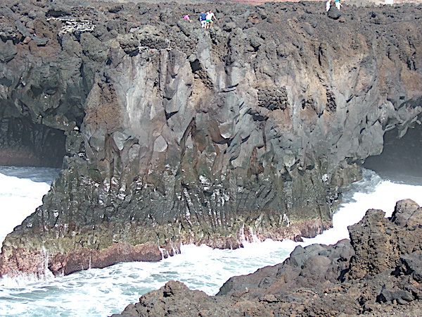
Lava flow Lanzarote with columnar jointing by Chris Simpson MWGC
The canary Islands form what is known as the Canary Volcanic Province but this is not the only area on the African plate that is volcanic as the area around Madera is also volcanic and known as the Madeira Volcanic Province and volcanism is also around Cape Verde islands. ( Cape Verde Volcanic Province) But all of these are linked to a much larger area of seamounts and these cover an area that is approx 1300 km long and 350 km wide which is known as the Canary Islands Seamount Province. The sea mounts vary in age with the oldest in the region of 142Ma.
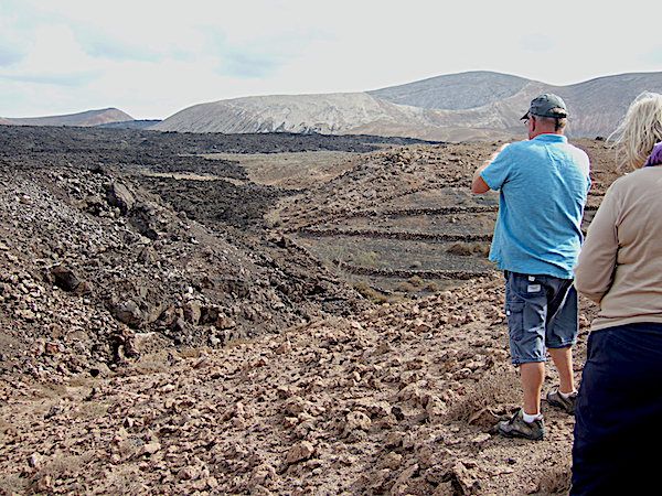
Aa Lava flow Lanzarote by Chris Simpson MWGC
The Canary Islands similar to the Hawaiian Islands, show different stages in their development over time. Firstly there is the submarine stage, followed by shield-building, declining, erosive and rejuvenation stages. The stages commence with the submarine seamount stage which contain submarine sediments and for example, alkali basalt pillow lavas and dyke swarms. This is followed by the emergent stage i.e. the stage at which the volcano is at the surface. It then begins to develop into a large shield volcano characterised by subaerial alkaline basalt and trachybasalt lava flows. As the volcano begins to decline then rocks like phonolite begin to appear. This stage is followed by erosion. Here there is little or no volcanic activity and there is vast erosional removal of previous lavas and ashes. Finally there is rejuvenation with minor volcanic activity and the formation of rocks such as nephelinites. Thus these structures need at least 10-15 million years to go through the various stages.
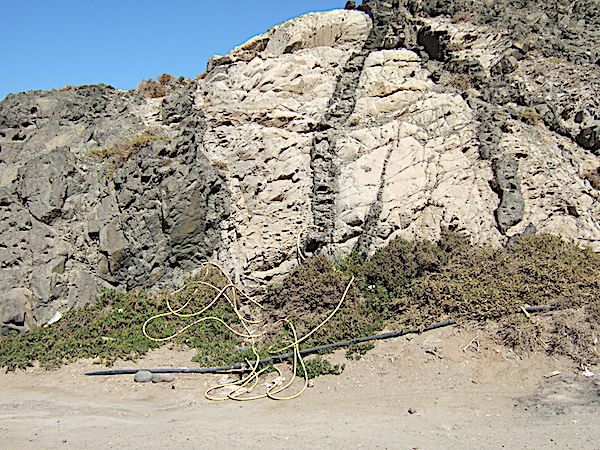
Multiple balsaltic dykes Fuerteventura by Chris Simpson MWGC
So what are the arguments for the formation of these islands. Firstly the idea that there is a large mantle plume over which the African plate moves but there are many arguments against this idea. Another suggestion is that they are related to a propagating fracture associated with the Atlas tectonic chain. Objection to this hypothesis is that there is no evidence of continuous faults connecting the two areas.
A third idea put forward by Paul van de Bogaard in 2013 is as follows: "shallow mantle upwelling beneath the Atlantic Ocean basin off the NW African continental lithosphere flanks produced recurrent melting anomalies and seamounts from the Late Jurassic to Recent, nominating the Canary Island Seamount Province as oldest hotspot track in the Atlantic Ocean and most long-lived preserved on earth.” (van den Bogaard, P. The origin of the Canary Island Seamount Province - New ages of old seamounts. Sci Rep 3, 2107 (2013). https://doi.org/10.1038/srep02107)
The geology of these islands appears to be complex with much more research necessary to understand their geology.