Coming out of the Ice Age - by Tony Thorp
Coming out of the Ice Age - by Tony Thorp
On Wednesday 17th May, At Plas Dolerw, Tony Thorp gave a talk on "Coming out of the Ice Age".
The talk focussed, not on the Ice Age as such, but on what is most visible now and on what we see still happening round us in our local area.
Rather than the image we were all taught at school of Alpine glaciers, "U" shaped valleys, hanging valleys and terminal moraines, we see more the residue from a waning, melting ice sheet depositing its load of dirty mud and rocky bits (very aptly described by the outdated term "boulder clay") on the existing rock terrain. Other than on hilltops, marshy bog must have been universal in the periglacial landscape. Its extent is well shown in the BGS "Solid and Drift" or "Bedrock and Superficial" series of geological maps by the pale blue "till" colouration. Tony took us to a few of his favourite neighbouring locations.
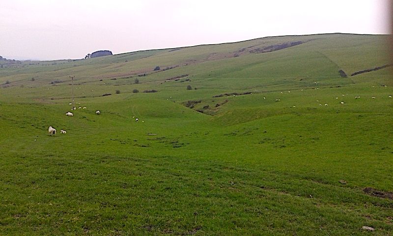
Crychell Moor
The first location was Crychell Moor, a broad flattish valley 2km west of Llananno, just off the A483, best viewed from the trig point on Ysgwd-ffordd, on a section of Glyndwr's Way. The floor of the moor is carpeted by a number of "ramparted depressions" outlined by rushes (Figs Palsa 1, 2). There has been some debate about whether these are relics of pingos or palsas. Pingos are ice-cored conical hills found in permafrost areas, whereas palsas are rather smaller scale freeze-thaw periglacial structures comprising peat and ice mounds which grow from a mire and eventually collapse, to be succeded by new ones and often developing into complex curvilinear patterns, very evident in Palsa 1. In Palsa 2 the grass and rushes had been cut, leaving the peaty boggy depressions proud. In some conditions the periglacial feature 'patterned ground' is visible through the turf near the trig point.
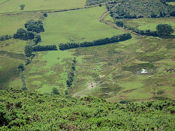
Palsa 1 by Tony Thorp
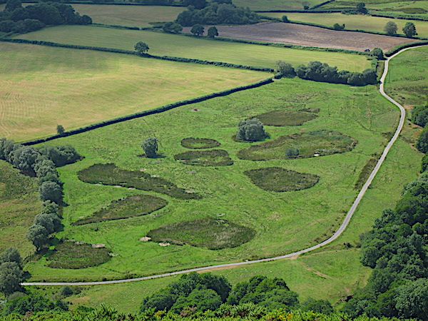
Palsa 2 by Tony Thorp
His own personal landslip!
As ice wanes and massive amounts of wet "Boulder clay" are deposited on the solid topography, which will often have been oversteepened by ice action, landslipping is endemic and very often it is still mobile today. Tony showed pictures of his own landslip which is still moving downhill towards the brook at the bottom. The narrow ridge at the top is all boulder clay (As evidenced by a series of bores made for recently planted telegraph poles.) and the top scar is the steep drop below the hedge. Below is a series of terracettes. At its toe the clay is quite plastic and discharges into the brook just below the trees he planted to try to stabilise it. Fenceposts keep moving downhill!
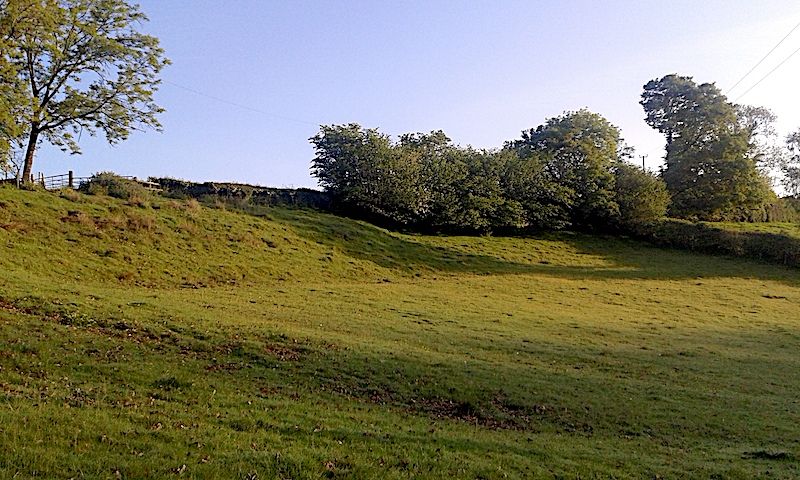
Scar of landslip by Tony Thorp
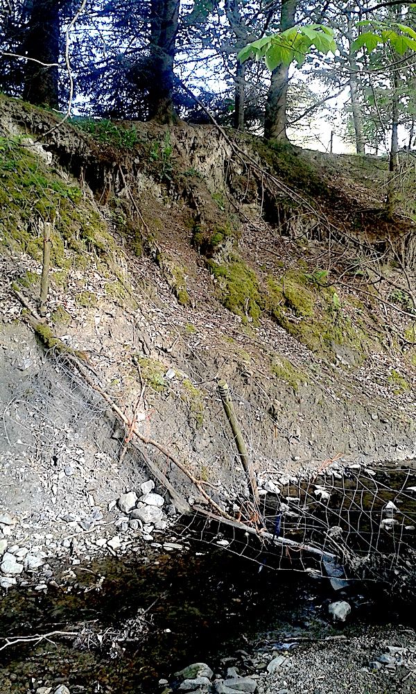
Toe of landslip by Tony Thorp
Elsewhere, the valley is a steep "V" shaped gorge, cut into the bedrock by rock-bearing meltwaters as the ice melted. Most times it is a quietly babbling brook, but every few years, after snowmelt, it can be as noisy as a jet engine and will move large boulders!
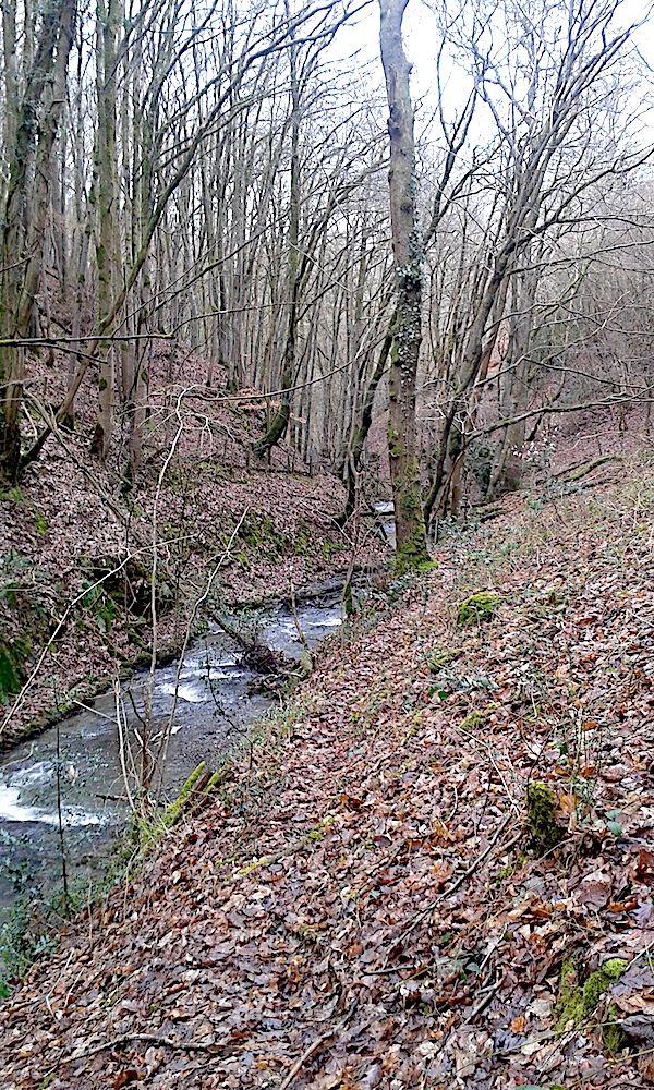
V-shaped valley by Tony Thorp
Severn Valley
The Severn Valley was the course of a significant ice stream moving faster than the rest of the cap in a northwesterly direction. It left a train of drumlins and glacially streamlined bedrock features along its length, very evident in the BRITICE Glacial Mapping Project V.2 (2017) (Ref 1). A significant drumlin, Trehafren Hill, is in Newtown and has a large landslip on its north side and a smaller one on the south. Such slips are a common feature and when Newtown was being developed in the 60s and 70s were the reason for the Development Board commissioning the BGS to produce a special six inch to the mile geological map. Sue Cain's 3D model based on that map shows them clearly and was examined by attendees in person at Plas Dolerw.
Black Gate
Black Gate is an interesting point along the Knighton road some two km out of Dolfor. It is within a stone's throw of the source of three rivers, the Mule which joins the Severn at Abermule, the Ithon which flows south to Llandrindod alongside the A483 and also the Teme, sourced less than a km southeast and flowing to Knighton and Ludlow. The amount of boulder clay in the Mule valley shows that the col between it and the Ithon was well covered by ice during peak glacial times and must have had a complex history in the multiple advances and retreats as the ice waned. As levels one side or the other may have been higher, meltwater would have flowed in either direction. This has left a complicated pattern of meltwater channels just north of the road.
Black Gate the view from the road looking northeast to the Mule valley with meltwater channels in the foreground and hints of lateral moraine in distance on the far side of the valley.
Sarn
Sarn lies in a fertile flat bottomed valley running east through Kerry from Newtown. It is floored by shaley rocks with more resistant Bailey Hill Fm rocks forming the high ground north and south. During the last glacial it was home to a significant ice stream which, as it retreated, dumped a lot of morainic clays and gravels near Sarn. This obstructed the original river Mule forcing it to find a way north through the gorge near Abermule before joining the Severn. Its lower stretches remain as the now smaller Caebitra continuing on its former course to Churchstoke where another river diversion took place forcing it to go north, joining the Camlad and joining the Severn.
The valley is also home to a drumlin swarm just south of Bacheldre. This is more subdued than those in the Severn valley where they have been augmented by the grain of the rocks and the speed of the ice stream.
Drumlin by Tony Thorp
Tony ended with a small sad sequence showing the (probable) demise of a kettle hole on the Severn outwash plain near Shrewsbury as it was demolished by a 5 furrow plough! Never mind, perhaps the peat, the wet and the roots of rushes will re-establish!
Ref1 The BRITICE Glacial Mapping Project: version two (2017) accessible at:
https://shefuni.maps.arcgis.com/apps/webappviewer/index.html?id=fd78b03a74bb477c906c5d4e0ba9abaf