A Geology trip across two Scottish Terranes by Dr Chris Simpson
The talk covered two field trips run by Chris Darmon at Geo Supplies in Sheffield. (Text and photos by Chris Simpson)
The first trip was to the Mull of Kintyre and the adjacent islands of Islay and Jura, which all lies between the Great Glen fault and the Highland Boundary fault. The second trip was to the Ayrshire coast, which is part of the Midlands Valley (Central Lowlands) terrain. These trips covered adjacent terrains, and enabled contrasts and comparisons to be made.
The Highland Boundary fault runs just south of the Mull of Kintyre. The basement for the whole of the Grampian terrain is the Rhinns complex – but it is only seen on the surface on Islay.
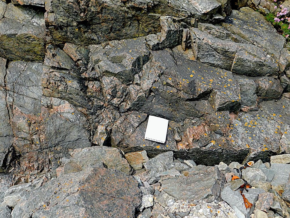
Typical “pink” gneiss of the Rhinns complex seen at Portnahavan.
(The scale is an A6 field notebook)
The commonest rocks on the surface are Dalradian schists which are seen from Islay in the west to Fraserborough on the east coast of Scotland. The degree of metamorphism is variable, but often low. This means that residual sedimentary features can be seen.
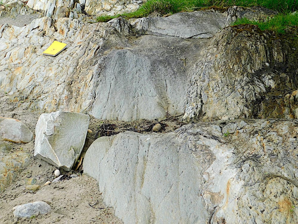
Dalradian schists at the side of Loch Caolisport. Original shale bed between two original sandstone beds.
(The scale is an A6 field notebook.)
Kiel Point at the southern tip of the Mull of Kintyre is a localised resistant rock standing out from its surroundings. It is a volcanic agglomerate within a volcanic pipe. The matrix is volcanic ash, and the clasts are pieces of the original country rock. The volcano came up through an area of Devonian sandstones.
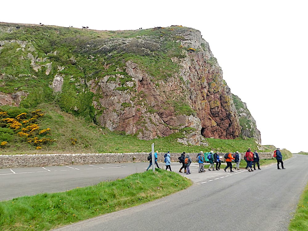
Kiel Point standing above the coast road
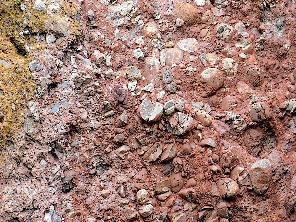
A closer view of the exposed rock face.
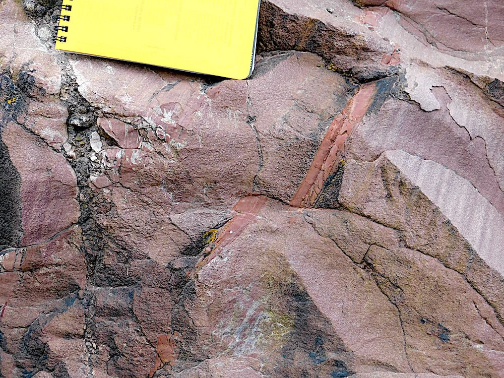
Devonian sandstones on the beach close to the plug show mechanical disruption. A micro-fault is visible.
(Scale is an A6 field notebook)
The Midlands Valley (Central Lowlands) is a rift valley which was mainly filled by a variety of sedimentary rocks, but also shows evidence of widespread volcanic activity.
The North Ayrshire region has a base of Old Red Sandstone rocks with some volcanics: basaltic lava flows and 2 sets of dykes, Tertiary and Permo-Triassic. Further south, there is an ophiolite complex at Ballantrae.
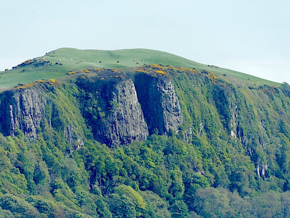
A lava flow on the Eastern bank of the Firth of Clyde just south of Hunterstone
Columnar jointing is evident on the exposed rock faces.
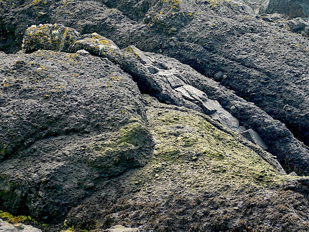
At the beach south of Largs.
There is a dyke on the right which has come through conglomerates.
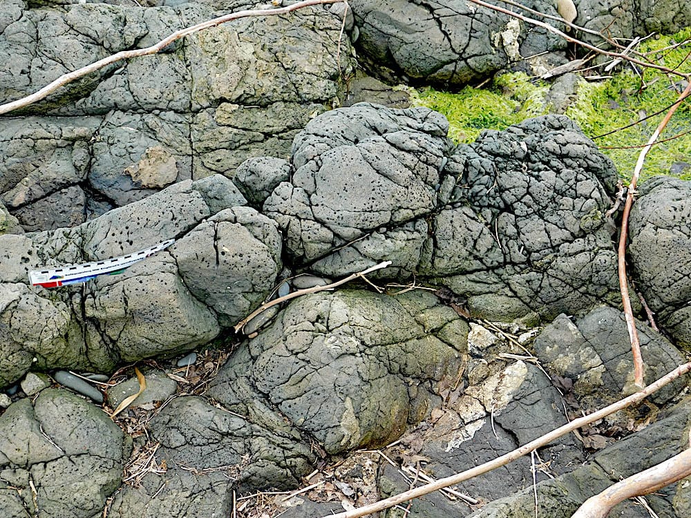
Pillow lavas on a beach south of Ballantrae.
The lava is vesiculated.
Ailsa Craig lies about 8 miles out from Girvan. We had a day trip there, landing and walking over the eastern side of the island, and then sailing right round. It is a Tertiary granitic inclusion, around 60Ma, formed at the time of the sudden opening of the Northern Atlantic Ocean. Similar intrusions are present on Arran and in Northern Ireland. It is an unusual intrusion because many of the cliffs show prominent pseudo-columnar jointing.These are not regular columnar joints and often only have three faces and are the result of the intersections of different joint faces.
Multiple doleritic dykes are also present.
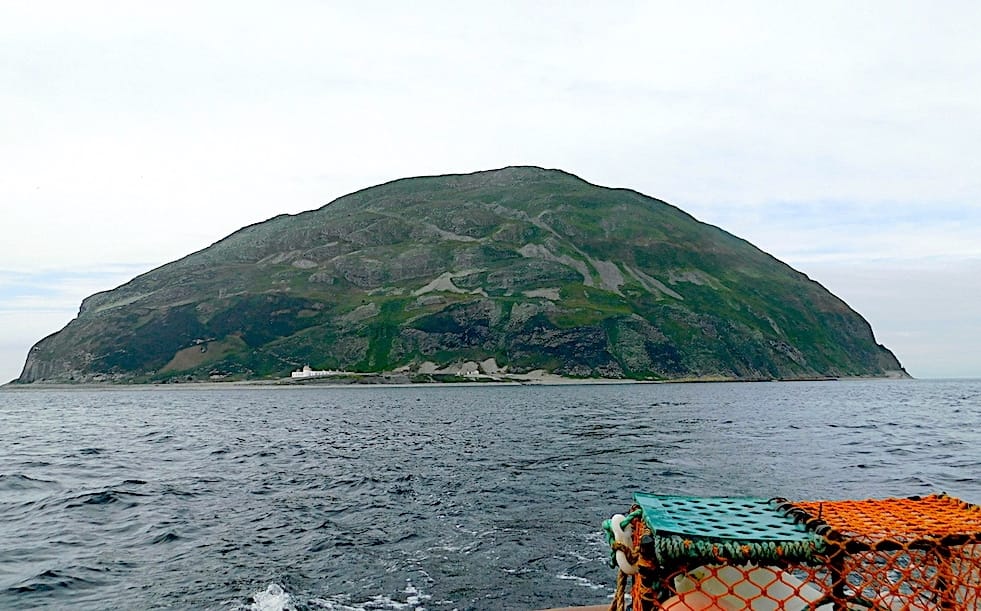
The eastern coast of Ailsa Craig where previous quarrying took place.
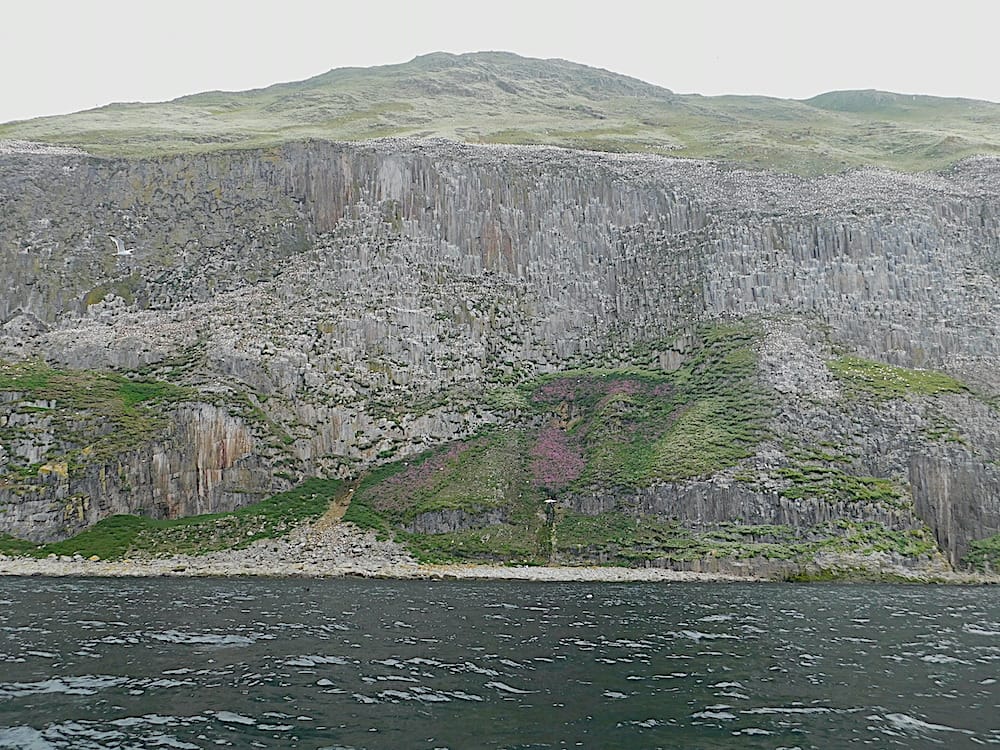
The western side of the island with tall sheer cliffs
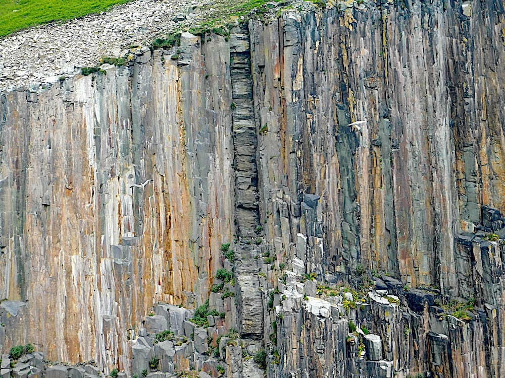
The vertical dyke in the centre is darker than the surrounding granite; and shows columnar jointing at right angles to the jointing seen in the rest of the cliff face.